Acts 27
| Acts 27 | |
|---|---|
|
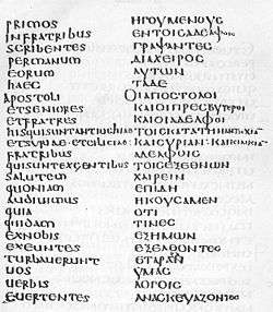
Acts 15:22-24 in Latin (left column) and Greek (right column) in Codex Laudianus, written about AD 550. | |
| Book | Acts of the Apostles |
| Bible part | New Testament |
| Order in the Bible part | 5 |
| Category | Church history |
Acts 27 is the twenty-seventh chapter of the Acts of the Apostles in the New Testament of the Christian Bible. It records the journey of Paul from Caesarea heading to Rome, but stranded for a time in Malta.[1] The book containing this chapter is anonymous but early Christian tradition uniformly affirmed that Luke composed this book as well as the Gospel of Luke.[2]
Text
The original text is written in Koine Greek and is divided into 44 verses. Some most ancient manuscripts containing this chapter are:
- Codex Vaticanus (AD 325-350)
- Codex Sinaiticus (AD 330-360)
- Codex Bezae (ca. AD 400)
- Codex Alexandrinus (ca. AD 400-440)
- Codex Ephraemi Rescriptus (ca. AD 450; extant 17-44)

Location
This chapter mentions or alludes to the following places (in order of appearance):
Structure
This chapter can be grouped:
- Acts 27:1-8 = The Voyage to Rome Begins
- Acts 27:9-12 = Paul’s Warning Ignored
- Acts 27:13-38 = In the Tempest
- Acts 27:39-44 = Shipwrecked on Malta
Verse 1
- And when it was decided that we should sail to Italy, they delivered Paul and some other prisoners to one named Julius, a centurion of the Augustan Regiment.[3]
Calculation of position
The meteorological and nautical evidence demonstrates, and in rather spectacular fashion, that these events must have occurred just as Luke records them. The most important piece of evidence is the exact compass bearing of the gale. This bearing can be established by means of three separate calculations.
- First, Luke states that Euraquilo struck shortly after they left Fair Havens. In other words, the ship must have been less than halfway to their intended destination at Phoenix. They must have been somewhere between Cape Matala and a point seventeen miles W.N.W. of the Cape when the gale struck.
- Second, there is the relation of the island of Clauda (or Cauda) to this start point. Cape Matala is on a bearing of east 7 degrees north from the eastern edge of Clauda, while the halfway point to Phoenix is east 40 degrees north. For the ship to get behind Clauda, Euraquilo must have been blowing from a point somewhere between these two bearings. The point midway between these two figures is east 25 degrees north (or E.N.E. 1/4 N.). This cannot be more than a point and a half off the actual direction of the wind.
- Third, Luke states that when they got behind Clauda, the sailors were afraid that they would be blown onto the Syrtis sandbanks of north Africa. However, for them to have been blown onto those banks from Clauda, Euraquilo would have had to have been blowing from a point somewhere between east 18 degrees north and east 37 degrees north. The point midway between these figures is east 27 degrees north. This figure is only 1/4 point off the mean figure of the previous calculation.
These three calculations establish that the direction from which the wind was blowing could not have been more than a point off the designation E.N.E. 1/2 N. As the ship drifted west from Clauda, it would have been pointed due north, because it could not have been pointed directly into the wind without capsizing. In other words, it had to have been pointed north, just off the direction from which the wind was coming. Using this information, with some precision both the direction and rate of the ship’s drift to the west can be calculated.[4]
Ancient records reveal that Egyptian grain ships were the largest vessels of the time, being about the size of an early nineteenth century sailing vessel. This size is implicitly confirmed by Luke’s statement that there were 276 people on board. Since their ship was pointed due north, while the wind was from the northeast, the azimuth, or direction, of the ship’s lateral - or sideways - drift from Clauda would have been approximately west eight degrees north. The island of Malta is not directly west of Clauda. Instead, Malta’s bearing from Clauda is exactly west eight degrees north.[4]
This brings to yet another piece of evidence. Luke states that it took them fourteen days to drift to Malta. The distance from Clauda to the easternmost point of Malta is 476.6 miles. To calculate the westward rate of drift of their ship, it is necessary to know two things: the size of the ship and the force of the gale. As the approximate size of the ship is known, it is possible to establish the mean intensity of the gale. An average rate of drift for Paul’s vessel can then be calculated. This calculation reveals an average westward drift of one and one half miles per hour. Thus it would take Paul’s ship about thirteen days to drift to Malta. Luke records that it took them fourteen days. This nautical and meteorological evidence provides with an astonishing confirmation of the historical accuracy of Luke's narrative.[4]
See also
References
- ↑ Halley, Henry H. Halley's Bible Handbook: an abbreviated Bible commentary. 23rd edition. Zondervan Publishing House. 1962.
- ↑ Holman Illustrated Bible Handbook. Holman Bible Publishers, Nashville, Tennessee. 2012.
- ↑ Acts 27:1
- 1 2 3 Paul's Shipwreck on Malta from the "Evidence and Paul's Journeys" (Paperback) by Jefferson White. Publisher: Parsagard Press (January 24, 2001). ISBN 978-0970569509
