Arradoul


Coordinates: 57°39′29″N 2°58′52″W / 57.658°N 2.981°W
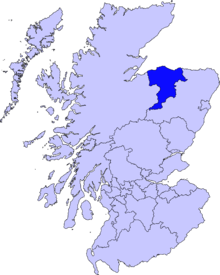
Arradoul is a small village in Scotland, in the traditional county of Banffshire, and in the Moray council area.[1] It is a ribbon settlement on the south side of main A98 road between Cullen and Fochabers, near to the Buckpool turn off to the town of Buckie. To the south of the village are the farms of Arradoul Mains, Walkerdales and Cairnfield. Arradoul Mains is owned by Christies of Fochabers and grows sapling trees for the forestry industry across the UK. The Cairnfield Estate is an arable farm growing oats and barley.
References
| Wikimedia Commons has media related to Arradoul. |
Places in Moray | ||
|---|---|---|
|  | |
This article is issued from Wikipedia - version of the 1/31/2016. The text is available under the Creative Commons Attribution/Share Alike but additional terms may apply for the media files.