Avhustynivka
| Avhustynivka Августинівка | |
|---|---|
| Village | |
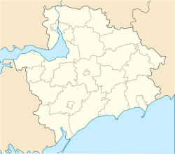
 Avhustynivka Location of Avhustynivka in Zaporizhia Oblast | |
| Coordinates: UA 48°02′15″N 35°02′00″E / 48.03750°N 35.03333°ECoordinates: UA 48°02′15″N 35°02′00″E / 48.03750°N 35.03333°E | |
| Country |
|
| Province | Zaporizhia Oblast |
| District | Zaporizhia Raion |
| Council | Avhustynivka Rural Council |
| Founded | 1921 |
| Elevation[1] | 108 m (354 ft) |
| Population (2001) | |
| • Total | 1,017 |
| Time zone | EET (UTC+2) |
| • Summer (DST) | EEST (UTC+3) |
| Postal code | 70403 |
| Area code | +380 61xx |
| Climate | Dfa |
| Website | http://rada.gov.ua/ |
Avhustynivka (Ukrainian: Августинівка; Russian: Августиновка) is a village (a selo) in the Zaporizhia Raion (district) of Zaporizhia Oblast in southern Ukraine. Its population was 1,017 in the 2001 Ukrainian Census.[2] Avhustynivka is the administrative center of the Avhustynivka Rural Council, a local government area.[2]
The village was formed in 1921 as the village of Hnativka (Ukrainian: Гнатівка); in 1929 it was renamed to Avhustynivka,[2] after 153 families were resettled to the village after the fooding of the village of Avhustynivka following the creation of the Dnieper Hydroelectric Station. The original village of Avhustynivka was founded in 1780.[3]
References
- ↑ "Avhustynivka (Zaporizhia Oblast, Zaporizhia Raion)". weather.in.ua. Retrieved 12 January 2015.
- 1 2 3 "Avhustynivka, Zaporizhia Oblast, Zaporizhia Raion". Regions of Ukraine and their Structure (in Ukrainian). Verkhovna Rada of Ukraine. Archived from the original on 4 March 2016. Retrieved 12 January 2015.
- ↑ "Anniversaries and memorable dates of Zaporizhia in 2005". Zaporizhia Oblast Universal Scientific Library of O.M. Gorky (in Ukrainian). Retrieved 13 January 2015.
This article is issued from Wikipedia - version of the 10/22/2016. The text is available under the Creative Commons Attribution/Share Alike but additional terms may apply for the media files.