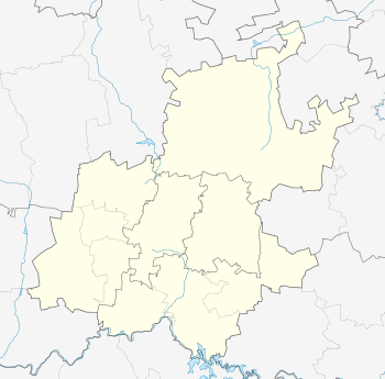
Bedfordview
| Bedfordview | |
|---|---|
 Bedfordview  Bedfordview  Bedfordview
| |
| Coordinates: 26°10′46″S 28°08′10″E / 26.17944°S 28.13611°ECoordinates: 26°10′46″S 28°08′10″E / 26.17944°S 28.13611°E | |
| Country | South Africa |
| Province | Gauteng |
| Municipality | Ekurhuleni |
| Established | 1926 |
| Area[1] | |
| • Total | 11.07 km2 (4.27 sq mi) |
| Population (2011)[1] | |
| • Total | 13,959 |
| • Density | 1,300/km2 (3,300/sq mi) |
| Racial makeup (2011)[1] | |
| • Black African | 23.2% |
| • Coloured | 1.7% |
| • Indian/Asian | 7.7% |
| • White | 63.9% |
| • Other | 3.3% |
| First languages (2011)[1] | |
| • English | 69.6% |
| • Afrikaans | 7.5% |
| • Zulu | 4.0% |
| • Northern Sotho | 2.2% |
| • Other | 16.6% |
| Postal code (street) | 2007 |
| PO box | 2008 |
Bedfordview is an affluent town on the East Rand, which is situated in Gauteng, South Africa. Bedfordview has been part of the Ekurhuleni Metropolitan Municipality since 2000. The Eastgate shopping centre is located here.
History
Although the area around Bedfordview had been inhabited by black natives for hundreds of years, the written history of the area commenced with the arrival of white settlers in the 19th Century.
The site of Bedfordview was largely taken up by the farm Elandsfontein, and was administered as part of the District of Potchefstroom in the South African Republic. The coat-of-arms of Bedfordview features an Eland holding a fountain as a tribute to the early rural history of the town.
The Witwatersrand Gold Reef had a huge impact on the area. Elandsfontein was purchased for the mineral rights, and was later divided into smaller farms and small-holdings, many of which were settled by retired miners. The entire area became known as Geldenhuis Estates Smallholdings.
One of these farms was owned by Sir George Herbert Farrar, a randlord who played a prominent role in planning the infamous Jameson Raid, one of the main causes of the Second Anglo-Boer War. His farm, Bedford, was located in the present-day suburb of St Andrews, and parts of the original farm can still be seen in St Andrews' School. The farm itself was named after Sir Farrar's home-town of Bedford in England. Apparently the raid itself was planned in a small house close to the farm. Sir George is buried in Milner Ave, close to the school, the only official grave in the town.
During the war, British cavalry was based in Bedfordview and apparently planted the oak trees along Van Buuren Ave. There is also a legend that an Indian Rajah-based with the unit died and was buried somewhere in Bedfordview in full regalia, including his jewel-encrusted sword.
The name "Bedfordview" came about as the result of a competition in 1926. A girl who won the competition thought there was a nice view from Bedford Farm. "Bedford View" (two words) was then registered. Over the years the name has contracted to one word.
By 1932 the small-holding had developed into a small village. The 1st Bedfordview Scout Troop opened its doors on 26 July 1928, and there was a government school and a post office. However, there were major health concerns. Bill Stuart, headmaster at the school, recalled that sewage would run down Van Buuren Road from Malvern East and that the piggeries and other farms caused swarms of flies. There was talk that the area should become part of a municipality in order to deal with the matter, and residents were asked whether they would prefer to join Johannesburg or Germiston. Joining a municipality would mean rates and taxes though, so the residents elected instead to set up a health committee to sort out the problem. This later developed into the Bedfordview Village Council and then the Bedfordview Town Council.
Bedfordview was forced to join with Germiston and Palm Ridge to form the Transitional Council of Greater Germiston, after the institutition of democracy. This was in turn merged with other East Rand towns to form the Ekurhuleni Metropolitan Council, which incorporated the old municipalities of Alberton, Bedfordview, Benoni, Boksburg, Brakpan, Edenvale, Germiston, Kempton Park, Nigel, and Springs.
Listings
The site Bedfordview.co.za is a dedicated listing for business, malls, shops, jobs and property in the Bedfordview area.
Economy
Airports Company South Africa has its head office in Bedfordview.[2]
TAAG Angola Airlines has an office in Bedfordview.[3]
Suburbs
The following suburbs form part of Bedfordview:
- Bedford Gardens
- Bedford Park
- Essexwold
- Morninghill
- Oriel
- Senderwood
- St Andrews
Malls
- Eastgate Shopping Centre
- Bedford Centre
Schools
- Bedfordview High School
- Bedfordview Primary School
- Bishop Bavin School
- Leeuwenhof Akademie
- New Crawford School
- Reddam House School
- SAHETI School
- St Andrew's School for Girls
- St Benedict's Catholic School for Boys
References
- 1 2 3 4 "Sub Place Bedfordview". Census 2011.
- ↑ "Contact us." Airports Company South Africa. Retrieved on 6 February 2011. "Physical address: 24 Johnson Road The Maples Office Park - Bedfordview Johannesburg."
- ↑ "TAAG Offices." TAAG Angola Airlines. Retrieved on 23 January 2010. "South Africa - Johannesburg 3rd Riley Road, Bedfordview Office Park Building 11A/ Stand 10 Bedfordview"
.svg.png)