Capo Sandalo Lighthouse
.jpg) Capo Sandalo, San Pietro Island | |
 Sardinia | |
| Location |
San Pietro Island Sardinia Italy |
|---|---|
| Coordinates | 39°08′50.8″N 8°13′25.42″E / 39.147444°N 8.2237278°ECoordinates: 39°08′50.8″N 8°13′25.42″E / 39.147444°N 8.2237278°E |
| Year first constructed | 1864 |
| Automated | 1994[1] |
| Construction | stone tower and keeper's house |
| Tower shape | cylindrical tower on a two story keeper's house |
| Markings / pattern | unpainted tower |
| Height | 30 metres (98 ft) |
| Focal height | 134 metres (440 ft)[2] |
| Light source | mains power |
| Range |
main: 24 nautical miles (44 km; 28 mi) reserve: 19 nautical miles (35 km; 22 mi) |
| Characteristic | Fl (4) W 20s. |
| Admiralty number | E1090 |
| NGA number | 8432 |
| ARLHS number | SAR-018 |
| Italy number | 1384 E.F |
| Managing agent | Marina Militare[3] |
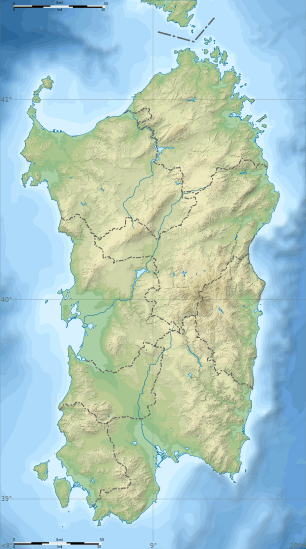
The Capo Sandalo Lighthouse (Italian: Faro di Capo Sandalo) is prominent lighthouse on the westernmost point of San Pietro Island marking the southwestern corner of Sardinia, Italy.
History
The original stone tower was built in 1864. It is an active aid to marine and aeronautical navigation. The focal plane is 134 m (440 ft) tall, perched on top of a cliff, and gives four white flashes every 20 seconds visible from 24 nautical miles (44 km). The tower itself is 30 m (98 ft) with lantern and gallery, attached to the front of a 2-story stone keeper's house. To this day, the lighthouse remains a beautiful structure of unpainted stone, with a gray metallic lantern dome. The lighthouse is now automated, and a keeper lived on premises until recently. Chart references: ARLHS SAR-018; Admiralty E1090; NGA 8432. French charts 7332. The lighthouse is connected by a well paved road to the main town of Carloforte on San Pietro Island.
See also
References
- ↑ Lighthouse Explorer
- ↑ The Lighthouse Directory University of North Carolina at Chapel Hill
- ↑ Faro di Capo Sandalo Marina Militare
External links
- Capo Sandalo Lighthouse cyberlights.com
- Servizio Fari Marina Militare (Italian)
| Wikimedia Commons has media related to Capo Sandalo lighthouse. |