Chatham Island (Andaman)
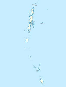 Chatham Island Location of Chatham Island | |
| Geography | |
|---|---|
| Location | Bay of Bengal |
| Coordinates | 11°41′17″N 92°43′26″E / 11.688°N 92.724°ECoordinates: 11°41′17″N 92°43′26″E / 11.688°N 92.724°E |
| Archipelago | Andaman Islands |
| Adjacent bodies of water | Indian Ocean |
| Total islands | 1 |
| Major islands |
|
| Area | 0.093 km2 (0.036 sq mi)[1] |
| Length | 0.2 km (0.12 mi) |
| Width | 0.46 km (0.286 mi) |
| Coastline | 1.78 km (1.106 mi) |
| Highest elevation | 0 m (0 ft)[2] |
| Administration | |
| District | South Andaman |
| Island group | Andaman Islands |
| Island sub-group | Port Blair Islands |
| Tehsil | Port Blair |
Largest settlement |
Chatham Island living quarters |
| Demographics | |
| Demonym | Hindi |
| Population | 1 (2011) |
| Pop. density | 10.75 /km2 (27.84 /sq mi) |
| Ethnic groups | Hindu, Andamanese |
| Additional information | |
| Time zone | |
| PIN | 744101[3] |
| Telephone code | 031927 [4] |
| Official website |
www |
| ISO Code | IN-AN-00[5] |
| Literacy | 84.4% |
| Avg. summer temperature | 30.2 °C (86.4 °F) |
| Avg. winter temperature | 23.0 °C (73.4 °F) |
| Sex ratio | 1.2♂/♀ |
| unit_pref | Metric |
| Census Code | 35.639.0004 |
| Official Languages | Hindi, English |
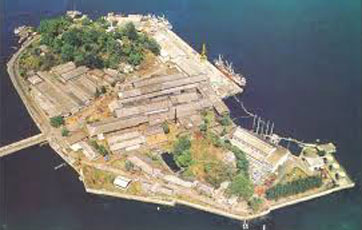
Chatham Island is an island of the Andaman Islands. It belongs to the South Andaman administrative district, part of the Indian union territory of Andaman and Nicobar Islands.[6] the island is lying 3 km (2 mi) north of downtown Port Blair.
History
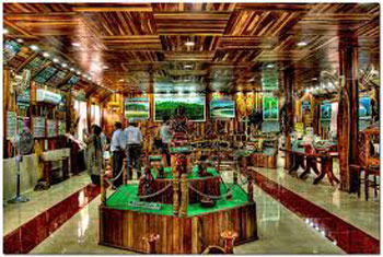
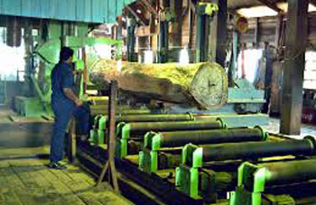
This is the island where the earliest settlement in Andamans began. In 1883, the British established the Chatham Saw Mill.[7][8] in 1990, the Indians built the Forest museum, where you get insight on the forest team activities, and has displays on the history of timber milling on the island.
Geography
The island belongs to the Port Blair Islands and lies in the middle of Port Meadows.
Administration
Politically, Chatham Island, along neighboring Port Blair Islands, are part of Port Blair Taluk.[9]
Demographics
There are living quarters for the JPC manager (the person in charge of the saw mill), and a caretaker is living there 24/7.
Image gallery
References
- ↑ "Islandwise Area and Population - 2011 Census" (PDF). Government of Andaman.
- ↑ "Sailing Directions (enroute) | India and the Bay of Bengal" (PDF) (173). National Geospatial-intelligence Agency, United States Government. 2014. Retrieved 2016-09-23.
- ↑ "A&N Islands - Pincodes". 22 September 2016. Archived from the original on 23 March 2014. Retrieved 22 September 2016.
- ↑ "STD Codes of Andaman and Nicobar". allcodesindia.in. Retrieved 2016-09-23.
- ↑ Registration Plate Numbers added to ISO Code
- ↑ "Village Code Directory: Andaman & Nicobar Islands" (PDF). Census of India. Retrieved 2011-01-16.
- ↑ Official site
- ↑ visit
- ↑ "DEMOGRAPHIC – A&N ISLANDS" (PDF). andssw1.and.nic.in. Retrieved 2016-09-23.
- ↑
- ↑
- ↑
- ↑
- ↑
| Wikimedia Commons has media related to Port Blair. |
 Andaman and Nicobar Islands travel guide from Wikivoyage