Florida Scenic Highways
| Florida Scenic Highways | |
|---|---|
|
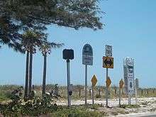
A Florida Scenic Highway sign, along SR A1A in North Peninsula State Park. | |
| Highway names | |
| Interstates: | Interstate X (I-X) |
| US Highways: | U.S. Route X (US X) |
| State: | Route X (SR X) |
| County routes: | County Route X (CR X) |
| System links | |
The Florida Scenic Highways Program is a grass-roots effort to heighten awareness of Florida's historical and intrinsic resources—cultural, recreational, natural, archeological, historical and scenic—which collectively, enhance the overall traveling experience. Program participation provides benefits to the community, such as resource preservation, enhancement and protection.
Participation
Anyone with an interest in their community can participate in this voluntary program, including citizens, civic groups, businesses and governments. As with any grass-roots effort, organization is key. Therefore, interested parties must form a Corridor Advocacy Group to help foster community support, form strong partnerships and develop the necessary documentation.
Benefits
There are numerous benefits to program participation:
- Showcases and protects natural resources
- Helps establish community vision
- Enhances the travel experience (for tourists, as well as residents)
- Improves quality of life
- Increases community pride and recognition
- Promotes tourism and economic development
- Encourages community partnering
- Tells Florida’s story, while providing education and an appreciation of history
Federally designated scenic byways
| Name | Image | From | To | Highways | Notes |
|---|---|---|---|---|---|
| A1A Scenic and Historic Coastal Byway |  |
Marineland | Ponte Vedra Beach | SR A1A | Follows Atlantic coast barrier islands |
| Indian River Lagoon Scenic Highway |  |
Wabasso | Titusville | SR A1A / SR 528 / US 1 / CR 402 | Diverse estuary near Kennedy Space Center |
| Overseas Highway (AKA Florida Keys Scenic Highway) |
 |
Key West | Key Largo | US 1 | All-American Road[1] |
| Tamiami Trail Scenic Highway |  |
Sarasota/Charlotte county line | Hillsborough/Manatee county line | US 41 | Traverses the Florida Everglades |
| Big Bend Scenic Byway | Tallahassee | Apalachicola | US 98 / SR 300 / CR 59 / SR 65 / SR 267 / CR 375 | 220 miles that travel through Leon County, Wakulla County, and Franklin County |
State designated scenic byways
| Name | Image | From | To | Highways | Notes |
|---|---|---|---|---|---|
| Bradenton Beach Scenic Highway |  |
SR 789 | |||
| Broward County A1A Scenic Highway |  |
Miami-Dade County Line | Palm Beach County Line | SR A1A | |
| Courtney Campbell Scenic Highway |  |
SR 60 | |||
| Florida Black Bear Scenic Byway |  |
SR 40 / SR 19 | |||
| Green Mountain Scenic Byway |  |
CR 455/CR Old 50/CR 438 | |||
| Heritage Crossroads: Miles of History Heritage Highway |  |
||||
| Indian River Lagoon - Treasure Coast Scenic Highway |  |
SR A1A / CR 707 | |||
| J.C. Penney Memorial Scenic Highway |  |
SR 21 | Paso Fino Road | SR 16 | Includes loop in Penney Farms |
| Lemon Bay/Myakka Trail Scenic Highway |  |
SR 776 / CR 771 / CR 775A | |||
| Old Florida Heritage Highway |  |
US 441 | |||
| Ormond Scenic Loop and Trail | CR 2002 / CR 4011 / CR 2820 / SR 40 / CR 2803 / SR A1A | ||||
| Palma Sola Scenic Highway |  |
SR 64 | |||
| Pensacola Scenic Bluffs Highway | Bayou Texar | US 90 Alt. in Ferry Pass | US 90 | ||
| The Ridge Scenic Highway |  |
SR 17 | |||
| River of Lakes Heritage Corridor Scenic Highway |  |
US 17 / CR 3 / SR 11 | |||
| Scenic Highway 30A |  |
Sandestin | Inlet Beach | CR 30A | |
| Suncoast Scenic Parkway | The Cheval | Northern Hernando County | SR 589 | ||
| William Bartram Scenic and Historic Highway | Old Bull Bay Bridge | CR 210 | SR 13 | ||
See also
 Florida portal
 U.S. Roads portal