Fort Howes
| Fort Howes | |
|---|---|
| Powder River County, Montana, south of Ashland, Montana | |
| Coordinates | 45°17′00″N 106°08′53″W / 45.28333°N 106.14806°WCoordinates: 45°17′00″N 106°08′53″W / 45.28333°N 106.14806°W[1] |
| Type | Redoubt |
| Site information | |
| Owner | Private property |
| Condition | Preserved |
| Site history | |
| Built | 1897 |
| Built by | Civilians |
| Materials | Rock, wood |
| Demolished | 1897 (decommissioned) |
| Garrison information | |
| Past commanders | Captain Calvin C. Howes |
| Garrison | Civilians |
| Airfield information | |
| Elevation | 3,297 feet (1,005 m) AMSL |
Fort Howes was a United States civilian's Redoubt established in 1897 in Custer County, Montana in response to the murder of a sheepherder.[2]
History
Fort Howes was established in the spring of 1897 by Custer County civilians after a sheepherder named John Hoover, who worked for John Barringer, and his sheep dog were murdered by several Cheyenne warriors, between April 28 and May 3, 1897, near the town of Ashland, Montana. After Hoover's body was recovered on May 27, 1897, the women and children that lived near Ashland, Montana were sent to Sheridan, Wyoming and Miles City, Montana. Men of the Ashland area began building the structure on the crest of a hill located on the Howes ranch, along Otter Creek, a tributary of the Tongue River. The walls were built with spaces for rifles to shoot through, and one large opening for men to enter through. Finally there was a wooden plank roof built over the fort. Weapons, ammunition, food, and water were stored inside. At its completion, the walls measured eighteen feet by ten feet, and the redoubt was named after Captain Calvin C. Howes, who owned the land under the fort. Guards of cowboys and stock men were posted at the fort, and on multiple occasions in the early summer of 1897, they observed Cheyenne warriors riding nearby and examining the structure. Custer County, Montana Sheriff John Gibbs came to the Howes ranch, and made twelve men deputies, including Levi Howes (the son of Calvin C. Howes). The group was joined by cowboys, then when numbering about 200 men, rode into Lame Deer, Montana to apprehend the Cheyenne warriors that had killed John Hoover. A contingent of United States Army soldiers from nearby Fort Keogh also traveled to Lame Deer to keep peace. After discussing the situation with Cheyenne's through interpreters, guilty Cheyenne warriors were turned over to Custer County Sheriff Gibbs, and his deputies, then later released. The anticipated "Indian uprising" did not take place, and the redoubt was abandoned in the summer of 1897.[3]
Fort Howes today
The rock walls are present at the original location and by May, 2015, will have been standing for 118 years, although the original roof has been replaced.[3]
Location
The Fort Howes redoubt is located on private property near a county road in present-day Powder River County, Montana near the unincorporated community of Otter, Montana, and south of the present-day census designated place, Ashland, Montana. It stands at 3,297 feet (1,005 meters) above sea level, and its coordinates are 45, 17' 00" North and 106, 08' 53" West.
See also
Notes
- ↑ "Fort Howes". Geographic Names Information System. United States Geological Survey.
- ↑ Howes "Montana Forts of the Old West - Page 3" Check
|url=value (help). legendsofAmerica.org. Retrieved 2014-07-24. - 1 2 "The story of Fort Howes and the Circle Bar Ranch". Circle Bar Ranch. Retrieved 2014-07-24.
Municipalities and communities of Powder River County, Montana, United States | ||
|---|---|---|
| Town | 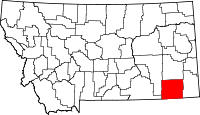 | |
| CDP | ||
| Other unincorporated communities | ||