Galt's Mill Complex
|
Galt's Mill Complex | |
 | |
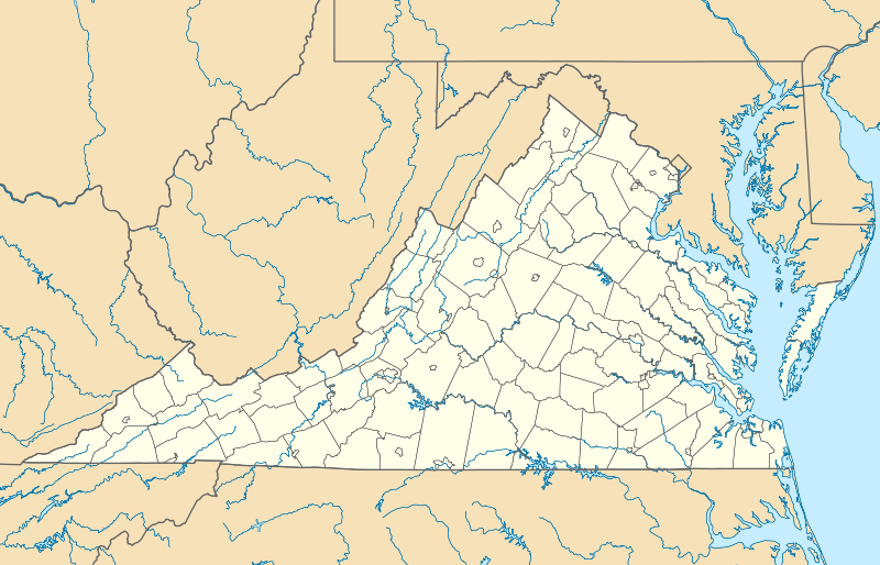  | |
| Location | 1133 Galt's Mill Rd., near Madison Heights, Virginia |
|---|---|
| Coordinates | 37°26′35″N 79°05′11″W / 37.44306°N 79.08639°WCoordinates: 37°26′35″N 79°05′11″W / 37.44306°N 79.08639°W |
| Area | 535 acres (217 ha) |
| Built | 1813 |
| Built by | Galt, William; Turner, Edgar J. |
| NRHP Reference # | 09000791[1] |
| VLR # | 005-5037 |
| Significant dates | |
| Added to NRHP | September 30, 2009 |
| Designated VLR | June 18, 2009[2] |
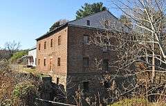
Galt's Mill Complex is a national historic district located near Madison Heights, Amherst County, Virginia. It encompasses 21 contributing buildings, 1 contributing site, 8 contributing structures, and 1 contributing object associated with a rural mill village. The buildings surround the masonry-constructed Galt’s Mill, and are a variety of vernacular log or wood frame structures. The mill was built in 1813, and is a two-story, brick structures. It was originally 5 1/5-stories, but lowered to its present height about 1950. The mill remained in operation until 1956. A store building was added about 1900. Other notable resources include the Aqueduct, Train Bridge (c. 1838), Railroad (c. 1870), Boathouse (c. 1900), Home House (c. 1813), Miller’s House (c. 1900), and Millrace and Dam Ruins (c. 1813 and 1914).[3]
It was added to the National Register of Historic Places in 2009.[1]
References
- 1 2 National Park Service (2010-07-09). "National Register Information System". National Register of Historic Places. National Park Service.
- ↑ "Virginia Landmarks Register". Virginia Department of Historic Resources. Retrieved 2013-05-12.
- ↑ Sandra F. Esposito (May 2008). "National Register of Historic Places Inventory/Nomination: Galt's Mill Complex" (PDF). and Accompanying four photos and Accompanying map