High Synagogue, Kraków
| High Synagogue | |
|---|---|
|
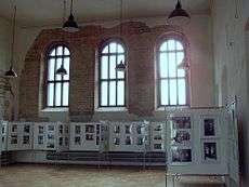
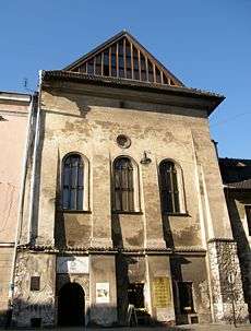
Synagogue with stonework exposed  Interior, historical exhibit Interior, historical exhibit.jpg) Ancient scripture under stucco after conservation Ancient scripture under stucco after conservation | |
| Basic information | |
| Location |
Jozefa 38 St., Kazimierz, Kraków, Poland |
| Affiliation | Orthodox Judaism |
| Status | Inactive synagogue |
| Completed | 1563 |
High Synagogue is an inactive Orthodox Jewish synagogue in Kazimierz District of Kraków, Poland. It was called the High (or Tall) Synagogue for many centuries for it was the tallest synagogue in the city. It was built in 1556-1563. It appears to be in a Renaissance manner with certain modifications common north of the alps (most notably the tracery, which resembles that of St-Pierre in Caen). It was the third synagogue to be erected in Kazimierz. Originally, the prayer rooms were located on the second floor above ground floor shops. The interior walls of the sanctuary feature paintings of scenes in Jerusalem, including the "Tomb of the Israelite Kings," "Western Wall," and a handsome pair of lions in the women's gallery.[1][2]
World War II history
During the occupation of Poland in World War II, Nazis stripped the interior of all equipment. The ceiling and roof were destroyed. At present only the stone niche for the Aron Kodesh and the wall-paintings uncovered early in the 21st century by art conservation remain. Gabled-windowed top floor, synagogue ceiling and roof were renovated in 2008 as part of the ongoing repairs.
The High Synagogue serves as a Landmark Conservation building. Since 2005 it has been open to visitors. Photographic and other exhibitions about customs and traditions of the Jewish community of the interwar period are staged indoors.[3]
High Synagogue (Prague) was modelled after the Krakow`s High Synagogue.
See also
- Oldest synagogues in the world
- Synagogues of Krakow
- Remuh Synagogue
- Tempel Synagogue
- Old Synagogue (Krakow)
- Izaak Synagogue
- Wolf Popper Synagogue
- Kupa Synagogue
References
- ↑ Rabbi Eliezer Gurary, Krakow High Synagogue WEJEW Mediashare Community, 2008 New Israel Media L.P.
- ↑ Rebecca Weiner, High or (Tall) Synagogue The Virtual Jewish History Tour
- ↑ The Jewish Krakow, The High Synagogue: ul. Jozefa 38
Coordinates: 50°3′4″N 19°56′50″E / 50.05111°N 19.94722°E
External links
-
 Media related to High Synagogue of Kazimierz, Kraków at Wikimedia Commons
 - Virtual tour at YouTube.com
