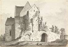
Hinton Priory
|
| |
| Monastery information | |
|---|---|
| Order | Carthusian |
| Established | 1227 |
| Disestablished | 1539 |
| People | |
| Founder(s) | Ela, Countess of Salisbury |
| Important associated figures | William Longspee, Earl of Salisbury |
| Site | |
| Location | Hinton Charterhouse, Somerset, England |
| Grid reference | ST777591 |
| Visible remains | buildings and earthworks |
| Public access | no |
Hinton Priory was one of the ten medieval Carthusian houses (charterhouses) in England. It was first established at Hatherop in 1222 by William Longspee, Earl of Salisbury. The monks disliked the location, and on Longspee's death in 1226 they petitioned his countess for a new site to achieve greater solitude. She gave them her manors of Hinton and Norton St Philip in Somerset and the new house was consecrated at Hinton Charterhouse in May 1232. It was called Locus Dei meaning 'God's Place'.

The house was suppressed as part of the dissolution of the monasteries on 31 March 1539, and then bought by Matthew Colthurst.[1]
The chapter house, prior's cell and refectory survive as agricultural buildings belonging to the sixteenth century mansion, Hinton Abbey. Surviving earthworks from the great cloister are still visible in an orchard and paddocks.
Hinton Priory is a grade I listed building,[2] and Scheduled Ancient Monument.[3] It is included in the Heritage at Risk Register produced by English Heritage.[4] The entry for 2012 states that its condition is "Poor" and that some parts are in need of condition assessment.
The Priory is in private ownership and there is no public access.
References
- ↑ Greenwood, Charles (1977). Famous houses of the West Country. Bath: Kingsmead Press. pp. 40–43. ISBN 978-0-901571-87-8.
- ↑ "The chapter house". Images of England. Retrieved 20 November 2006.
- ↑ "List of Scheduled Ancient Monuments". Bath and North East Somerset Council. Retrieved 9 October 2010.
- ↑ "South West England" (PDF).
- Glyn Coppack and Mick Aston: Christ's Poor Men — the Carthusians in England ISBN 0-7524-1961-7
Coordinates: 51°19′50″N 2°19′17″W / 51.33055°N 2.32146°W