Hlaponci
| Hlaponci | |
|---|---|
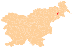
 Hlaponci Location in Slovenia | |
| Coordinates: 46°28′5.07″N 15°58′38.53″E / 46.4680750°N 15.9773694°ECoordinates: 46°28′5.07″N 15°58′38.53″E / 46.4680750°N 15.9773694°E | |
| Country |
|
| Traditional region | Styria |
| Statistical region | Drava |
| Municipality | Juršinci |
| Area | |
| • Total | 4.61 km2 (1.78 sq mi) |
| Elevation | 228.4 m (749.3 ft) |
| Population (2002) | |
| • Total | 243 |
| [1] | |
Hlaponci (pronounced [ˈxlaːpɔntsi]) is a settlement in the Municipality of Juršinci in northeastern Slovenia. It lies in the valley of a minor left tributary of the Pesnica River in the Slovene Hills (Slovene: Slovenske gorice). The area is part of the traditional region of Styria. It is now included with the rest of the municipality in the Drava Statistical Region.[2]
A small chapel-shrine with a belfry in the southwestern part of the settlement was built in the second half of the 19th century.[3]
References
External links
| Settlements | Administrative centre: Juršinci
|  | ||||||
|---|---|---|---|---|---|---|---|---|
| Notable people |
| |||||||
This article is issued from Wikipedia - version of the 12/22/2015. The text is available under the Creative Commons Attribution/Share Alike but additional terms may apply for the media files.