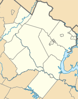
John Marshall's Leeds Manor Rural Historic District
|
John Marshall's Leeds Manor Rural Historic District | |
 | |
   | |
| Location | Pts of E. John Marshall Hwy, Farm House Rd., Leeds Manor Rd., Old Markham Rd. Poverty Hollow Ln, Rail Stop Rd. etc., near Markham, Fauquier County, Virginia |
|---|---|
| Coordinates | 38°53′50″N 77°59′57″W / 38.89722°N 77.99917°WCoordinates: 38°53′50″N 77°59′57″W / 38.89722°N 77.99917°W |
| Area | 22,184 acres (8,978 ha) |
| Built | 1736 |
| Architect | Sutton, William |
| Architectural style | Colonial, Early Republic |
| NRHP Reference # | 07001138[1] |
| VLR # | 030-5428 |
| Significant dates | |
| Added to NRHP | November 1, 2007 |
| Designated VLR | September 5, 2007[2] |
John Marshall's Leeds Manor Rural Historic District is a national historic district located near Markham, in Fauquier County, northeastern Virginia.
Description
.jpg)
John Marshall's Leeds plantation house.
The historic district encompasses 395 contributing buildings, 45 contributing sites, and 24 contributing structures. The district is characterized as a cohesive locality that is characterized by large expanses of open agricultural land, historic roadways, and rolling foothill terrain.
The architectural resources located within the district are a diverse collection of types and styles dating from the mid-18th century through the mid-20th century.[3]
It was listed on the National Register of Historic Places in 2007.[1]
References
- 1 2 National Park Service (2010-07-09). "National Register Information System". National Register of Historic Places. National Park Service.
- ↑ "Virginia Landmarks Register". Virginia Department of Historic Resources. Retrieved 5 June 2013.
- ↑ Debra A. McClane (May 2007). "National Register of Historic Places Inventory/Nomination: John Marshall's Leeds Manor Rural Historic District" (PDF). Virginia Department of Historic Resources. and Accompanying four photos
This article is issued from Wikipedia - version of the 11/30/2016. The text is available under the Creative Commons Attribution/Share Alike but additional terms may apply for the media files.

