Joliette
| Joliette | |
|---|---|
| City | |
|
Saint-Charles-Borromée Cathedral | |
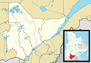
 Location within Joliette RCM. | |
 Joliette Location in central Quebec. | |
| Coordinates: 46°01′N 73°27′W / 46.017°N 73.450°WCoordinates: 46°01′N 73°27′W / 46.017°N 73.450°W[1] | |
| Country |
|
| Province |
|
| Region | Lanaudière |
| RCM | Joliette |
| Constituted | November 12, 1966 |
| Government[2] | |
| • Mayor | Alain Beaudry |
| • Federal riding | Joliette |
| • Prov. riding | Joliette |
| Area[2][3] | |
| • City | 23.60 km2 (9.11 sq mi) |
| • Land | 22.81 km2 (8.81 sq mi) |
| • Metro[4] | 109.03 km2 (42.10 sq mi) |
| Population (2011)[3] | |
| • City | 19,621 |
| • Density | 860.3/km2 (2,228/sq mi) |
| • Metro[4] | 46,932 |
| • Metro density | 430.5/km2 (1,115/sq mi) |
| • Pop 2006-2011 |
|
| • Dwellings | 9,919 |
| Demonym(s) | Joliettain, Joliettaine |
| Time zone | EST (UTC−5) |
| • Summer (DST) | EDT (UTC−4) |
| Postal code(s) | J6E |
| Area code(s) | 450 and 579 |
| Highways |
|
| Website |
www |
Joliette is a city in southwest Quebec, Canada. It is approximately 50 kilometres (31 mi) northeast of Montreal, on the L'Assomption River and is the seat of the Regional County Municipality of Joliette. The city is home to the Joliette Art Museum, whose works of art include paintings, sculptures, paper artwork and a large collection of art from the French Middle Ages.
Joliette has 3 francophone high schools and 1 anglophone high school as well as the Joliette campus of the Cégep régional de Lanaudière.
It was founded as L'Industrie by businessman Barthélemy Joliette in 1823 and was incorporated as a city in 1863.
The city's economy is mainly in the manufacturing and service sectors. The largest gravel manufacturer in the area, Graybec, is located in Joliette and exploits a huge quarry just outside the city.
Joliette is the seat of the judicial district of Joliette.[5]
Government and infrastructure
Joliette Institution for Women, a prison of the Correctional Service of Canada, is in this town.
Local institutions
Post-secondary:
- Cégep régional de Lanaudière à Joliette - Collège Constituant de Joliette
Commission scolaire des Samares operates Francophone public schools;
- École secondaire Thérèse-Martin
- École secondaire Barthélemy-Joliette
- Académie Antoine-Manseau
- École Primaire Les Mélèzes
- École Primaire Saint-Pierre (Marie-Charlotte)
Anglophone schools are operated by the Sir Wilfrid Laurier School Board:
- Joliette High School
Diocese
- Diocèse de Joliette
- Cathédrale Saint-Charles-Borromée de Joliette
See also
References
- ↑ Reference number 125035 of the Commission de toponymie du Québec (French)
- 1 2 "Joliette". Répertoire des municipalités (in French). Ministère des Affaires municipales, des Régions et de l'Occupation du territoire. Retrieved 2011-11-08.
- 1 2 "Joliette census profile". 2011 Census data. Statistics Canada. Retrieved 2012-05-24.
- 1 2 "Joliette (Census agglomeration) census profile". 2011 Census data. Statistics Canada. Retrieved 2012-05-24.. The census agglomeration consists of Joliette, Notre-Dame-des-Prairies, Saint-Charles-Borromée, Saint-Paul. In the 2006 census, the census agglomeration had also included Saint-Pierre.
- ↑ Territorial Division Act. Revised Statutes of Quebec D-11.
External links
| Wikimedia Commons has media related to Joliette, Quebec. |
- Ville de Joliette
- Diocèse de Joliette
- "Diocese of Joliette". Catholic-Hierarchy.org. David M. Cheney.
 |
Saint-Charles-Borromée | Notre-Dame-des-Prairies |  | |
| Saint-Pierre | |
Saint-Thomas | ||
| ||||
| | ||||
| Saint-Paul |
