K'àak' Chi'
 |
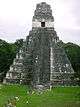
| Maya civilization |
|---|
| History |
| Preclassic Maya |
| Classic Maya collapse |
| Spanish conquest of the Maya |
K'àak' Chi' (“Mouth of Fire”)[1] is an unexplored potential archaeological site of the pre-Columbian Maya civilization, proposed by William Gadoury of Saint-Jean-de-Matha, Quebec in 2016.[2] It is located in the state of Campeche in southern Mexico, in the extreme south of the Yucatán Peninsula. The location was determined by overlaying Maya constellations with a map of the Yucatán Peninsula. The alleged site has caused controversy as Mayanists have cast doubt upon the potential discovery.
Remote prediction
The hypothetical discovery is based on analysis by the Canadian Space Agency of satellite data from NASA, and from the Japanese Space Agency, JAXA. The position of the site was predicted by Gadoury, age 15, from his theory that Maya site locations correlated with their astronomical data matching 117 known Maya sites with the positions of stars in 22 known Maya constellations. K'àak' Chi lies at a location suggested by a 23rd constellation (containing three stars) with only two known sites corresponding on the ground. However, the density of Maya cities in the region is such that the supposed alignment of Maya sites with the constellations has been attributed to coincidence.[3]
Gadoury reported that his study was sparked by reading the Mayan doomsday prophesies in 2012:
I did not understand why the Maya built their cities away from rivers, on marginal lands and in the mountains... They had to have another reason, and as they worshipped the stars, the idea came to me to verify my hypothesis... I was really surprised and excited when I realised that the most brilliant stars of the constellations matched the largest Maya cities.[4]— William Gadoury
Satellite images were used to imply the existence of an ancient city with a large pyramid and about thirty buildings, and, if confirmed, it might be the fourth largest Maya city in existence.[1] Gadoury has already presented his findings to two Mexican archaeologists, who assured him he can join expeditions to the area.[1]
Archeological exploration
Mayanist Geoffrey Braswell pointed out that he had been working in the area pinpointed by Gadoury, and confirmed that the area was in fact fields and seasonal swamps.[3] Archaeologist Richard Hansen noted that the location is also very close to the Maya ruins of Uxul, which have been the subject of archaeological investigation since 2009.[3] Mexican archaeologist Rafael Cobos Palma pointed out that the area of the supposed discovery has been extensively explored by archaeologists since the 1930s, and was very close to various already-identified Maya sites in southern Campeche.[5]
Controversy
The Instituto Nacional de Antropología e Historia (INAH) (National Institute of Anthropology and History) in Mexico said it was not even “considering” the alleged find, since “there is no scientific basis for it”.[6]
Mayanist David Stuart cast doubt upon the discovery, describing it as an example of "junk science", and identified the object on satellite imagery as an old cornfield, or milpa.[7] Mayanist Geoffrey Braswell of the University of California stated that the object is definitely not a Maya pyramid, and identified the imagery as either an abandoned milpa or an active marijuana field.[8]
In a response to the alleged discovery, anthropologist and astronomer Anthony Aveni stated that trying to correlate a direct correspondence between a star map and a large quantity of man-made features is "an act of creative imagination."[9] Aveni has pointed out that there are several competing theories as to what the 13 Maya zodiacal constellations represent, and upon how they are arranged.[9]
Mayanist Francisco Estrada-Belli has pointed out that even should a Maya site be located in the predicted place, it could be down to coincidence since there are likely to be hundreds of undiscovered Maya archaeological sites; he commented that the chances were very good of putting a finger anywhere on a map of the region and pinpointing a Maya site.[9]
See also
Regarding astronomical constellation configurations:
References
- 1 2 3 "Quebec teen discovers ancient Mayan ruins by studying the stars" 9 may 2016, Daily Buzz. retrieved 10 May 2016
- ↑ "Un ado découvre une cité maya", 7 May 2016, Journal de Montreal. Retrieved 10 May 2016 (French)
- 1 2 3 Zhang, Sarah That long-lost Mayan city a teen found isn't lost...Or a city Wired magazine online. 10 May 2016.
- ↑ McMah, Lauren (May 10, 2016). "Boy, 15, discovers long-lost ancient Mayan city using constellations and Google Earth". NZ Herald News. news.com.au. Retrieved May 11, 2016.
- ↑ Cruz, Mónica; and Abril Mulato, Las dudas de los expertos ante la ciudad maya ‘descubierta’ por un quinceañero canadiense El País: Verne 10 May 2016. Retrieved 19 May 2016. (Spanish)
- ↑ http://www.efe.com/efe/english/technology/mexico-casts-doubt-on-discovery-of-ancient-maya-city-by-canadian-teen/50000267-2923295
- ↑ Canadian teen William Gadoury's discovery of 'Mayan city' debunked as junk scienceSydney Morning Herald 11 May 2016.
- ↑ McCrum and Hamill 'Lost Mayan city' discovered in the jungle could be a WEED FARM, archaeologist claims Daily Mirror 12 May 2016.
- 1 2 3 Romey, Kristin Experts: Teen's 'Discovery' of Maya City is a Very Western Mistake: Why modern astronomical maps may not lead us to ancient sites., National Geographic online, 11 May 2016
Coordinates: 17°56′41.98″N 90°09′58.08″W / 17.9449944°N 90.1661333°W