Kalloli
| Kalloli | |
|---|---|
| Village | |
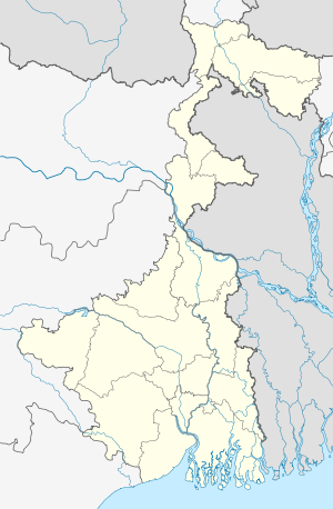 Kalloli  Kalloli Location in West Bengal, India | |
| Coordinates: 23°26′10.0″N 86°40′59.2″E / 23.436111°N 86.683111°ECoordinates: 23°26′10.0″N 86°40′59.2″E / 23.436111°N 86.683111°E | |
| Country |
|
| State | West Bengal |
| District | Purulia |
| Population (2011) | |
| • Total | 1,524 |
| Languages | |
| • Official | Bengali, English |
| Time zone | IST (UTC+5:30) |
| PIN | 723121 (Adra) |
| Telephone/STD code | 03251 |
| Lok Sabha constituency | Purulia |
| Vidhan Sabha constituency | Kashipur |
| Website |
purulia |
Kalloli is a village in Kashipur CD Block in Raghunathpur subdivision of Purulia district in the state of West Bengal, India.
Demographics
As per 2011 Census of India Kalloli had a total population of 1,524 of which 783 (51%) were males and 741 (49%) were females. Population below 6 years was 164. The total number of literates in Kalloli was 1,076 (79.12% of the population over 6 years).[1]
CD Block HQ
The headquarters of Kashipur CD Block are located at Kalloli.[2]
Transport
Kashipur-Chhatna Road passes through Kalloli.[3]
Healthcare
Kalloli Block Primary Health Centre functions with 30 beds.[4]
References
- ↑ "2011 Census – Primary Census Abstract Data Tables". West Bengal – District-wise. Registrar General and Census Commissioner, India. Retrieved 2 December 2016.
- ↑ "District Census Handbook: Puruliya" (PDF). Map of District Puruliya with CD Block HQs and Police Stations (on the fifth page). Directorate of Census Operations, West Bengal, 2011. Retrieved 2 December 2016.
- ↑ Google maps
- ↑ "Rural Health". Purulia district administration. Retrieved 2 December 2016.
Cities, towns and locations in Purulia District | |||||||||||
|---|---|---|---|---|---|---|---|---|---|---|---|
| Cities, municipal and census towns |
| ||||||||||
| Locations other than cities and towns |
| ||||||||||
| Related topics |
| ||||||||||
This article is issued from Wikipedia - version of the 12/4/2016. The text is available under the Creative Commons Attribution/Share Alike but additional terms may apply for the media files.