Krstenica
| Krstenica | |
|---|---|
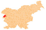
 Krstenica Location in Slovenia | |
| Coordinates: 46°4′19.76″N 13°37′24.34″E / 46.0721556°N 13.6234278°ECoordinates: 46°4′19.76″N 13°37′24.34″E / 46.0721556°N 13.6234278°E | |
| Country |
|
| Traditional region | Littoral |
| Statistical region | Gorizia |
| Municipality | Kanal |
| Area | |
| • Total | 0.52 km2 (0.20 sq mi) |
| Elevation | 152.4 m (500.0 ft) |
| [1] | |
Krstenica (pronounced [kəɾstɛˈniːtsa]) is a small settlement on the right bank of the Soča River between Kanal and Anhovo in the Littoral region of Slovenia.[2] Until 2007, the area was part of the settlement of Gorenja Vas.[1]
The local church is dedicated to Saint Nicholas and belongs to the parish of Kanal.[3]
References
- 1 2 Statistical Office of the Republic of Slovenia Archived November 18, 2008, at the Wayback Machine.
- ↑ Kanal municipal site
- ↑ Roman Catholic Diocese of Koper List of Churches May 2008 Archived March 6, 2009, at the Wayback Machine.
External links
| Settlements | Administrative centre: Kanal
|  | ||||||
|---|---|---|---|---|---|---|---|---|
| Landmarks |
| |||||||
| Notable people |
| |||||||
This article is issued from Wikipedia - version of the 11/14/2016. The text is available under the Creative Commons Attribution/Share Alike but additional terms may apply for the media files.