Kvenvær
| Kvenvær herad | |
|---|---|
| Former Municipality | |
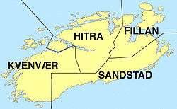
 Map of the old municipal boundaries in Hitra | |
| Municipality ID | NO-1618 |
| Adm. Center | Kvenvær |
| Area[1] | |
| • Total | 216 km2 (83 sq mi) |
| Created from | Hitra in 1913 |
| Merged into | Hitra in 1964 |
| Kvenvær | |
|---|---|
| Village | |
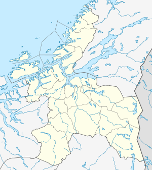
 Kvenvær  Kvenvær Location in Sør-Trøndelag | |
| Coordinates: 63°31′58″N 08°23′26″E / 63.53278°N 8.39056°ECoordinates: 63°31′58″N 08°23′26″E / 63.53278°N 8.39056°E | |
| Country | Norway |
| Region | Trøndelag |
| County | Sør-Trøndelag |
| District | Fosen |
| Municipality | Hitra |
| Elevation[2] | 4 m (13 ft) |
| Time zone | CET (UTC+01:00) |
| • Summer (DST) | CEST (UTC+02:00) |
| Post Code | 7243 Kvenvær |
Kvenvær is a fishing village and former municipality in Sør-Trøndelag county, Norway. The village of Kvenvær is located on the northwestern coast of the island of Hitra in the present-day municipality of Hitra. It is just south of the Bispøyan islands.
The former municipality of Kvenvær included the western part of the island of Hitra plus many surrounding islands including Bispøyan. Villages in Kvenvær included Forsnes, Andersskogan, and Kvenvær.[1]
History
The municipality of Kvenvær was established on 1 January 1913 when it was separated from Hitra to form a municipality of its own. The initial population of Kvenvær was 1,157. On 1 January 1964, the municipalities of Kvenvær, Hitra, Sandstad, and Fillan were merged to form a new, larger municipality of Hitra. Prior to the merger, Kvenvær had a population of 840.[3]
References
- 1 2 Store norske leksikon. "Kvenvær – tidl. kommune" (in Norwegian). Retrieved 2010-12-29.
- ↑ "Kvenvær" (in Norwegian). yr.no. Retrieved 2010-12-29.
- ↑ Jukvam, Dag (1999). "Historisk oversikt over endringer i kommune- og fylkesinndelingen" (PDF) (in Norwegian). Statistisk sentralbyrå.