Lientur Rocks
 Lientur Rocks Location in Antarctica | |
| Geography | |
|---|---|
| Location | Antarctica |
| Coordinates | 62°19′36″S 59°31′55″W / 62.32667°S 59.53194°WCoordinates: 62°19′36″S 59°31′55″W / 62.32667°S 59.53194°W |
| Archipelago | South Shetland Islands |
| Administration | |
|
None | |
| Demographics | |
| Population | Uninhabited |
| Additional information | |
| Administered under the Antarctic Treaty System | |

Lientur Rocks is a group of prominent adjacent rocks lying off the north coast of Robert Island in the South Shetland Islands, Antarctica and extending 660 m (722 yd) in east-west direction and 320 m (350 yd) in north-south direction. The area was visited by early 19th-century sealers operating from nearby Clothier Harbour.
The feature was named by the 1949-50 Chilean Antarctic Expedition after the expedition patrol ship Lientur.
Location
The rocks are centred at 62°19′36″S 59°31′55″W / 62.32667°S 59.53194°W which is 1.26 km (0.78 mi) north-northwest of Newell Point, 710 m (776 yd) north-northeast of Tatul Island, 3.12 km (1.94 mi) southeast of Henfield Rock, 3.41 km (2.12 mi) southwest of Mellona Rocks and 3.74 km (2.32 mi) west-southwest of Liberty Rocks (British mapping in 1968, Chilean in 1971, Argentine in 1980, and Bulgarian in 2009).
See also
- Composite Antarctic Gazetteer
- List of Antarctic islands south of 60° S
- SCAR
- Territorial claims in Antarctica
Maps
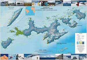
- L.L. Ivanov. Antarctica: Livingston Island and Greenwich, Robert, Snow and Smith Islands. Scale 1:120000 topographic map. Troyan: Manfred Wörner Foundation, 2009. ISBN 978-954-92032-6-4