List of Archaeological Protected Monuments in Ampara District
This is a list of Archaeological Protected Monuments in Ampara District, Sri Lanka.[1]
| Monument | Image | Location | Grama Niladhari Division |
Divisional Secretary's Division |
Registered | Description | Refs |
|---|---|---|---|---|---|---|---|
| Akuloba ruins | Akuloba | Borapola | Maha Oya | 26 December 2014 | Site of the ruins of buildings (Latitude 07º 52´ 30.7´´ N and longitude 081º 39´ 29.9´´ E) | [2] | |
| Alioluwa Wewa ruins | Colony No. B 07 | No. W/86/H, Ambamalthalawa | Ampara | 26 December 2014 | Site of the construction of ancient buildings with stone pillars at Catchment area of Alioluwa lake (Latitude 07º 14´ 54.2´´ N and longitude 81º 34´ 12.9´´ E) | [3] | |
| Aloka Raja Maha Vihara | Ekgaloya | No. W/24/B, Ekgaloya | Damana | 26 December 2014 | All places of ruins of ancient Arama complex including ancient Chaithya and ruins of buildings (Latitude 07º 18´ 43.8´´ N and longitude 81º 64´ 50.3´´ E) | [4] | |
| Aralupitiya ancient bridge | No. 140, Kehelulla | Padiyathalawa | 10 October 2014 | (latitude 07º 19' 372 N and longitude 081º 13' 554 E) | [5] | ||
| Aththaikandam ruins | Kambiluwil 02 | Thirukkovil | 26 December 2014 | Hillock of ancient Stupa, ruins of buildings at surrounding area and rock plane with archeological ruins belonging to the village (latitude 07º 08´ 17´´ N and longitude 81º 48´ 46´´ E) | [6] | ||
| Bandaraduwa Megalithic cemeteries | No. W/104B/2, Bandaraduwa | Uhana | 26 December 2014 | (Latitude 071º 25´ 26.7´´ N and longitude 081º 34´ 32.2´´ E) | [2] | ||
| Buddhangala Forest Hermitage | 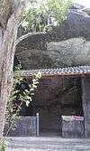 | Ampara | [7] | ||||
| Colony No. B 07 ruins | Colony No. B 07 | No. W/86/H, Ambamalthalawa | Ampara | 26 December 2014 | Rock plane with plight of steps in the paddy field (Latitude 07º 15´ 06.8´´ N and longitude 81º 34´ 15.5´´ E) | [3] | |
| Dewala Elakandiya Archaeological ruins | Pollebedda | Maha Oya | 23 January 2009 | The ancient ruins situated at Dewala Elakandiya ruins | [8] | ||
| Dighavapi | 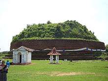 | Dighavapi | Addalachchenai | 18 April 1947 | The Stupa | [9][10] | |
| Dighavapi | Dighavapi | Addalachchenai | 31 December 1999 | Ancient caves with drip ledges and inscriptions, brick rampart, stone steps, stone pillars, carved holes on rock, workshops using stone posts and complete land with other ruins | [11] | ||
| Diviyagala Raja Maha Vihara | No. W/27/D, Diviyagala | Damana | 26 December 2014 | Arama complex including ancient Chaithya all caves with inscriptions and drip ledges, rock inscriptions and ruins of buildings (Latitude 07º 22´ 798´´ N and longitude 81º 62´ 68.4´´ E) | [4] | ||
| Dungalayaya ruins | Polwaga Colony | No. W/86/F, Polwaga Colony | Ampara | 26 December 2014 | Site of ruins with ancient stone pillars in the area called Dungalayaya, 117 (Latitude 07º 14´ 31.5´´ N and longitude 81º 35´ 22.6´´ E) | [3] | |
| Eragama lake ruins | Eragama 01 | No. 5-2-34-035, Eragama 01 | Eragama | 26 December 2014 | Rock plane with archeological evidences (Olinda poru, crucible) and the place nearby where pieces of ancient pottery are scattered near Eragama lake (Latitude 07º 14´ 419.1´´ N and longitude 81º 43´ 056´´ E) | [6] | |
| Eththama ruins | Eththama | No. P/10, Eththama | Pothuvil | 26 December 2014 | Place with ancient stone pillars at the place where houses are situated in Eththama village (Latitude 06º 53´ 17´´ N and longitude 81º 49´ 33´´ E) | [6] | |
| Galahitiyagoda ruins | Galahitiyagoda | No. W/88A/170, Galahitiyagoda | Uhana | 26 December 2014 | Small rock plane with Chronicles at the area called 40 Idama (Latitude 07º 21´ 52´´ N and longitude 081º 36´ 23´´ E) | [2] | |
| Galapitagala ruins | Galapitagala | No. W/104/C, Galapitagala | Uhana | 26 December 2014 | Small rock with plight of steps near the road of paddy field No. 32/109 (Latitude 07º 27´ 34´´ N and longitude 081º 39´ 17´´ E) | [2] | |
| Galmaduwa Raja Maha Vihara | Grama No. 05, Galmaduwa | No. W/27/H, Galmaduwa | Damana | 26 December 2014 | All archeological evidences including stone pillars and places of ancient buildings (Latitude 07º 26´ 23.5´´ N and longitude 81º 68´ 93.2´´ E) | [4] | |
| Gamwela ruins | Gamwela | No. 141/C, Hagamwela | Padiyathalawa | 10 October 2014 | Rock with archaeological evidences in the land called Mungalawa (latitude 07º 26' 42.6 N and longitude 081º 13' 25.2 E) | [5] | |
| Gamawela ruins | Gamawela | No. 141/C, Hagamwela | Padiyathalawa | 26 December 2014 | The rocks with archeological evidences in the land called Gamawelawaththa (Latitude 07º26´ 24.7´´ N and longitude 81º 13´ 18.5´´ E) | [6] | |
| Girikumbala Raja Maha Vihara | No. WA104/020, Bakkiella | Uhana | 26 December 2014 | Bases of pillars Postholes, place with ruins of buildings where pieces of ancient bricks and tiles are scattered and inscription at the premises (Latitude 07º 18´ 21.2´´ N and longitude 081º 35´ 50.1´´ E) | [3] | ||
| Gonagala ruins | Gonagala | No. W/104C/2105, Gonagala | Uhana | 26 December 2014 | Site with chronicles on the rock plane in Paddy land No. 31/65 (Latitude 07º 25´ 55´´ N and longitude 081º 39´ 33´´ E) | [2] | |
| Gonagolla Vihara | 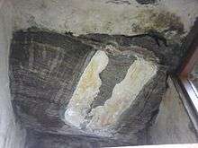 | Kotmale oya | Ancient frescoes and other ruins | [12] | |||
| Gorikana stone quarry | 136 A 1 Borapola | Maha Oya | 23 January 2009 | The stone quarry situated on the Gorikana Mount slope | [8] | ||
| Grama 09 Keenawaththa ruins | 35A land | No. W/27/E, Keenawaththa | Damana | 26 December 2014 | Cave complex with drip ledges and inscriptions (Latitude 07º 22´ 98.2´´ N and longitude 81º 65´ 430´´ E) | [4] | |
| Hagamwela ruins | Hagamwela | No. 141/C, Hagamwela | Padiyathalawa | 10 October 2014 | Archaeological evidences found in Kokagala mountain range (latitude 07º 25' 028 N and longitude 081º 12' 910 E) | [5] | |
| Hagirigolla Kotawehera ruins | Grama 09 Keenawaththa | No. W/27/E, Keenawaththa | Damana | 26 December 2014 | Rock plane with ancient Chaithya and evidences of buildings in the middle of paddy field (Latitude 07º 24´ 250´´ N and longitude 81º 63´ 63.8´´ E) | [4] | |
| Heethawanniya rock Archaeological ruins | 136 A 1 Borapola | Maha Oya | 23 January 2009 | The drip ledged rock caves with inscriptions situated on the Heethawanniya Mount slope | [8] | ||
| Hennanigala Raja Maha Vihara | Hennanigala | Dehiattakandiya | 23 February 2007 | Ancient Bodhigaraya, image house, pond with naga symbol, ancient rampart, Dathumandira, Poyage, Dagoba and the cave | [13] | ||
| Himidurawa ruins | Himidurawa | No. WA88-C270, Himidurawa | Uhana | 26 December 2014 | Site of the ruins of buildings with stone pillars (Latitude 07º 18´ 26.3´´ N and longitude 81º 37´ 52´´ E) | [3] | |
| Horabokka ruins | No. 141/C, Hagamwela | Padiyathalawa | 10 October 2014 | Complex of ruins including all the caves with Brahmi inscription and drip ledges in the mountain range called Kokagalakanda (Horabokka) (latitude 07º 27' 24.8 N and longitude 081º 12' 28.4 E) | [5] | ||
| Hulannuge ruins | Hulannuge | No. PP/12, Hulannuge | Lahugala | 26 December 2014 | Hillock of ancient Dagoba and place of ruins with stone pillars at the place called 14th mile post belonging to Hulannuge village (Latitude 06º 91´ 566´´ N and longitude 81º 65´ 134´´ E) | [6] | |
| Ilukpitiya Purana Vihara | Peranigama | No. W/27/A, Peranigama | Damana | 26 December 2014 | All places with archeological evidences including ancient Chaithya, cave complex with drip ledges and inscriptions and ruins of buildings (Latitude 07º 21´ 210´´ N and longitude 81º 66´ 47.8´´ E) | [4] | |
| Isanganichmai ruins | Isanganichmai | No. AP/20A/3, Isanganichmai | Akkaraipattu | 26 December 2014 | Rock plane, where chisel holings and pices of ancient bricks and pottery and other archeological evidences are scattered, in the middle of paddy field (Latitude 071º 258´´ N and longitude 81º 47´ 55´´ E) | [4] | |
| Isanganichmai ruins | No. AP/20A/3, Isanganichmai | Akkaraipattu | 26 December 2014 | Rock plane with hillock of ancient Chaithya, places of the ruins of buildings and where ancient tiles, bricks etcare scattered, in the middle of paddy field belonging to Isanganichmai village (Latitude 07º 13´ 06´´ N and longitude 81º 47´ 46´´ E) | [3] | ||
| Kambetta ruins | Kambetta | No. 02, Kambatta | Thirukkovil | 10 October 2014 | 03 rock boulders with archaeological evidence situated in the middle of the paddy field (latitude 07º 08' 21 N and longitude 081º 48' 07 E) | [5] | |
| Karabana ruins | Wadinagala | Damana | 26 December 2014 | Archeological sites, where slags and pices of ancient pottery are scattered, belonging to Karabana village (Latitude 071º 05´ 38´´ N and longitude 81º 57´ 78.4´´ E) | [4] | ||
| Karabana ruins | Wadinagala | Damana | 26 December 2014 | Places of buildings with ancient stone pillars belonging to Karabana village (Latitude 71º 0884´´ N and longitude 81º 57´ 35.2´´ E) | [4] | ||
| Karandikulam Archaeological ruins | Karandikulam | Addalachchenai | 31 December 1999 | All rocks, carved stairway, ancient stone corry and ruins of buildings | [11] | ||
| Kohombana ruins | Kohombana | No. W/102/01, Walagampura | Uhana | 26 December 2014 | Site with ruins of buildings (Latitude 07º 23´ 18´´ N and longitude 081º 37´ 02´´ E) | [2] | |
| Kokkulama ruins | Kokkulama | No. 11C, Sagama | Thirukkovil | 10 October 2014 | Old settlement site with ancient pieces of pottery and stone archaeological evidences situated in Kokkulama reserve (latitude 07º 05' 22 N and longitude 081º 44' 58 E) | [5] | |
| Kollegama Raja Maha Vihara (Holike) | No. 138, Holike | Padiyathalawa | 26 December 2014 | The place with ruins of buildings and other archeological relics at Ancient Temple premises (latitude 07º 22´ 098´´ N and longitude 81º 15´ 66.7´´ E) | [6] | ||
| Konduwattuwana Wewa Archaeological ruins |  | Ampara | |||||
| Kotawehera Purana Raja Maha Vihara | Ganangolla | No. W/86/K, Kotawehera | Ampara | 26 December 2014 | Hillock of Chaithya, hillock of ruins and other archaeological evidences (Latitude 07º 15´ 29.7´´ N and longitude 81º 37´ 51.5´´ E) | [3] | |
| Kotigala rock Archaeological ruins | 136 A 1 Borapola | Maha Oya | 24 July 2009 | The drip-ledged cave and Brahmi letters and the drip-ledged cave at the Venue called Digavapya, Kotigala | [14] | ||
| Kudumbigala | Panama | Padiyathalawa | Ancient stupa and other ruins | [15] | |||
| Kuduwil ruins | Kuduwil | No. SP84C-005-07, Eragama (Irakkamam) | Eragama | 26 December 2014 | Two rocks with relics of Teracotta items and the place where iron has been produced, pieces of ancient pottery in Kuduwil village (Latitude 07º 16´ 10´´ N and longitude 81º 44´ 42´´ E) | [6] | |
| Kuduwil ruins | Kuduwil | No. 5-2-34-005-07, Eragama | Eragama | 26 December 2014 | Rock plane with ancient signs (signs of a mortar) and rock plane with evidences of ancient buildings belonging to Kuduwil village (Latitude 07º 16´ 09´´ N and longitude 81º 49´ 20´´ E) | [6] | |
| Kurunduvinna Archaeological ruins | Kurunduvinna | Pollebedda | Maha Oya | 23 January 2009 | The ancient steps carved on the natural rock situated in the Village of Kurunduwinna | [8] | |
| Lunubokka (Nagiri) Aranya Senasana | Marava | No. 139B, Komana | Padiyathalawa | 10 October 2014 | All the caves with inscriptions, drip ledges and other archaeological remains (latitude 07º 21' 363 N and longitude 081º 19' 750 E) | [5] | |
| Magul Maha Viharaya | 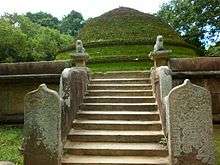 | Lahugala | Lahugala | 26 March 1954 | [16] | ||
| Mahathalawa ruins | Mahathalawa | Unuwathurabubula | Maha Oya | 26 December 2014 |
|
[17] | |
| Methodist Church, Kalmunai | Kalmunei | No. 01 B, Kalmunei | Kalmunai | 26 December 2014 | [17] | ||
| Meulugala Aranya Senasana | Kirihandigala | No. 138/B, Kolamanthalawa | Padiyathalawa | 10 October 2014 | Drip ledged rock caves (latitude 07º 21' 414 N and longitude 081º 17' 066 E) | [5] | |
| Mihindu Aranya Senasanaya | Kethsirigama | No. W/26/A, Kethsirigama | Damana | 26 December 2014 | Arama complex with ruins of ancient buildings, plight of steps, Chaithya at the premises (Latitude 71º 66´ 85´´ N and longitude 81º 58´ 195´´ E) | [4] | |
| Muhandiram Archaeological ruins | Mollikulam | Addalachchenai | 31 December 1999 | Ancient caves with drip ledge at Muhandiram rock | [11] | ||
| Muhudu Maha Viharaya | 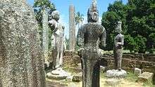 | Pothuvil | Pothuvil | [18] | |||
| Muwangala Raja Maha Vihara | No. W/27/13, Muwangala | Damana | 26 December 2014 | Rock with the drip ledged cave, rock inscriptions, ruins of buildings, plight of steps and other archaeological evidences at the premises (Latitude 07º 35´ 002´´ N and longitude 81º 76´ 20.6´´ E) | [4] | ||
| Navagiriyawa ruins | Navagiriyawa | No. W/104/60, Navagiriyawa | Uhana | 26 December 2014 | Site of ruins of buildings with stone pillars (Latitude 07º 26´ 42´´ N and longitude 081º 37´ 070´´ E) | [2] | |
| Nawainna Purana Vihara | No. 141/B, Unapana | Padiyathalawa | 26 December 2014 | The two places with ruins of buildings and other archaeological evidences at Ancient Temple premises (latitude 07º 26´ 152´´ N and longitude 81º 14´ 104´´ E) | [6] | ||
| Nidangala | Pollebedda | No. 136B | Maha Oya | 26 December 2014 | Rock called Nidangala with two rock inscriptions, plight of steps, chronicles and square type marks (Latitude 07º 47´ 94.1´´ N and longitude 081º 38´ 530´´ E) | [2] | |
| Niuguna Rajamaha Vihara | No. 5-2-34-0501, Eragama 05 | Eragama | 26 December 2014 | Hillock of Dagoba, rock inscription, ruins of buildings, plight of steps, places with evidences of Pre-historic era and the mountain range with ruins of buildings, drip ledged caves, siripathul gal situated in the south of the Vihara (Latitude 07º 13´ 40´´ N and longitude 81º 43´ 14´´ E) | [6] | ||
| Orukulam Archaeological ruins | Karandikulam | Addalachchenai | 31 December 1999 | Carved stairway of two rocks and carved elephant figures at Orukulam paddy field | [11] | ||
| Ovagiriya | Polwatta, Ampara | Ancient stupa and other ruins | |||||
| Padagoda Raja Maha Vihara | Pahalanda | No. W/28/A, Pahalanda | Damana | 26 December 2014 |
|
[4] | |
| Padavikanda Vihara | Marava | No. 139B, Komana | Padiyathalawa | 10 October 2014 | Natural rock plane with Hillock of ruins and inscriptions, drain system and pothole carved with a fish at the place (latitude 07º 20' 335 N and longitude 081º 20' 038 E) | [5] | |
| Padiyadora Vihara | Padiyathalawa | No. 140/D, Thalapita Oya Left | Padiyathalawa | 10 October 2014 | The ancient stupa, ruins of buildings, pond, wall and other archaeological evidences (latitude 70º 23' 981 N and longitude 081º 14' 900 E) | [5] | |
| Palaweli Shivan Kovil | Palaweli | No. 89B, Walathapitiya 01 | Samanthurai | 26 December 2014 | Rock plane with other archeological evidences including ancient letters and signs in front of the premises of Shivan Kovil (Latitude 07º 18´ 27.6´´ N and longitude 81º 43´ 05.1´´ E) | [3] | |
| Pallekadu Archaeological ruins | Oluvil | Addalachchenai | 31 December 1999 | Ruins of ancient dagoba, ancient stone wall and ruins of ancient buildings at Pallekadu jungle | [11] | ||
| Panagolla old quarry | Kahatagasyaya | No. W/100A/180, Kahatagasyaya | Uhana | 26 December 2014 | Small rock with the marks of old quarry (Latitude 07º 19´ 49´´ N and longitude 081º 34´ 26´´ E) | [2] | |
| Pannathgoda Purana Vihara | Pallamoya | No. W/26/B, Pallamoya | Damana | 26 December 2014 | All ruins of Arama complex with ancient Chaithya, rock inscription, plight of steps (Latitude 071º 46´ 59´´ N and longitude 81º 55´ 235´´ E) | [4] | |
| Pansalyaya ruins | No. 11C, Sagama | Thirukkovil | 10 October 2014 | Drip ledged cave, ruined buildings and other archaeological evidences found in the land (latitude 07º 06' 12 N and longitude 081º 45' 45 E) | [5] | ||
| Perawelthalawa ruins | Perawelthalawa | Unuwathura Bubula | Maha Oya | 26 December 2014 | Site of the ruins of buildings (Latitude 07º 37´ 79´´ N and longitude 081º 35´ 44.8´´ E) | [2] | |
| Piyangala Forest Hermitage | 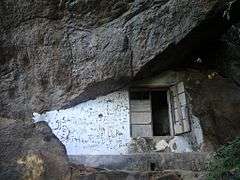 | Piyangala | No. 104/5W, Piyangala | Uhana | 26 December 2014 | Site of the ruins of buildings with stone pillars (Latitude 07º 30´ 16´´ N and longitude 081º 37´ 40´´ E) | [2] |
| Piyangala frescoes cave | Piyangala | Uhana | Ancient cave with veddas' paintings | ||||
| Pollebedda drainage system ruins | Pollebedda | Maha Oya | 23 January 2009 | The drainage system made of rock | [8] | ||
| Rajagama 08 ruins | Rajagama 08 | No. W/944/1-135, Rajagama South | Uhana | 26 December 2014 | Hillock of Dagoba in 95/1, land (Latitude 07º 24´ 45.3´´ N and longitude 081º 41´ 45.4´´ E) | [2] | |
| Rajagalatenna | 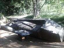 | Rajagalatenna | Uhana | [19] | |||
| Rajagalatenna ruins | Rajagalathenna 80 Bunteka | No. W/104/3, Rajagalathenna North | Uhana | 26 December 2014 |
|
[2] | |
| Rajagiri Purana Vihara | Mahakandiya | No. WA100, Mahakandiya | Uhana | 26 December 2014 | Rock with hillock of ancient Dagoba, ruins of buildings with stone pillars, places with chisel holing and other archaeological evidences | [3] | |
| Rambakan Oya Dam ruins | 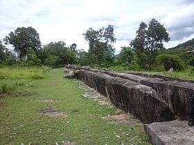 | Pollebedda | Maha Oya | 23 January 2009 | The ancient Tank bund of Rambukken Oya (Watawala Kandiya) | [8] | |
| Sagama Seya | Urakawattei | No. 11/C, Sagama | Thirukkovil | 10 October 2014 | (latitude 07º 08' 24 N and longitude 081º 49' 24 E) | [5] | |
| Sagamam ruins | No. 11C, Sagama | Thirukkovil | 10 October 2014 | The site of archaeological ruins with evidences of ancient settlements in the land near Kalipotaru canal (latitude 07º 07' 59 N and longitude 081º 48' 00 E) | [5] | ||
| Samangala Forest Hermitage |  | Kohombana | Ancient caves with drip ledge and brahmi inscriptions | [20] | |||
| Saranagama ruins | Saranagama | No. 140/D, Saranagama | Padiyathalawa | 10 October 2014 | Premises with slag. (Premises adjoining Thalapitaoya from Demodara College) situated within latitude 07º 25' 004 N and longitude 081º 15' 945 E | [5] | |
| Serankada Purana Vihara | No. 137/A, Serankada | Padiyathalawa | 26 December 2014 | The two places with ruins of buildings and other archaeological evidences at Ancient Temple premises (latitude 07º 27´ 165´´ N and longitude 81º 16´ 660´´ E) | [6] | ||
| Sir Swami Vipulananda house | Karthivu | Karthivu 01 | Karativu | 26 December 2014 | [3] | ||
| Sri Chandimarama Purana Vihara | Serupitiya | No. 142, Serupitiya | Dehiattakandiya | 26 December 2014 | Other archaeological relics including ancient shrine with stone statue of Buddha and stone pillars at the premises | [17] | |
| Sri Sumanarama Vihara, Weheragama | Weheragama | No. W/94A/3-115, Weheragama West | Uhana | 26 December 2014 | Natural rock plane with archeological evidences including ruins of buildings, drains, chisel holing, small stone ponds at the premises | [3] | |
| Sri Suvusudhdharmara Vihara, Moragahapallama | Moragahapallama | Damana | 26 December 2014 | Drip ledged cave (Latitude 07º 20´ 85.4´´ N and longitude 81º 60´ 62.9´´ E) | [4] | ||
| Sudagala pond | Wattamadu | No. 11C, Sagama | Thirukkovil | 10 October 2014 | The pond situated on the rock called Sudugala (latitude 07º 07' 13 N and longitude 081º 46' 06 E) | [5] | |
| Thalapitaoya ruins | Thalapitaoya South | No. 140/B, Thalapitaoya south | Padiyathalawa | 26 December 2014 | The place with ruins of buildings with stone pillars and rock plane with Brahmi inscriptions in the village (latitude 07º 23´ 811´´ N and longitude 81º 15´ 867´´ E) | [6] | |
| Thiruwaliwarpuram ruins | Thiruwaliwarpuram | No. 89, Thiruwaliwarpuram Malwaththa 01 | Samanthurai | 26 December 2014 |
|
[3] | |
| Thonikal Kandam ruins | Thonikal Kandam | No. 11C, Sagama | Thirukkovil | 10 October 2014 | Buddhist Monastery complex with hillock covering of stupa, drip ledged caves, rock inscriptions and ruins of buildings (latitude 07º 07' 49 N and longitude 081º 46' 33 E) | [5] | |
| Udayagiri Raja Maha Vihara |  | Udagirigama | No. W/88B, Udagirigama Eas | Uhana | 26 December 2014 | Site with the evidences of buildings with stone pillars, all archaeological relics such as Stupa chatra, Balustardes, Moonstone and flower altar at the premises | [2] |
| Uraniya ruins | Uraniya | No. P/25, Kanakarakiramam | Pothuvil | 26 December 2014 | Brick wall and archaeological evidences found in nearby area in the land called Suddage waththa (Latitude 06º 53´ 59´´ N and longitude 81º 50´ 34´´ E) | [6] | |
| Uththara Jayamaha Vihara | Hingurana | No. W/27/F, Karalewa | Damana | 26 December 2014 | Caves with drip ledges and inscriptions (Latitude 07º 22´ 14.5´´ N and longitude 81º 67´ 93.3´´ E) | [4] | |
| Veddagala Archaeological ruins | Mollikulam | Addalachchenai | 31 December 1999 | Ancient caves with drip ledge and other ruins of ancient buildings at Veddagala rock | [11] | ||
| Veeradi Amuna | Neinakadu | Addalachchenai | 31 December 1999 | Old Bund called Veeraadi Amuna crossed the Gal Oya | [11] | ||
| Veheragala Archaeological ruins | Dighavapi | Addalachchenai | 31 December 1999 | Stone inscription and other ruins in veheragala rock | [11] | ||
| Veheragala Archaeological ruins | Veheragala, Maha Oya | Maha Oya | 6 July 2007 | Ancient Bodhigaraya, image house, pond with naga symbol, ancient rampart, Dathumandira, Poyage, Dagoba and the cave | [21] | ||
| Veheragoda ruins | Thalapita Oya South | No. 140/B, Thalapita Oya South | Padiyathalawa | 10 October 2014 | Ruins with the Hillock of stupa and pillars at the place (latitude 07º 23' 315 N and longitude 081º 15' 913 E) | [5] | |
| Wahava ruins | Wahava | No. 139, Dorakumbura | Padiyathalawa | 10 October 2014 | Hillock of ancient stupa, ruins of buildings and other archaeological remains (latitude 07º 21' 609 N and longitude 081º 18' 419 E) | [5] | |
| Walathapitiya ruins | No. 89B, Walathapitiya 01 | Samanthurai | 26 December 2014 | Rock plane with grinding places and other archaeological evidences in the paddy field, Pudukkadu (Latitude 07º 18´ 50.0´´ N and longitude 81º 43´ 48.9´´ E) | [3] | ||
| Walathapitiya Wewa road ruins | No. 89B, Walathapitiya 01 | Samanthurai | 26 December 2014 | Rock plane with sign of quarry at Walathapitiya lake road (Latitude 07º 18´ 42.6´´ N and longitude 081º 43´ 17.7´´ E) | [3] | ||
| Waralanda ruins | Waralanda | Waralanda | Lahugala | 26 December 2014 | Place of ruins with ancient stone pillars in a land near the causeway on Lahugala-Kiriwehera road belonging to Waralanda village (Latitude 06º 87´ 208´´ N and longitude 81º 72´ 11.9´´ E) | [6] | |
| Wattamadu ruins | Wattamadu | No. 11C, Sagama | Thirukkovil | 10 October 2014 | Building complex with ruins with places consists of ruined buildings, stupas and stone remains at the place called Wattamadu (latitude 07º 06' 29 N and longitude 081º 45' 45 E) | [5] | |
| Wavinna Gewal Hatha ruins | Wavinna Gewal Hatha | No. W/86/E, Wavinna | Ampara | 26 December 2014 | Rock plane with rock inscription and evidences of the construction of ancient buildings (Latitude 07º 14´ 089´´ N and longitude 81º 14´ 58.5´´ E) | [3] | |
| Weeragoda Purana Gale Vihara | Weeragoda | No. W/93C/4-220, Weeragoda North | Uhana | 26 December 2014 | Rock plane with hillock of Chaithya, ruins of a shrine and base pockets of pillars at the premises (Latitude 07º22´ 48.7´´ N and longitude 081º 41´ 29.9´´ E) | [2] | |
| Wembeadikulam ruins | Wembeadikulam | No. 11C, Sagama | Thirukkovil | 10 October 2014 | Natural rock plain with flight of steps and base stones at the Eastern end of forest reservations (latitude 07º 05' 42 N and longitude 081º 43' 54 E) | [5] | |
| Wembeadikulam ruins | Wembeadikulam | No. 11C, Sagama | Thirukkovil | 10 October 2014 | Rock with pre historic evidences and ruins of Buddhist Monastery complex situated on the North-East from the lake called Wembeadikulam (latitude 07º 05' 34 N and longitude 081º 43' 40 E) | [5] | |
| Werankotagoda Agrarian Services office ruins | Werankotagoda | No. W/104A/005, Mayadunna | Uhana | 26 December 2014 | Site with other archaeological evidences including the building with laid down stone tablets and the wall around the building situated towards south from Agrarian Services office (Latitude 07º 25´ 12´´ N and longitude 081º 37´ 16´´ E) | [2] | |
| Wiranathalawa ruins | Wiranathalawa | Unuwathurabubula | Maha Oya | 26 December 2014 |
|
[17] | |
This list is incomplete; you can help by expanding it.
Notes
- ↑ "Protercted Monument List 2012-12-12 (In Sinhala)" (PDF). Department of Archaeology. 12 December 2012. Retrieved 29 March 2016.
- 1 2 3 4 5 6 7 8 9 10 11 12 13 14 15 16 Gazette 1895 26 December 2014, p. 1150.
- 1 2 3 4 5 6 7 8 9 10 11 12 13 14 15 Gazette 1895 26 December 2014, p. 1149.
- 1 2 3 4 5 6 7 8 9 10 11 12 13 14 15 Gazette 1895 26 December 2014, p. 1148.
- 1 2 3 4 5 6 7 8 9 10 11 12 13 14 15 16 17 18 19 20 21 Gazette 1884 10 October 2014, p. 912.
- 1 2 3 4 5 6 7 8 9 10 11 12 13 14 Gazette 1895 26 December 2014, p. 1147.
- ↑ "Buddangala". Department of Archaeology. Retrieved 1 March 2016.
- 1 2 3 4 5 6 Gazette 1586 23 January 2009, p. 108.
- ↑ "Gazette". The Gazette of the Democratic Socialist Republic of Sri Lanka. 9692. 18 April 1947.
- ↑ Deegawapi Chaithiya i and its vicinity declared a sacred premise
- 1 2 3 4 5 6 7 8 "Gazette". The Gazette of the Democratic Socialist Republic of Sri Lanka. 2106. 31 December 1999.
- ↑ "Gonagolla". Department of Archaeology. Retrieved 1 March 2016.
- ↑ Gazette 1486 23 February 2007, p. 9.
- ↑ Gazette 1612 24 July 2009, p. 1025.
- ↑ "Kudumbigala". Department of Archaeology. Retrieved 1 March 2016.
- ↑ "Gazette". The Gazette of the Democratic Socialist Republic of Sri Lanka. 10657. 26 March 1954.
- 1 2 3 4 Gazette 1895 26 December 2014, p. 1151.
- ↑ "Muhudu Maha Viharaya". Department of Archaeology. Retrieved 1 March 2016.
- ↑ "Rajagala". Department of Archaeology. Retrieved 1 March 2016.
- ↑ "Samangala". Department of Archaeology. Retrieved 1 March 2016.
- ↑ Gazette 1505 6 July 2007, p. 11.
References
- "PART I : SECTION (I) — GENERAL Government Notifications" (PDF). The Gazette of the Democratic Socialist Republic of Sri Lanka. 1486. 23 February 2007.
- "PART I : SECTION (I) — GENERAL Government Notifications" (PDF). The Gazette of the Democratic Socialist Republic of Sri Lanka. 1505. 6 July 2007.
- "PART I : SECTION (I) — GENERAL Government Notifications" (PDF). The Gazette of the Democratic Socialist Republic of Sri Lanka. 1586. 23 January 2009.
- "PART I : SECTION (I) — GENERAL Government Notifications" (PDF). The Gazette of the Democratic Socialist Republic of Sri Lanka. 1612. 24 July 2009.
- "PART I : SECTION (I) — GENERAL Government Notifications" (PDF). The Gazette of the Democratic Socialist Republic of Sri Lanka. 1884. 10 October 2014.
- "PART I : SECTION (I) — GENERAL Government Notifications" (PDF). The Gazette of the Democratic Socialist Republic of Sri Lanka. 1895. 26 December 2014.
External links
This article is issued from Wikipedia - version of the 10/17/2016. The text is available under the Creative Commons Attribution/Share Alike but additional terms may apply for the media files.