| [3] |
Name on the Register[4] |
Image |
Date listed[5] |
Location |
City or town |
Description |
|---|
| 1 |
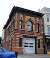
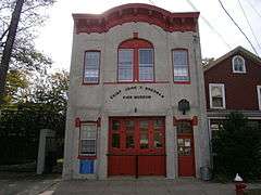
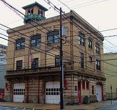
Association of Exempt Firemen Building |
|
000000001984-03-30-0000March 30, 1984
(#84002678) |
213 Bloomfield St.
40°44′22″N 74°02′01″W / 40.739444°N 74.033611°W / 40.739444; -74.033611 (Association of Exempt Firemen Building) |
Hoboken |
Hoboken Firefighters Museum; part of the Hoboken Firehouses and Firemen's Monument Thematic Resource (TR)
|
| 2 |
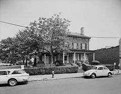
Dr. William Barrow Mansion |
|
000000001977-05-02-0000May 2, 1977
(#77000872) |
83 Wayne St.
40°43′12″N 74°02′56″W / 40.72°N 74.048889°W / 40.72; -74.048889 (Dr. William Barrow Mansion) |
Jersey City |
|
| 3 |
Bayonne Truck House No. 1 |
|
000000001976-01-02-0000January 2, 1976
(#76001155) |
12 W. 47th St.
40°40′51″N 74°06′18″W / 40.680833°N 74.105°W / 40.680833; -74.105 (Bayonne Truck House No. 1) |
Bayonne |
Bayonne Firefighters Museum
|
| 4 |
Bayonne Trust Company |
|
000000002006-08-08-0000August 8, 2006
(#06000693) |
229-231 Broadway
40°39′25″N 74°07′35″W / 40.656944°N 74.126389°W / 40.656944; -74.126389 (Bayonne Trust Company) |
Bayonne |
Bayonne Community Museum
|
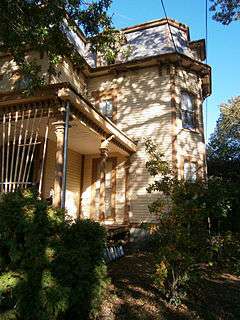
| 5 |
Buildings at 1200-1206 Washington Street |
|
000000001987-03-09-0000March 9, 1987
(#87000350) |
1200-1206 Washington St.
40°44′57″N 74°01′38″W / 40.749167°N 74.027222°W / 40.749167; -74.027222 (Buildings at 1200-1206 Washington Street) |
Hoboken |
aka The Yellow Flats
|
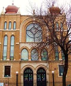
| 6 |
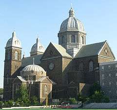
Church of Our Lady of Grace |
|
000000001996-05-31-0000May 31, 1996
(#96000550) |
400 Willow Ave.
40°44′32″N 74°02′03″W / 40.742222°N 74.034167°W / 40.742222; -74.034167 (Church of Our Lady of Grace) |
Hoboken |
|
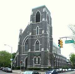
| 7 |
Church of the Holy Innocents |
|
000000001977-05-24-0000May 24, 1977
(#77000871) |
Willow Ave. and 6th St.
40°44′38″N 74°02′01″W / 40.743889°N 74.033611°W / 40.743889; -74.033611 (Church of the Holy Innocents) |
Hoboken |
|
| 8 |
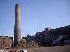
Clark Thread Company Historic District |
|
000000001978-06-02-0000June 2, 1978
(#78001764) |
900 Passaic Ave.
40°45′07″N 74°09′45″W / 40.751944°N 74.1625°W / 40.751944; -74.1625 (Clark Thread Company Historic District) |
East Newark |
|
| 9 |
Engine Company No. 2 |
|
000000001984-03-30-0000March 30, 1984
(#84002684) |
1313 Washington St.
40°45′09″N 74°01′36″W / 40.7525°N 74.026667°W / 40.7525; -74.026667 (Engine Company No. 2) |
Hoboken |
part of the Hoboken Firehouses and Firemen's Monument TR
|
| 10 |
Engine Company No. 3 |
|
000000001984-03-30-0000March 30, 1984
(#84002687) |
201 Jefferson St.
40°44′27″N 74°02′17″W / 40.740833°N 74.038056°W / 40.740833; -74.038056 (Engine Company No. 3) |
Hoboken |
part of the Hoboken Firehouses and Firemen's Monument TR
|
| 11 |
Engine Company No. 4 |
|
000000001984-03-30-0000March 30, 1984
(#84002691) |
212 Park Ave.
40°44′23″N 74°02′01″W / 40.739722°N 74.033611°W / 40.739722; -74.033611 (Engine Company No. 4) |
Hoboken |
part of the Hoboken Firehouses and Firemen's Monument TR
|
| 12 |
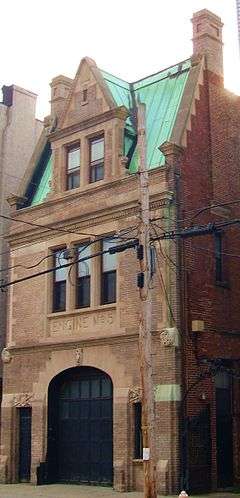
Engine Company No. 5 |
|
000000001984-03-30-0000March 30, 1984
(#84002693) |
412 Grand St.
40°44′33″N 74°02′10″W / 40.7425°N 74.036111°W / 40.7425; -74.036111 (Engine Company No. 5) |
Hoboken |
part of the Hoboken Firehouses and Firemen's Monument TR
|
| 13 |
Engine Company No. 6 |
|
000000001984-03-30-0000March 30, 1984
(#84002695) |
801 Clinton St.
40°44′47″N 74°02′01″W / 40.746389°N 74.033611°W / 40.746389; -74.033611 (Engine Company No. 6) |
Hoboken |
part of the Hoboken Firehouses and Firemen's Monument TR
|
| 14 |
Engine House No. 3, Truck No. 2 |
|
000000001984-03-30-0000March 30, 1984
(#84002700) |
501 Observer Hwy.
40°44′11″N 74°02′26″W / 40.736389°N 74.040556°W / 40.736389; -74.040556 (Engine House No. 3, Truck No. 2) |
Hoboken |
part of the Hoboken Firehouses and Firemen's Monument TR
|
| 15 |
Erie-Lackawanna Railroad Terminal at Hoboken |
|
000000001973-07-24-0000July 24, 1973
(#73001102) |
On the Hudson River at the foot of Hudson Pl.
40°44′05″N 74°01′27″W / 40.734722°N 74.024167°W / 40.734722; -74.024167 (Erie-Lackawanna Railroad Terminal at Hoboken) |
Hoboken |
|
| 16 |
Fairmount Apartments |
|
000000001995-03-03-0000March 3, 1995
(#95000183) |
2595 Kennedy Blvd.
40°43′30″N 74°04′27″W / 40.725°N 74.074167°W / 40.725; -74.074167 (Fairmount Apartments) |
Jersey City |
|
| 17 |
Ficken's Warehouse |
|
000000001984-06-14-0000June 14, 1984
(#84002703) |
750-766 Grand St.
40°42′55″N 74°04′12″W / 40.715278°N 74.07°W / 40.715278; -74.07 (Ficken's Warehouse) |
Jersey City |
|
| 18 |
Firemen's Monument |
|
000000001986-10-30-0000October 30, 1986
(#86003454) |
Church Square Pk.
40°44′31″N 74°01′56″W / 40.741944°N 74.032222°W / 40.741944; -74.032222 (Firemen's Monument) |
Hoboken |
part of the Hoboken Firehouses and Firemen's Monument TR
|
| 19 |
First Baptist Church |
|
000000002006-02-01-0000February 1, 2006
(#05001570) |
901-907 Bloomfield St.
40°44′58″N 74°01′43″W / 40.749444°N 74.028611°W / 40.749444; -74.028611 (First Baptist Church) |
Hoboken |
|
| 20 |
First Reformed Dutch Church of Bergen Neck |
|
000000001982-04-22-0000April 22, 1982
(#82003274) |
Avenue C and 33rd St.
40°40′25″N 74°06′52″W / 40.673611°N 74.114444°W / 40.673611; -74.114444 (First Reformed Dutch Church of Bergen Neck) |
Bayonne |
|
| 21 |
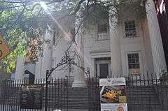
Grace Church Van Vorst |
|
000000001979-08-01-0000August 1, 1979
(#79001492) |
268 2nd St
40°43′21″N 74°02′42″W / 40.7225°N 74.045°W / 40.7225; -74.045 (Grace Church Van Vorst) |
Jersey City |
|
| 22 |
Great Atlantic and Pacific Tea Company Warehouse |
|
000000001978-06-02-0000June 2, 1978
(#78001766) |
Provost St. between 1st and Bay Sts.
40°43′16″N 74°02′25″W / 40.721111°N 74.040278°W / 40.721111; -74.040278 (Great Atlantic and Pacific Tea Company Warehouse) |
Jersey City |
|
| 23 |
Hackensack Water Company Complex |
|
000000001980-01-03-0000January 3, 1980
(#80002491) |
4100 Park Ave.
40°46′24″N 74°01′13″W / 40.773333°N 74.020278°W / 40.773333; -74.020278 (Hackensack Water Company Complex) |
Weehawken |
|
| 24 |
Hale-Whitney Mansion |
|
000000001996-06-07-0000June 7, 1996
(#96000657) |
100 Broadway
40°38′56″N 74°07′42″W / 40.648889°N 74.128333°W / 40.648889; -74.128333 (Hale-Whitney Mansion) |
Bayonne |
|
| 25 |
Hamilton Park Historic District |
|
000000001979-01-25-0000January 25, 1979
(#79001493) |
Roughly bounded by Brunswick, Grove, 6th, and 9th Sts.
• Boundary increase (listed 000000001982-12-02-0000December 2, 1982, refnum 82001044): Jersey Ave. and 10th St.
40°43′35″N 74°02′45″W / 40.726389°N 74.045833°W / 40.726389; -74.045833 (Hamilton Park Historic District) |
Jersey City |
|
| 26 |
Harsimus Cove Historic District |
|
000000001987-12-09-0000December 9, 1987
(#87002118) |
Roughly bounded by Grove Dr., Bay & First Sts., Jersey Ave., Second, & Coles Sts.
40°43′24″N 74°02′41″W / 40.723333°N 74.044722°W / 40.723333; -74.044722 (Harsimus Cove Historic District) |
Jersey City |
|
| 27 |
Highland Hose No. 4 |
|
000000001987-05-29-0000May 29, 1987
(#87000856) |
72-74 Halstead St.
40°45′45″N 74°09′03″W / 40.7625°N 74.150833°W / 40.7625; -74.150833 (Highland Hose No. 4) |
Kearny |
|
| 28 |
Hoboken City Hall |
|
000000001976-01-01-0000January 1, 1976
(#76001156) |
86-98 Washington St.
40°44′14″N 74°01′55″W / 40.737222°N 74.031944°W / 40.737222; -74.031944 (Hoboken City Hall) |
Hoboken |
|
| 29 |
Hoboken Free Public Library and Manual Training School |
|
000000002015-08-04-0000August 4, 2015
(#14000535) |
500 Park Ave.
40°44′34″N 74°01′56″W / 40.74290°N 74.03228°W / 40.74290; -74.03228 (Hoboken Free Public Library and Manual Training School) |
Hoboken |
|
| 30 |
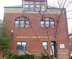
Hoboken Land and Improvement Company Building |
|
000000001979-07-03-0000July 3, 1979
(#79001491) |
1 Newark St.
40°44′10″N 74°01′44″W / 40.736111°N 74.028889°W / 40.736111; -74.028889 (Hoboken Land and Improvement Company Building) |
Hoboken |
|
| 31 |
Holland Tunnel |
|
000000001993-11-04-0000November 4, 1993
(#93001619) |
Connecting Lower Manhattan and Jersey City, running under the Hudson R.
40°43′38″N 74°00′41″W / 40.727222°N 74.011389°W / 40.727222; -74.011389 (Holland Tunnel) |
Jersey City |
|
| 32 |
Hook and Ladder No. 3 |
|
000000002015-08-24-0000August 24, 2015
(#15000049) |
218 Central Ave.
40°44′31″N 74°03′07″W / 40.741999°N 74.051920°W / 40.741999; -74.051920 (Hook and Ladder No. 3) |
Jersey City |
|
| 33 |
Hudson and Manhattan Railroad Powerhouse |
|
000000002001-11-23-0000November 23, 2001
(#01001256) |
60-84 Bay St., 344-56 Washington Blvd.
40°43′14″N 74°02′10″W / 40.720556°N 74.036111°W / 40.720556; -74.036111 (Hudson and Manhattan Railroad Powerhouse) |
Jersey City |
|
| 34 |
Hudson County Courthouse |
|
000000001970-08-25-0000August 25, 1970
(#70000385) |
Newark and Baldwin Aves.
40°43′53″N 74°03′29″W / 40.731389°N 74.058056°W / 40.731389; -74.058056 (Hudson County Courthouse) |
Jersey City |
|
| 35 |
Jefferson Trust Company |
|
000000001986-02-13-0000February 13, 1986
(#86000214) |
313-315 First St.
40°44′15″N 74°02′09″W / 40.7375°N 74.035833°W / 40.7375; -74.035833 (Jefferson Trust Company) |
Hoboken |
|
| 36 |
Jersey City Central Railroad Terminal |
|
000000001975-09-12-0000September 12, 1975
(#75001138) |
U.S. 78 north of Ellis Island
40°42′30″N 74°02′39″W / 40.708333°N 74.044167°W / 40.708333; -74.044167 (Jersey City Central Railroad Terminal) |
Jersey City |
|
| 37 |
Jersey City High School |
|
000000001982-06-01-0000June 1, 1982
(#82003275) |
2 Palisade Ave.
40°43′48″N 74°03′16″W / 40.73°N 74.054444°W / 40.73; -74.054444 (Jersey City High School) |
Jersey City |
|
| 38 |
Jersey City Medical Center |
|
000000001985-11-27-0000November 27, 1985
(#85003057) |
Roughly bounded by Montgomery St., Cornelison Ave., Dupont St., Clifton Pl., and Baldwin Ave.
40°43′20″N 74°03′51″W / 40.722222°N 74.064167°W / 40.722222; -74.064167 (Jersey City Medical Center) |
Jersey City |
Renovation/restoration as residential/commercial mixed-use development, The Beacon
|
| 39 |
Jersey City YMCA |
|
000000001999-11-12-0000November 12, 1999
(#99001314) |
654 Bergan Ave.
40°43′17″N 74°04′19″W / 40.721389°N 74.071944°W / 40.721389; -74.071944 (Jersey City YMCA) |
Jersey City |
|
| 40 |
KESTREL (steam yacht) |
Upload image |
000000001977-08-12-0000August 12, 1977
(#77000873) |
George C. Boldt Yacht House, Saint Lawrence River, Jefferson County, New York
Coordinates missing |
moored at West New York when listed |
renovated and relocated
donated to Thousand Islands Bridge Authority
|
| 41 |
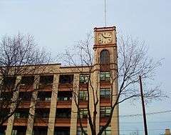
Keuffel and Esser Manufacturing Complex |
|
000000001985-09-12-0000September 12, 1985
(#85002183) |
3rd, Grand & Adams St.
40°44′29″N 74°02′13″W / 40.741389°N 74.036944°W / 40.741389; -74.036944 (Keuffel and Esser Manufacturing Complex) |
Hoboken |
Now residences known as Clock Towers
|
| 42 |
Labor Bank Building |
|
000000001984-06-14-0000June 14, 1984
(#84002705) |
26 Journal Sq.
40°43′49″N 74°03′50″W / 40.730278°N 74.063889°W / 40.730278; -74.063889 (Labor Bank Building) |
Jersey City |
|
| 43 |
Lembeck and Betz Eagle Brewing Company District |
|
000000001984-06-21-0000June 21, 1984
(#84002707) |
Bounded by 9th, 10th, Grove and Henderson StS.
40°43′42″N 74°02′29″W / 40.728333°N 74.041389°W / 40.728333; -74.041389 (Lembeck and Betz Eagle Brewing Company District) |
Jersey City |
The brewery buildings were demolished in 1997.
|
| 44 |
Monastery and Church of Saint Michael the Archangel |
|
000000001986-03-06-0000March 6, 1986
(#86000418) |
2019 West St.
40°45′56″N 74°02′14″W / 40.765556°N 74.037222°W / 40.765556; -74.037222 (Monastery and Church of Saint Michael the Archangel) |
Union City |
|
| 45 |
Morris Canal |
|
000000001974-10-01-0000October 1, 1974
(#74002228) |
Irregular line beginning at Phillipsburg and ending at Jersey City
40°41′08″N 75°09′49″W / 40.685556°N 75.163611°W / 40.685556; -75.163611 (Morris Canal) |
Not applicable |
|
| 46 |
Old Bergen Church |
|
000000001973-08-14-0000August 14, 1973
(#73001103) |
Bergen and Highland Aves.
40°43′37″N 74°04′10″W / 40.726944°N 74.069444°W / 40.726944; -74.069444 (Old Bergen Church) |
Jersey City |
|
| 47 |
Paulus Hook Historic District |
|
000000001982-06-21-0000June 21, 1982
(#82003276) |
Greene, Washington, Grand, Sussex, Morris, Essex, Warren and York Sts.
• Boundary increase (listed 000000001985-05-13-0000May 13, 1985, refnum 85002450): Roughly bounded by York, Green, Essex and Henderson
40°42′55″N 74°02′21″W / 40.715278°N 74.039167°W / 40.715278; -74.039167 (Paulus Hook Historic District) |
Jersey City |
|
| 48 |
Pohlmann's Hall |
|
000000001985-09-05-0000September 5, 1985
(#85002001) |
154 Ogden Ave.
40°44′23″N 74°02′45″W / 40.739722°N 74.045833°W / 40.739722; -74.045833 (Pohlmann's Hall) |
Jersey City |
|
| 49 |
Reservoir No. 3 |
|
000000002012-08-27-0000August 27, 2012
(#12000569) |
Bounded by Summit, Jefferson, Central & Reservoir Aves.
40°44′25″N 74°03′18″W / 40.740307°N 74.054956°W / 40.740307; -74.054956 (Reservoir No. 3) |
Jersey City |
|
| 50 |
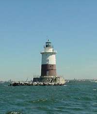
Robbins Reef Light Station |
|
000000002006-07-19-0000July 19, 2006
(#06000631) |
Southwest Upper New York Bay, 2.6 miles (4.2 km) southeast of I-78 Interchange 14A
40°39′26″N 74°03′56″W / 40.657222°N 74.065556°W / 40.657222; -74.065556 (Robbins Reef Light Station) |
Bayonne |
|
| 51 |
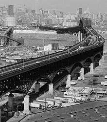
Route 1 Extension |
|
000000002005-08-12-0000August 12, 2005
(#05000880) |
US 1 and 9 milepoint: 51.25-54.55, NJ 139 milepoint 0-1.45
40°44′09″N 74°05′30″W / 40.73583°N 74.09167°W / 40.73583; -74.09167 (Route 1 Extension) |
Jersey City and Kearny |
Includes Pulaski Skyway. Also listed in Essex County section.
|
| 52 |
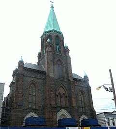
Saint Ann's Roman Catholic Church and Rectory |
|
000000002015-11-24-0000November 24, 2015
(#15000817) |
704 Jefferson St.
40°44′46″N 74°02′10″W / 40.746226°N 74.036196°W / 40.746226; -74.036196 (Saint Ann's Roman Catholic Church and Rectory) |
Hoboken |
|
| 53 |
St. Anthony of Padua Roman Catholic Church |
|
000000002004-03-22-0000March 22, 2004
(#04000225) |
457 Monmouth St.
40°43′41″N 74°02′57″W / 40.728056°N 74.049167°W / 40.728056; -74.049167 (St. Anthony of Padua Roman Catholic Church) |
Jersey City |
|
| 54 |
St. Patrick's Parish and Buildings |
|
000000001980-09-17-0000September 17, 1980
(#80002489) |
Grand St., Ocean and Bramhall Aves.
40°42′50″N 74°04′23″W / 40.713889°N 74.073056°W / 40.713889; -74.073056 (St. Patrick's Parish and Buildings) |
Jersey City |
|
| 55 |
St. Vincent de Paul Roman Catholic Church |
|
000000002011-08-24-0000August 24, 2011
(#11000590) |
979 Ave. C
40°40′55″N 74°06′24″W / 40.681944°N 74.106667°W / 40.681944; -74.106667 (St. Vincent de Paul Roman Catholic Church) |
Bayonne |
|
| 56 |
Statue of Liberty National Monument, Ellis Island and Liberty Island |
|
000000001966-10-15-0000October 15, 1966
(#66000058) |
Upper New York Bay
40°41′38″N 74°02′37″W / 40.693889°N 74.043611°W / 40.693889; -74.043611 (Statue of Liberty National Monument, Ellis Island and Liberty Island) |
Jersey City |
|
| 57 |
Edwin A. Stevens Hall |
|
000000001994-02-04-0000February 4, 1994
(#94000009) |
Fifth St. between Hudson and River Sts.
40°44′32″N 74°01′41″W / 40.742222°N 74.028056°W / 40.742222; -74.028056 (Edwin A. Stevens Hall) |
Hoboken |
|
| 58 |
United Synagogue of Hoboken |
|
000000002008-06-27-0000June 27, 2008
(#08000563) |
115-117 Park Ave
40°44′17″N 74°02′01″W / 40.738104°N 74.033496°W / 40.738104; -74.033496 (United Synagogue of Hoboken) |
Hoboken |
|
| 59 |
Van Vorst Park Historic District |
|
000000001980-03-05-0000March 5, 1980
(#80002490) |
Roughly bounded by Railroad Ave., Henderson, Grand, Bright, and Monmouth Sts.
• Boundary increase (listed 000000001984-10-11-0000October 11, 1984, refnum 84000084): Roughly bounded by Railroad Ave., Henderson, Bright, Varick and Monmouth Sts.
40°43′07″N 74°02′50″W / 40.718611°N 74.047222°W / 40.718611; -74.047222 (Van Vorst Park Historic District) |
Jersey City |
|
| 60 |
Van Wagenen House |
|
000000002006-08-16-0000August 16, 2006
(#05000884) |
298 Academy St.
40°43′49″N 74°03′58″W / 40.730259°N 74.066242°W / 40.730259; -74.066242 (Van Wagenen House) |
Jersey City |
|
| 61 |
West Bergen-East Lincoln Park Historic District |
Upload image |
000000002016-07-19-0000July 19, 2016
(#15000050) |
Roughly bounded by Bergen, Harrison, West Side, Kensington & Fairmount Aves., Kennedy Blvd. & Montgomery St.
40°43′13″N 74°04′19″W / 40.720326°N 74.072016°W / 40.720326; -74.072016 (West Bergen-East Lincoln Park Historic District) |
Jersey City |
|



.jpg)





.jpg)
