Médio Tejo (intermunicipal community)
Not to be confused with Médio Tejo Subregion.

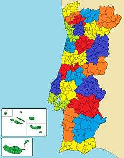
Map showing the location of the Médio Tejo intermunicipal community (in light blue)
The Comunidade Intermunicipal do Médio Tejo (English: Middle Tagus) is an administrative division in Portugal. It was created in December 2008, replacing the former Comunidade Urbane do Médio Tejo created in 2004.[1] It takes its name from the river Tagus. The seat of the intermunicipal community is Tomar. Médio Tejo comprises parts of the former districts of Santarém and Castelo Branco. The population in 2011 was 247,331,[2] in an area of 3,344.31 km².[3]
Municipalities
The CIM Médio Tejo is composed of 13 municipalities:[4]
| Municipality | Population (2011)[2] | Area (km²)[3] | NUTS III region |
|---|---|---|---|
| Abrantes | 39,325 | 714.69 | Médio Tejo |
| Alcanena | 13,868 | 127.33 | Médio Tejo |
| Constância | 4,056 | 80.37 | Médio Tejo |
| Entroncamento | 20,206 | 13.73 | Médio Tejo |
| Ferreira do Zêzere | 8,619 | 190.38 | Médio Tejo |
| Ourém | 45,932 | 416.68 | Médio Tejo |
| Sardoal | 3,939 | 92.15 | Médio Tejo |
| Tomar | 40,677 | 351.20 | Médio Tejo |
| Torres Novas | 36,717 | 270.00 | Médio Tejo |
| Vila Nova da Barquinha | 7,322 | 49.53 | Médio Tejo |
| Mação | 7,338 | 399.98 | Pinhal Interior Sul |
| Sertã | 15,880 | 446.73 | Pinhal Interior Sul |
| Vila de Rei | 3,452 | 191.55 | Pinhal Interior Sul |
| Total | 247,331 | 3,344.31 |
References
- ↑ CIM Médio Tejo
- 1 2 Instituto Nacional de Estatística
- 1 2 Direção-Geral do Território
- ↑ "Law nr. 75/2013" (pdf). Diário da República (in Portuguese). Assembly of the Republic (Portugal). Retrieved 18 August 2014.
External links
Coordinates: 39°36′N 8°25′W / 39.600°N 8.417°W
This article is issued from Wikipedia - version of the 10/25/2016. The text is available under the Creative Commons Attribution/Share Alike but additional terms may apply for the media files.