Manea railway station
| Manea | |
|---|---|
|
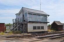
A view of the two platforms | |
| Location | |
| Place | Manea |
| Local authority | Fenland |
| Grid reference | TL479911 |
| Operations | |
| Station code | MNE |
| Managed by | Abellio Greater Anglia |
| Number of platforms | 2 |
| DfT category | F2 |
|
Live arrivals/departures, station information and onward connections from National Rail Enquiries | |
| Annual rail passenger usage* | |
| 2010/11 |
|
| 2011/12 |
|
| 2012/13 |
|
| 2013/14 |
|
| 2014/15 |
|
| National Rail – UK railway stations | |
| * Annual estimated passenger usage based on sales of tickets in stated financial year(s) which end or originate at Manea from Office of Rail and Road statistics. Methodology may vary year on year. | |
|
| |

Manea railway station /ˈmeɪniː/, on the Ely to Peterborough Line, serves the village of Manea in Cambridgeshire, England.
History
In 1966, the Minister of Transport Barbara Castle refused British Rail's request to close the station, although she did agree to the closure of the stations at Stonea and Bentley.[1]
Services
Currently, from Mondays to Saturdays, there is a basic two-hourly service on Abellio Greater Anglia trains between Peterborough and Ipswich, with an additional two trains in each direction operated by CrossCountry on the Stansted Airport to Birmingham New Street route. There is no Sunday service. An amended weekday service operates on most Bank holidays.[2]
This improved service started on 28 December 2013 [3]
| Preceding station | Following station | |||
|---|---|---|---|---|
| CrossCountry Birmingham-Stansted Airport Limited service | ||||
| Abellio Greater Anglia | ||||
| Historical railways | ||||
Line open, station closed | Great Eastern Railway | Line open, station closed |
||
Notes
- ↑ The vast increase in numbers is attributed by the ORR to the improved service from January 2014 onwards
References
- ↑ Allen, G. Freeman, ed. (November 1966). "Closures and withdrawals". Modern Railways. XXII (218): 619–620.
- ↑ Table 17 National Rail timetable, May 2016
- ↑ National Rail Enquiries - Changes to the National Rail Timetable
External links
- Train times and station information for Manea railway station from National Rail
 Media related to Manea railway station at Wikimedia Commons
Coordinates: 52°29′53″N 0°10′41″E / 52.498°N 0.178°E