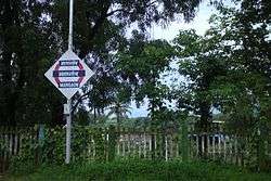
Mangaon
| Mangaon माणगांव | |
|---|---|
| Taluka | |
 | |
 Mangaon Location in Maharashtra, India | |
| Coordinates: 18°14′N 73°17′E / 18.233°N 73.283°ECoordinates: 18°14′N 73°17′E / 18.233°N 73.283°E | |
| Country | India |
| State | Maharashtra |
| District | Raigad |
| Population | |
| • Total | 13,373 |
| Languages | |
| Time zone | IST (UTC+5:30) |
| PIN | 402104 |
| Telephone code | 02140 |
| Vehicle registration | MH-06 |
| Nearest city | Mumbai (130 km), Pune (120 km), Goa (450 km) |
| Literacy | 75.30% |
| Climate | Hot-humid; heavy rain during monsoon season |
| Avg. summer temperature | 35 °C (95 °F) |
| Avg. winter temperature | 20 °C (68 °F) |
| Website |
maharashtra |
Mangaon is a taluka in the Raigad district of the Indian state of Maharashtra.[1]
Transport
Mangaon is located on the Mumbai-Goa National Highway (NH-17) and State Highway 97. It has its own railway station on the Konkan Railway and an S.T. bus depot. It is located on the Kāl River, a tributary of the Sāvitri River.Mangaon hold a central position for 3 MIDCs, Vile-Bhaagad MIDC (well known for companies like POSCO India, Pioneer Gas), Mahad-Birwadi MIDC (Chemical Industries area)and Roha-Dhaatav MIDC (Also Chemical Industries area) .
| Mangaon (MNI) | ||
| Next small station towards Mumbai: Indapur |
Konkan Railway | Next small station from Mumbai: Goregaon |
| Distance from Mumbai (CST) = 0188 km | ||
| Next main station towards Mumbai: Roha |
Konkan Railway | Next main station from Mumbai: Khed |
Places to visit
Mangad fort is located 15 km from the taluka market area of Nijampur and lies in the Manjarwane Panchayat area. The fort consists of only one main gate connected via chain of mountain ranges and Kumbhe waterfall in the vicinity.
Mangaon is very close to the Raigad fort therefore people pass through it while visiting Raigad.It is like a resting spot people visiting Raigad fort
Mangaon is famous for the temple at Kadappa.It is also famous for sportscentre at Khardi.
It is also famous for a Shiva temple along the river Kaal and it is also famous for temple of the local Goddess Vakdai.
The name of Mangaon is derived from one small fort called Mangad. Mangaon is near by river Kaal. A Tirupati temple is the special thing of Mangaon.
Dr. Babasaheb Ambedkar Technological University, a prominent Engineering and science autonomous university situated in Lonere in around 500 Acres of Campus.
Hydroelectric project at Bhira is place of attraction.It provides to the whole taluka.
In the coming years ,due to special
development plan of Raigad district, Mangaon will become major city in next 10-15 years.
Administrative subdivisions
There are 187 villages in Mangaon taluka,[2] organized into 74 panchayats.[3]
Panchayats
- Ambarle
- Bamnoli
- Bhagad
- Bhale
- Bbhandivli
Borwadi (nivachiwadi)
- Chandore
- Chinchavali
- Dahiwali Kond
- Dahiwali Tarf Govele
- Dakhane
- Degaon
- Devali
- Dongroli
- Gangawali
- Goregaon
- Govele
- Harkol
- Hodgaon
- Jite
- Javali
- Kadape
- Kakal
- Karambeli
- Kavilvahal Kh.
- Kavilvahal
- Kharavali
- Koshimble
- Koste Kh.
- Kumbhe
- Kumshet
- Kurvade
- Lakhapale
- Lonere
- Lonshi
- Madhegaon
- Mangaon
- Mangrul
- Manjarwane
- Maktigaon
- Morba
- Muthavali Tarf Tale
- Nagaon
- nagaroli
- Nandavi
- Nhave
- Nijampur
- Nilaj
- Pahel
- Palasgaon Bk.
- Palsap
- Panalghar Kh
- Panhalghar Bk.
- Pansai
- Patnus
- Pen Tarf Tale
- Phalani
- Potner
- Purar
- Ratwad
- Rawalje
- Rudrol
- Sai
- Saje
- Sale
- Salve
- Sanaswadi
- Shirawali Tarf. Nijampur
- Shirsad
- Surav Tarf. Tale
- Talashet
- Talegaon Tarf Goregaon
- Tol budruk
- Tol khurd
- Unegaon
- Vanimalaikond
- Vihule
- Vile
- Wadawali
- Wadgaon
- Warachiwadi
- Warak
- Wave Diwali
References
- ↑ Māngaon (Approved) at GEOnet Names Server, United States National Geospatial-Intelligence Agency
- ↑ "List of Habitation Directory: Mangaon". Ministry of Drinking Water and Sanitation.
- ↑ "Village Panchayat Names of Mangaon, Raigad, Maharashtra". Ministry of Panchayati Raj, Government of India. Archived from the original on 3 January 2013.