Mateete
| Mateete | |
|---|---|
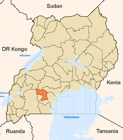
 Mateete Map of Uganda showing the location of Mateete. | |
| Coordinates: 00°14′32″S 31°29′17″E / 0.24222°S 31.48806°E | |
| Country |
|
| Region | Central Region, Uganda |
| District | Sembabule District |
| Population (2011 Estimate) | |
| • Total | 5,000[1] |
| Time zone | EAT (UTC+3) |
Mateete is a town in the Central Region of Uganda.
Location
Mateete is on the 38 kilometres (24 mi) Sembabule–Mateete–Lwensinga Road, about equidistant from Sembabule to the north, where the district headquarters are located, and Lwensinga, which lies on the Masaka–Mbarara Road, to the south.[2] The coordinates of the town are 0°14'32.0"S, 31°29'17.0"E (Latitude:-0.242234; Longitude:31.488044).[3]
Overview
Mateete is a growing urban centre. One of the alarming developments is the high number of girls aged 15 to 18 years, engaged in the prostitution trade in the town.[4]
Population
The population of Mateete Municipality was estimated at 5,000 in 2011.[1]
Points of interest
- offices of Mateete Town Council
- Mateete central market
- headquarters of Mateete sub-county in Mawogola County[5]
- Sembabule–Mateete–Lwensinga Road, passing through the middle of town in a general north/south direction.
- Bamu Hospital - a private healthcare facility[1]
See also
References
- 1 2 3 Sandqvist J.; et al. (30 November 2011). "HIV Awareness and Risk Behavior among Pregnant Women in Mateete, Uganda (2010)". ISRN Obstetrics and Gynecology: 2011. Retrieved 30 July 2016.
- ↑ Globefeed.com (30 July 2016). "Distance between Rainbow Motel (Sembabule), Sembabule, Central Region, Uganda and Lwensinga, Central Region, Uganda". Globefeed.com. Retrieved 30 July 2016.
- ↑ Google (30 July 2016). "Location of Mateete, Sembabule District, Central Uganda" (Map). Google Maps. Google. Retrieved 30 July 2016.
- ↑ Muwulya, Moses (30 July 2016). "Sebambule girl prostitution worries Buganda chiefs". Daily Monitor. Kampala. Retrieved 30 July 2016.
- ↑ LCMT (1 August 2016). "Map of Mateete Sub-county, Mawogola County, Sembabule District, Central Region, Uganda". Lcmt.org (LCMT). Retrieved 1 August 2016.
Coordinates: 00°14′32″S 31°29′17″E / 0.24222°S 31.48806°E
This article is issued from Wikipedia - version of the 9/1/2016. The text is available under the Creative Commons Attribution/Share Alike but additional terms may apply for the media files.
