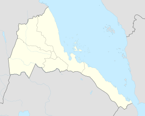
Mendefera
| Mendefera መንደፈራ | |
|---|---|
| Town | |
 Mendefera Location in Eritrea | |
| Coordinates: 14°53′14″N 38°48′55″E / 14.88722°N 38.81528°E | |
| Country |
|
| Region | Debub |
| District | Mendefera |
| Elevation | 1,972 m (6,470 ft) |
| Population (2012) | |
| • Town | 25,332 |
| • Metro | 64,000 |
| Climate | BSh |
Mendefera (Tigrinya: መንደፈራ?), formerly Adi Ugri, is the capital city of the Debub Region of Eritrea. The town's name derives from the high hill in the center of the city, and is a source of pride to Eritreans. It means 'no one dared' and is a reminder of the local anti-colonial movement.
History
Mendefera was established as early as the fifth century BCE. It evolved into an important city in the Aksumite civilisation. Numerous buildings have been excavated since 1959, with both crosses and local and Roman coins found. Many areas, including tombs, have yet to be explored.
The town is now a bustling market town in a fertile region of Eritrea. It is a place where small and large scale factories produce different products.
Location
Some villages in the vicinity of Mendefera include Guhtse'a(ጉሕጭዓ), Ksad Da'aro (ክሳድ ዳዓሮ), and Adi Bana (አዲ ባና).
Climate
| Climate data for Mendefera | |||||||||||||
|---|---|---|---|---|---|---|---|---|---|---|---|---|---|
| Month | Jan | Feb | Mar | Apr | May | Jun | Jul | Aug | Sep | Oct | Nov | Dec | Year |
| Average high °C (°F) | 27.8 (82) |
28.5 (83.3) |
30.0 (86) |
30.0 (86) |
29.5 (85.1) |
28.2 (82.8) |
23.3 (73.9) |
22.6 (72.7) |
27.5 (81.5) |
27.5 (81.5) |
26.6 (79.9) |
26.6 (79.9) |
27.34 (81.22) |
| Average low °C (°F) | 8.0 (46.4) |
9.2 (48.6) |
11.1 (52) |
12.0 (53.6) |
12.7 (54.9) |
12.6 (54.7) |
11.7 (53.1) |
12.3 (54.1) |
12.2 (54) |
9.7 (49.5) |
8.6 (47.5) |
8.1 (46.6) |
10.68 (51.25) |
| Average rainfall mm (inches) | 0 (0) |
4 (0.16) |
12 (0.47) |
28 (1.1) |
41 (1.61) |
57 (2.24) |
190 (7.48) |
189 (7.44) |
50 (1.97) |
11 (0.43) |
16 (0.63) |
4 (0.16) |
602 (23.69) |
| Source: Climate-Data[1] | |||||||||||||
See also
References
- ↑ "Climate-Data : Eritrea". Retrieved 11 July 2013.
Coordinates: 14°53′N 38°49′E / 14.883°N 38.817°E