Santiago Metropolitan Region
| Santiago Metropolitan Region | |||
|---|---|---|---|
| Region of Chile | |||
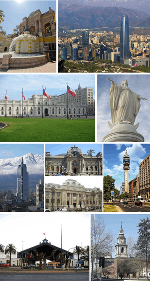 | |||
| |||
 Map of Santiago Metropolitan Region | |||
| Coordinates: 33°26′16″S 70°39′01″W / 33.43778°S 70.65028°WCoordinates: 33°26′16″S 70°39′01″W / 33.43778°S 70.65028°W | |||
| Country |
| ||
| Capital | Santiago | ||
| Provinces | Santiago, Chacabuco, Cordillera, Maipo, Melipilla, Talagante | ||
| Government | |||
| • Intendant | Claudio Orrego (PDC) | ||
| Area[1] | |||
| • Total | 15,403.2 km2 (5,947.2 sq mi) | ||
| Area rank | 15 | ||
| Highest elevation | 6,570 m (21,560 ft) | ||
| Population (2012)[1] | |||
| • Total | 6,685,685 | ||
| • Rank | 1 | ||
| • Density | 430/km2 (1,100/sq mi) | ||
| ISO 3166 code | CL-RM | ||
| Website | (Spanish) Gobierno Regional Metropolitano de Santiago | ||
Santiago Metropolitan Region or simply Metropolitan Region (Spanish: Región Metropolitana de Santiago) is one of Chile's 15 first-order administrative divisions. It is the country's only landlocked administrative region and contains the nation's capital, Santiago. Most commercial and administrative centers are located in the region, including Chile's main international airport, Arturo Merino Benítez.
With an area of 15,403.2 km2 (5,947 sq mi) and population over 6 million, it is Chile's smallest by area, most populated and most densely populated region. It is also the country's only region that does not have a Roman numeral identifier.
History
The region's history of European influence started in 1542,[1] a few days after Santiago was founded. When the Santiago cabildo was built, its function was to supervise the entire territory. Later, with the creation of the cities of La Serena and Concepción and the creation of their respective cabildos, its territorial reach was reduced.
On 30 August 1826, 8 provinces were created, with the Santiago Province being one of them, but it wasn't until 1980 that the Metropolitan Region was created.

Geography
Metropolitana is Chile's only landlocked region and lies in the Intermediate Depression valley between the Chilean Coast Range and the Andes mountains. Cerro San Cristóbal dominates the sprawling Santiago cityscape at a height of 880 m (2,887 ft) above sea level with city suburbs steadily climbing the foothills of the Andes to the east. The Tupungato stratovolcano, measures 6,570 m (21,555 ft) on the Argentine border, is one of South America's highest peaks.
The dominant drainage basin feeds into the Maipo River; its main tributaries are the Mapocho, Yeso and Colorado rivers.[1]
Climate and natural features
The climate of the Metropolitan Region is temperate Mediterranean cold, of the kind called continental. Precipitation is concentrated in the winter months, generally as snow over 900 m above sea level and, in colder years, over the city of Santiago. Winter tends to be cold with frequent frosts during which temperature drops below 0 °C (32 °F). The summer months are usually dry and hot. The Cordillera de la Costa acts as a climate screen and reduces marine influence, which makes the climate more continental. This situation becomes apparent when comparing precipitation from a coastal location such as Valparaíso (460 mm) with that of Santiago de Chile (360 mm).
The annual median precipitation reaches 367 mm on average. The annual median temperature comes out to 13.5 °C (56 °F), with a median high of 21 °C (70 °F) and a median low of 6 °C (43 °F) in urban areas. Rural areas tend to be colder, as temperature reaches −10 °C (14 °F) in the coldest months (July, August)
Most of the region is made up of an extremely fertile, level prairie that the locals call la Depresión intermedia (Intermediate Depression). The terrain is known for its low elevation in relation to sea level and for being surrounded by hills, as well as emergent so-called island hills, such as Santa Lucía (an ancient extinct volcano), Blanco, and Renca, present today in the city of Santiago.
There is some occurrence of the endangered Chilean Wine Palm, Jubaea chilensis within the Santiago Province;[2] this iconic tree of central Chile had a much larger range prehistorically, before the decimation of much of its habitat by the expanding human population.
Economy and culture
The region's principal industries include manufacturing, services, retail, and financial services. The capital of Santiago serves as the country's administrative, industrial, commercial, financial and cultural center, producing 41.5% of Chile's gross domestic product, according to central bank estimates. The Plaza de Armas, the central square in downtown Santiago, hosts the city's cathedral and city hall. Eight city blocks around the presidential palace, La Moneda, are where most ministries, services and commercial banks can be found. Vitacura and El Golf host most of the city's high-rise buildings and are also home to the Latin American headquarters of several United Nations organizations.[1] Though Santiago's expansion has caused newer vineyards to move to more rural locations, many of the country's oldest wineries, built in the 19th century, have preserved cellars in the valley.[1]
Government and administration
The region is divided into 6 provinces, which are themselves divided into 52 communes. The region is governed by the intendant, who is assigned by the president. The current intendant is Claudio Orrego (PDC, centrist).
The region's representatives in the Senate are:
- West Santiago: Guido Girardi (PPD, social-democrat) and Andrés Allamand (RN).
- East Santiago: Carlos Montes (PS, socialist) and Manuel José Ossandón (RN).
References
- 1 2 3 4 5 6 "Santiago Metropolitan Region". Government of Chile Foreign Investment Committee. Retrieved 13 March 2010.
- ↑ C. Michael Hogan (2008) Chilean Wine Palm: Jubaea chilensis, GlobalTwitcher.com, ed. Nicklas Stromberg
Gallery
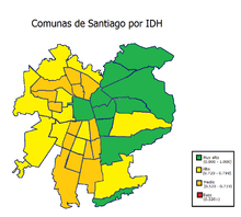 Metropolitan communes by Human Development Index
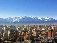 Santiago de Chile
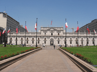 View of Palacio de La Moneda
 Kennedy Avenue, East Santiago with the Hyatt at the far right.
 Isidora Goyenechea Avenue, Santiago financial district.
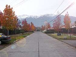 Typical middle-class neighbourhood
 Santiago at night
- View of the region's rural part
 One of the region's ski centers
 Sanhattan, Santiago's financial district with the Great Tower of Santiago.
 Santiago's Financial District with the Great Tower on the right and the Titanium on the left.
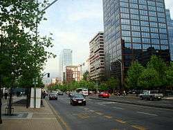 Apoquindo Avenue, the main avenue leading to the financial district.
- House in one of the region's ski centers.
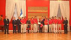 Polo national team with ex-president Michelle Bachelet after winning the World Polo Championship in 2008.
External links
| Wikimedia Commons has media related to Santiago Metropolitan Region. |
- Official website (Spanish)
- Interactive map of Santiago (Spanish)


