Maidan Shar
| Maidan Shar میدان ښار | |
|---|---|
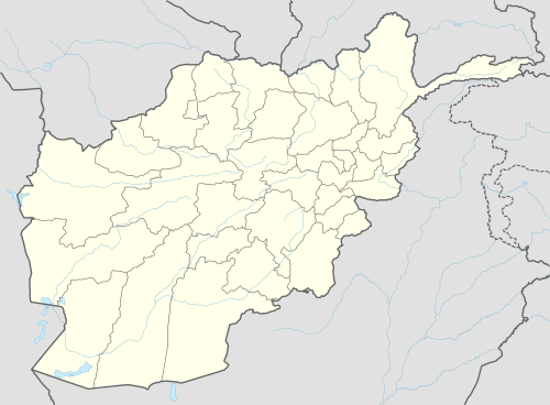
 Maidan Shar Location in Afghanistan | |
| Coordinates: 34°27′N 68°47′E / 34.450°N 68.783°ECoordinates: 34°27′N 68°47′E / 34.450°N 68.783°E | |
| Country |
|
| Province | Wardak Province |
| Area | |
| • City | 345 km2 (133 sq mi) |
| Elevation | 2,225 m (7,300 ft) |
| Population (2006) | |
| • City | 2,400 |
| • Density | 7.0/km2 (18/sq mi) |
| • Urban | 14,265 [1] |
| Time zone | UTC+4:30 |
Maidan Shār (Pashto: میدان ښار Maidān Ṣ̌ār/Maidān X̌ār;[2][3][4] Persian: میدان شهر), also Maidan Shahr or Maidanshar, is the capital of Wardak Province, Afghanistan. Its population was estimated to be 35,008 in 2003,[5] of which 85% are Pashtuns, and a smaller number of Hazaras and Tajiks forming the rest.[6]
The city of Maidan Shar has a population of 14,265. [7] It has 4 districts and a total land area of 3,347 Hectar. [8] The total number of dwellings in Maidan Shar is 1,585. [9]
Climate
With a cold and temperate climate, Maidan Shar features a cool-summer humid continental climate (Dsb) under the Köppen climate classification. It has cool, dry summers and cold, snowy winters. The average temperature in Maidan Shar is 8.8 °C, while the annual precipitation averages 373 mm.
July is the warmest month of the year with an average temperature of 21.2 °C. The coldest month January has an average temperature of -6.4 °C.
| Climate data for Maidan Shar | |||||||||||||
|---|---|---|---|---|---|---|---|---|---|---|---|---|---|
| Month | Jan | Feb | Mar | Apr | May | Jun | Jul | Aug | Sep | Oct | Nov | Dec | Year |
| Average high °C (°F) | −0.3 (31.5) |
1.6 (34.9) |
9.6 (49.3) |
16.3 (61.3) |
19.9 (67.8) |
27.7 (81.9) |
29.4 (84.9) |
28.8 (83.8) |
25.7 (78.3) |
18.2 (64.8) |
11.6 (52.9) |
4.1 (39.4) |
16.05 (60.9) |
| Daily mean °C (°F) | −6.4 (20.5) |
−4.2 (24.4) |
3.9 (39) |
10.2 (50.4) |
12.5 (54.5) |
19.4 (66.9) |
21.2 (70.2) |
20.3 (68.5) |
16.8 (62.2) |
9.7 (49.5) |
4.2 (39.6) |
−2.2 (28) |
8.78 (47.81) |
| Average low °C (°F) | −12.5 (9.5) |
−9.9 (14.2) |
−1.7 (28.9) |
4.1 (39.4) |
5.1 (41.2) |
11.1 (52) |
13.0 (55.4) |
11.9 (53.4) |
7.9 (46.2) |
1.3 (34.3) |
−3.1 (26.4) |
−8.4 (16.9) |
1.57 (34.82) |
| Source: Climate-Data.org[10] | |||||||||||||
Land Use
Maidan Shar is an urban village located 40km west of Kabul. [11] The majority of the land is not occupied or utilized with barren land and vacant plots combining for 81% of total land use. [12] Institutional land is the second largest built-up land use (22%). [13] Residential dwellings are concentrated in Districts 1 and 2.v` [14]
Geography
Maidan Shar is located in the north eastern part of Wardag Province, Afghanistan. It is surrounded by Arghandeh and Paghman mountains of Kabul Province, Jalrez and Nirkh districts of Wardag Province.
It has an area of 345 km2, its elevation above sea level is 2225 meters.
The district consists of 59 main villages and 1 sub-village.
Economy
The majority of people in Maidan Shar are engaged in agriculture, livestock, gardening and trade. The overall economical status of the people of Maidan Shar is poor.
Education
By the end of 2008, there were a total of 14 schools serving approximately 9268 students. There were around 275 teachers teaching in these schools.[15]
References
- ↑ "The State of Afghan Cities report2015".
- ↑ http://www.mwardag.gov.af/?pg=133
- ↑ http://www.mrrd.gov.af/nabdp/Provincial%20Profiles/Wardak%20PDP%20Provincial%20profile.pdf
- ↑ http://www.ketabtoon.net/ketaboona/Wardag_qawm_seema_BOOK.pdf
- ↑ http://www.mrrd.gov.af/nabdp/Provincial%20Profiles/Wardak%20PDP%20Provincial%20profile.pdf Wardak Provincial Profile - MRRD
- ↑ aims.org.af
- ↑ "The State of Afghan Cities report2015".
- ↑ "The State of Afghan Cities report 2015".
- ↑ "The State of Afghan Cities report 2015".
- ↑ "Climate: Maidan Shar - Climate-Data.org". Retrieved 9 September 2016.
- ↑ "The State of Afghan Cities report 2015".
- ↑ "The State of Afghan Cities report 2015".
- ↑ "The State of Afghan Cities report 2015".
- ↑ "The State of Afghan Cities report 2015".
- ↑ http://www.mwardag.gov.af/media/Maidan%20Wardak%20Province%20Three%20years%20Report(English).pdf