Mong Kok Station
| MTR rapid transit station | ||||||||||||||||
|
Platform 4 | ||||||||||||||||
| Chinese name | ||||||||||||||||
| Chinese | 旺角 | |||||||||||||||
| Literal meaning | Flourishing corner | |||||||||||||||
| ||||||||||||||||
| General information | ||||||||||||||||
| Location |
Nathan Road × Argyle Street, Mong Kok Yau Tsim Mong District, Hong Kong | |||||||||||||||
| Coordinates | 22°19′09″N 114°10′10″E / 22.3192°N 114.1694°ECoordinates: 22°19′09″N 114°10′10″E / 22.3192°N 114.1694°E | |||||||||||||||
| Operated by | MTR Corporation | |||||||||||||||
| Line(s) | ||||||||||||||||
| Platforms | 4 (island platforms) | |||||||||||||||
| Connections | Bus, public light bus | |||||||||||||||
| Construction | ||||||||||||||||
| Structure type | Underground | |||||||||||||||
| Platform levels | 2 | |||||||||||||||
| Disabled access | Yes | |||||||||||||||
| Other information | ||||||||||||||||
| Station code | MOK | |||||||||||||||
| History | ||||||||||||||||
| Opened |
| |||||||||||||||
| Previous names | Argyle | |||||||||||||||
| Services | ||||||||||||||||
| ||||||||||||||||
| Location | ||||||||||||||||
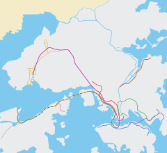
 Mong Kok Location within the MTR system | ||||||||||||||||
Mong Kok (Chinese: 旺角) is a rapid transit station on the Kwun Tong and Tsuen Wan Lines of the MTR system in Hong Kong. One of the first stations of the network to open, it is now used by more than 200,000 passengers daily. The colour scheme for Mong Kok is dim red. It was first opened as Argyle, after Argyle Street.
Location
Mong Kok Station is located in the neighbourhood of the same name in Kowloon, along Nathan Road at the intersection with Argyle Street. Important nearby places include the Grand Century Place, Langham Place, and the Pioneer Centre.[1] Mong Kok East Station is about 500 metres to the northeast.
History
Mong Kok Station opened on 31 December 1979, originally serving as part of the Kwun Tong Line. When the Tsuen Wan Line opened in 1982, this station became an interchange station of the two lines.
The station was originally named Argyle after Argyle Street, a major cross street, during the planning stage and early years of operations. The name was changed to Mong Kok on May 31, 1985, when the Island Line was opened.
Station layout
Mong Kok Station serves as a cross-platform interchange for passengers changing between the Tsuen Wan Line and Kwun Tong Line for stations in the same direction. Opposite-direction interchange of the same two lines takes place at Prince Edward and Yau Ma Tei.
| G | Ground level | Exits |
| C | Concourse | Customer Service, MTRshops |
| Vending machines, Automatic teller machines | ||
| Octopus Promotion Machine | ||
| P1 Platform |
Platform 1 | Tsuen Wan Line towards Tsuen Wan (Prince Edward) → |
| Island platform, doors will open on the left, right | ||
| Platform 3 | Kwun Tong Line towards Tiu Keng Leng (Prince Edward) → | |
| P2 Platform |
Platform 2 | ← Tsuen Wan Line towards Central (Yau Ma Tei) |
| Island platform, doors will open on the left, right | ||
| Platform 4 | ← Kwun Tong Line towards Whampoa (Yau Ma Tei) | |
Entrances and exits
There are five exits at Mong Kok Station, all located within one block north and south of the intersection of Nathan Road and Argyle Street. Langham Place, a major shopping mall, is accessed through a short underground passage at exit C3.[1]
Transport connections
Minibus RoutesTo Lok Mun Sun Chuen:
To Open University of Hong Kong:
To Waterloo Hill:
To Wyler Gardens:
|
Bus RoutesTo Ping Shek:
To Choi Wan:
To Po Tat:
To Lam Tin (Kwong Tin Estate):
To Ho Man Tin:
|
MTR East Rail Line
Mong Kok East Station and Mong Kok Station are considerably far apart. To reach Mong Kok East from Mong Kok, use exit B3, walk up the Mong Kok Road Footbridge System, and go via Grand Century Plaza to reach Mong Kok East.
Gallery
| Wikimedia Commons has media related to Mong Kok Station. |
|
References
- 1 2 "Mong Kok Station street map" (PDF). MTR Corporation. Retrieved 30 July 2014.
- ↑ "Mong Kok Station layout" (PDF). MTR Corporation. Retrieved 30 July 2014.