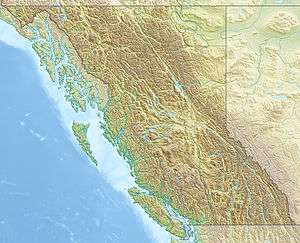
Mount Benson (British Columbia)
| Mount Benson | |
|---|---|
|
Mt. Benson viewed from the east at Duke Point | |
| Highest point | |
| Elevation | 1,023 m (3,356 ft) [1] |
| Prominence | 668 m (2,192 ft) [1] |
| Coordinates | 49°08′59″N 124°03′04″W / 49.14972°N 124.05111°WCoordinates: 49°08′59″N 124°03′04″W / 49.14972°N 124.05111°W [1] |
| Geography | |
 Mount Benson | |
| Parent range | Vancouver Island Ranges |
| Topo map | NTS 92F/01 |
Mount Benson is a mountain located on Vancouver Island, British Columbia located 9 km (5.6 mi) west of Nanaimo. There was road access to the peak, and it is popular with local hikers. It has good views of the Strait of Georgia and the mainland coast of British Columbia.[1]
Formerly known as Wake-siah, this hill was named in 1859 by Captain Richards, RN, after his friend Alfred Robson Benson, MD, a physician from Whitby (Yorkshire), who was in the Hudson's Bay Company service 1857-62.[2]:48
Most of the summit is flat with several small lakes, surrounded by clearcuts.
1951 Kemano air crash
In October 1951 23 people died in worst aviation accident to that time in British Columbia history when a Canso operated by Queen Charlotte Airlines en route from Kitimat to Vancouver crashed into Mount Benson at the 490 m (1,610 ft) level. Remnants remained on the slopes for many years afterwards.[3]:26
Mount Benson Regional Park
In July 2008 the Mount Benson Regional Park, comprising 212 ha (520 acres) on the upper north east slope of Mount Benson was established on land acquired in 2005 by the Regional District of Nanaimo and the Nanaimo and Area Land Trust. There is no road access to the park itself. Only a portion of the mountain is within the park not including the twin summits. The park area is the head waters of the Millstone River and, to the east, the Chase River.[3]
See also
References
- 1 2 3 4 "Mount Benson". Bivouac.com. Retrieved 2009-04-04.
- ↑ Walbran, Captain John T. (1971), British Columbia Place Names, Their Origin and History (Facsimile reprint of 1909 ed.), Vancouver/Toronto: Douglas & McIntyre, ISBN 0-88894-143-9
- 1 2 HB Lanarc Consultants Ltd (2009), Mount Benson Regional Park 2010-2020 Management Plan (PDF)
External links
"Mount Benson". BC Geographical Names.
