Nangal Choudhary
| Nangal Choudhary | |
|---|---|
| City | |
 Nangal Choudhary  Nangal Choudhary | |
| Coordinates: 27°53′32″N 76°06′44″E / 27.8923°N 76.1122°ECoordinates: 27°53′32″N 76°06′44″E / 27.8923°N 76.1122°E | |
| Country | India |
| State | Haryana |
| Thesil | Mahendragarh |
| Elevation | 302 m (991 ft) |
| Population (2011) | |
| • Total | 8,536 |
| Languages | |
| • Official | Hindi& English |
| Time zone | IST (UTC+05:30) |
| Area code(s) | 01282 |
| ISO 3166 code | IN-HR |
| Vehicle registration |
HR-35 xxxx (for non-commercial vehicles) HR-66 xxxx (for commercial vehicles) |
| Sex ratio | 879 ♂/♀ |
| Climate | Cw (Köppen) |
| Precipitation | 570 millimetres (22 in) |
| Avg. summer temperature | 38 °C (100 °F) |
| Avg. winter temperature | 04 °C (39 °F) |
| Website |
haryana |
Nangal Choudhary is an important town and tehsil headquarters of District Mahendragarh at Narnaul. It holds the crown of being "First Cyber Village of Haryana". Now it has an assembly seat in Haryana government. Abhe Singh Yadav of BJP is MLA from Nangal Choudhary and It is part of Ahirwal. Yadav dominated region.[1][2][3]
History
During the Mughal rule, Narnaul was a flourishing town.
Nawab Shah Quli Khan, a Governor of Akbar, erected many splendid buildings at Narnaul, laid out many beautiful gardens and built a fine mausoleum for 500 years before to Vikran Samwat 1962, Udai Jat came from Sirohi and taken possession of Nangal Choudhary. After some time, he included Sitaram Brahamin with him in land possession. Both of them distributed the land among their children. By the time, they also included Rajputs and Malis in village land occupation.
After some times fours casts has taken equal possession namely Yadavs, Brahmins, Jats, Rajputs and Malis. They ruled and charges recovery for this land in cultivation.
Initially when Udai rehabitated this village and named as Udai Nangal. But it is not known that since when this village is popular and known as Nangal Choudhary. This village was never nonpopulated and never shifted to any place. It is situated on the same location since history.
Then Jhajhar Nawab has put this village on Batai and recovered its charges. In samwat 1914, an English officer has given this land on Rs 1525 on contract basis for one year. But after 1915 samwat, Mahraja Patiyala has cancelled this contract and started recovery in his own way.
Geography
Presently, Nangal Choudhary is one of district block headquarters situated in southern part of the district and touchs districts of Alwar, Sikar and Jaipur of Rajasthan state. The upland tract unit covers the area between northern Narnaul and Nangal Choudhary Hills in the Narnaul Tehsil. A desert upland, situated between 284 and 302 meters above the mean sea level belongs to the Aravali System. Nangal Choudhary hills in Narnaul tehsil near Haryana-Rajasthan boundary are one of the many geographical features of Independent hill ranges in Mahendragarh in Narnaul Tehsils. East of the Kasaunti or Krishnawati river stream, the elevation of 626 m and relative relief of 160 m is found near Mukandpura village. North-west and south of Narnaul town, rounded hillocks and elliptical hills are prominent features of the landscape in the sandy terrain between the Dohan and Kasaunti streams. The elevation of the conical hillock near Thans village is the highest, 652 m. Recently Nangal Choudhary is granted status of Tehsil and Municipal Committee by Haryana Chief Minister Mr. Bhupender Singh Hooda during a public rally held at Nangal Choudhary on May 6, 2012.
Transport
Roads
Road: Nangal Choudhary is connected by road to Kotputli 28km, Jaipur 138km, Narnaul 22km, Behror 25km, Neem ka Thana 43km, these and other cities of Haryana and Rajasthan.
Bus
Chandigarh, Kota, Jaipur, connected
Rail
Railway: Narnaul 22 km and Nizampur 14 km, is located on the Delhi-Ringas-Abu Road-Ahmedabad-Mumbai railway track. Only seven trains run on this section. The track is a part of Western Dedicated Freight Corridor.
Airport
Airport: Delhi is the nearest international and domestic airport; the second nearest international and domestic airport is Jaipur.
Distances to cities
Distances to cities: Mahendragarh 47 km, Rewari 76 km, Behror 25 km, km, Alwar 80 km, Jhunjhunu 90 km, Gurgaon 110 km, Delhi 140 km, Jaipur 138 km, Chandigarh 397 km.
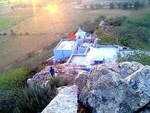
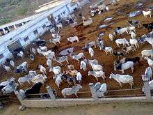
Temple and Gosalla


Resources
In the vicinity of the village, limestone is found in the riverbed of Krishnawati river and village Dostpur. There are mines of various ores. In village Gulawala, quartz (Phelsphar) is found in hills. In neighboring village Aantri Biharipur, some other rare stones are found. In Nizampur, the iron ore is present in abundance. Recently illegal stone crushers Mushroomed in and around this constituency.