National Register of Historic Places listings in Dutchess County, New York
List of the National Register of Historic Places listings in Dutchess County, New York
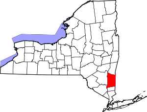
This is intended to be a complete list of the 245 properties and districts listed on the National Register of Historic Places in Dutchess County, New York. The locations of National Register properties and districts (at least for all showing latitude and longitude coordinates below) may be seen in a map by clicking on "Map of all coordinates".[1] There are eight properties and districts which are further designated National Historic Landmarks in the county.
Locations in the city and town of Poughkeepsie are listed separately, as are the locations in Rhinebeck. In the rest of the county, there are 122 properties and districts listed on the National Register. These are:
- This National Park Service list is complete through NPS recent listings posted December 16, 2016.[2]
| Albany (Albany) – Allegany – Bronx – Broome – Cattaraugus – Cayuga – Chautauqua – Chemung – Chenango – Clinton – Columbia – Cortland – Delaware – Dutchess (Poughkeepsie, Rhinebeck) – Erie (Buffalo) – Essex – Franklin – Fulton – Genesee – Greene – Hamilton – Herkimer – Jefferson – Kings – Lewis – Livingston – Madison – Monroe (Rochester) – Montgomery – Nassau – New York (Below 14th Street, 14th to 59th Streets, 59th to 110th Streets, Above 110th Street, Islands) – Niagara – Oneida – Onondaga (Syracuse) – Ontario – Orange – Orleans – Oswego – Otsego – Putnam – Queens – Rensselaer – Richmond – Rockland – St. Lawrence – Saratoga – Schenectady – Schoharie – Schuyler – Seneca – Steuben – Suffolk – Sullivan – Tioga – Tompkins – Ulster – Warren – Washington – Wayne – Westchester (Northern, Southern, New Rochelle, Peekskill, Yonkers) – Wyoming – Yates |
Current listings
Poughkeepsie
Rhinebeck
Remainder of county
| [3] | Name on the Register | Image | Date listed[4] | Location | City or town | Description |
|---|---|---|---|---|---|---|
| 1 | Akin Free Library | 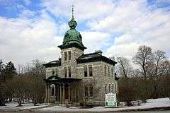 |
(#91001726) |
97 Quaker Hill Rd. 41°33′32″N 73°32′57″W / 41.558889°N 73.549167°W |
Pawling | Eclectic Victorian building at rural crossroads housing natural history museum and library |
| 2 | Attlebury Schoolhouse | 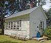 |
(#16000253) |
6917 NY 82 41°55′10″N 73°40′05″W / 41.91935°N 73.66794°W |
Stanford | Wooden 1910 one-room schoolhouse is only one remaining in town in its original form |
| 3 | Bain Commercial Building | 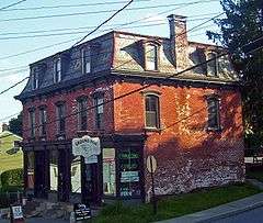 |
(#84002369) |
59-61 W. Main St. 41°36′04″N 73°55′16″W / 41.601111°N 73.921111°W |
Wappingers Falls | 1875 residence and store is unusual intact 19th-century commercial building on east side of Wappinger Creek in the former hamlet of Channingville. |
| 4 | Bangall Post Office |  |
(#14000224) |
105 Hunns Lake Rd. 41°52′32″N 73°41′31″W / 41.87566°N 73.69186°W |
Bangall | Early 20th century post office at center of small hamlet designed and built by local postmaster has had a variety of other uses; still remains in postal service. |
| 5 | Bannerman's Island Arsenal | 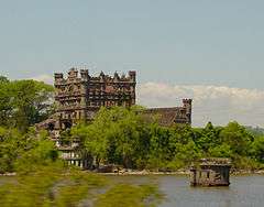 |
(#82001121) |
Pollepel Island, off NY 9-D 41°27′19″N 73°59′19″W / 41.455278°N 73.988611°W |
Fishkill | Home and warehouse of a military surplus dealer; currently owned by state but with severely restricted public access |
| 6 | Walter Beckwith House | 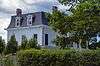 |
(#16000306) |
482 Jameson Hill Rd. 41°50′34″N 73°43′39″W / 41.84284°N 73.72743°W |
Stanford | Intact 1876 Second Empire farmhouse |
| 7 | Bard Infant School and St. James Chapel | 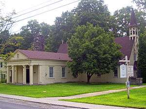 |
(#93000848) |
East Market St. 41°47′18″N 73°56′07″W / 41.788333°N 73.935278°W |
Hyde Park | Greek Revival school built in 1832; Gothic Revival chapel added in 1856. |
| 8 | Oliver Barrett House | 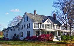 |
(#00001416) |
Reagan Rd. 41°54′08″N 73°31′01″W / 41.902222°N 73.516944°W |
Millerton | 1853 farmhouse extensively altered in late Victorian era for Coleman Station postmaster |
| 9 | Beacon Engine Company No. 1 Firehouse | |
(#04001341) |
57 E. Main St. 41°30′11″N 73°57′41″W / 41.503056°N 73.961389°W |
Beacon | |
| 10 | Beekman Meeting House and Friends' Cemetery | 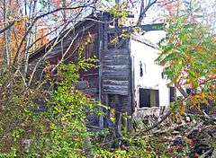 |
(#89000303) |
Emans Rd. 41°38′00″N 73°46′02″W / 41.633333°N 73.767222°W |
LaGrangeville | Ruins of 1809 Quaker meeting house, one of only two in county to become Orthodox meetings after 1828 schism |
| 11 | Bergh–Stoutenburgh House | 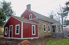 |
(#72000829) |
U.S. 9 41°46′55″N 73°55′57″W / 41.781944°N 73.9325°W |
Hyde Park | One of only two remaining Dutch stone houses in Hyde Park. Until recently used as a Japanese restaurant but now unoccupied. |
| 12 | Beth David Synagogue | 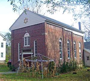 |
(#02000308) |
E. Main St. 41°51′01″N 73°33′10″W / 41.850278°N 73.552778°W |
Amenia | 1929 synagogue built by small local community of Russian Jewish emigrants is only one listed on east side of Hudson north of New York City |
| 13 | Bloomvale Historic District |  |
(#91001874) |
Jct. of NY 82, Co. Rd. 13 and E. Branch Wappingers Cr., Pleasant Valley and Washington Townships 41°48′01″N 73°45′24″W / 41.800278°N 73.756667°W |
Salt Point | 18th-century mill community that remained productive through early 20th century |
| 14 | Bogardus-DeWindt House | 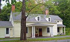 |
(#93000280) |
16 Tompkins Ave. 41°30′37″N 73°58′46″W / 41.510278°N 73.979444°W |
Beacon | Well-preserved home of early landowner and descendants |
| 15 | Madam Catharyna Brett Homestead | |
(#76001212) |
50 Van Nydeck Ave. 41°30′09″N 73°58′04″W / 41.5025°N 73.967778°W |
Beacon | 1709 home of early settler in area is oldest home in county. Later used by Continental Army |
| 16 | Bykenhulle | 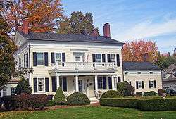 |
(#91001872) |
21 Bykenhulle Rd. 41°34′59″N 73°46′13″W / 41.583056°N 73.770278°W |
Hopewell Junction | Well-preserved 1841 Dutch farmhouse built by Peter Adriance; renamed by later owners and now a bed and breakfast |
| 17 | Dr. Cornelius Nase Campbell House | Upload image | (#07000333) |
6031 NY 82 41°52′11″N 73°42′33″W / 41.869722°N 73.709167°W |
Stanfordville | |
| 18 | Cornelius Carman House | 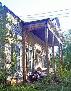 |
(#87001372) |
River Rd. S. 41°32′59″N 73°58′14″W / 41.549722°N 73.970556°W |
Chelsea | 1835 Greek Revival house |
| 19 | Chelsea Grammar School | 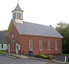 |
(#87001371) |
Liberty St. 41°33′08″N 73°58′04″W / 41.552222°N 73.967778°W |
Chelsea | Intact 1875 brick one-room schoolhouse used today as post office and auxiliary church building |
| 20 | Ezra Clark House | 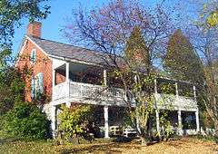 |
(#85000338) |
Mill Rd. 41°55′15″N 73°31′05″W / 41.920833°N 73.518056°W |
Millerton | Intact 1780 brick farmhouse is second-oldest in Coleman Station |
| 21 | Clinton Corners Friends Church | 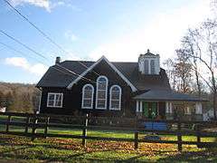 |
(#89000305) |
Salt Point Tnpk./Main St. 41°49′54″N 73°45′41″W / 41.831667°N 73.761389°W |
Clinton Corners | |
| 22 | Coleman Station Historic District |  |
(#93000945) |
Coleman Station, Indian Lake, Regan and Sheffield Hill Rds. 41°54′06″N 73°30′57″W / 41.901667°N 73.515833°W |
Millerton | Almost three square miles of rural community with buildings and lands largely intact from the 19th century. Several farms and houses separately listed. |
| 23 | Capt. Moses W. Collyer House |  |
(#87001370) |
River Rd. S 41°33′05″N 73°58′15″W / 41.551389°N 73.970833°W |
Chelsea | 1899 home of former riverboat captain who later coauthored Sloops of the Hudson definitive history of sailing-ship commerce on Hudson. |
| 24 | Creek Meeting House and Friends' Cemetery |  |
(#89000299) |
Salt Point Tnpk./Main St. 41°49′53″N 73°45′43″W / 41.831389°N 73.761944°W |
Clinton Corners | |
| 25 | Crum Elbow Meeting House and Cemetery |  |
(#89000302) |
Quaker Ln. 41°48′18″N 73°51′59″W / 41.805°N 73.866389°W |
East Park | |
| 26 | Dakin-Coleman Farm | 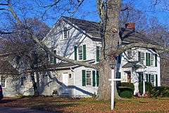 |
(#00001421) |
Coleman Station Rd. 41°54′19″N 73°31′34″W / 41.905278°N 73.526111°W |
Millerton | 1773 farmhouse is oldest house in Coleman Station Historic District |
| 27 | Watts De Peyster Fireman's Hall | 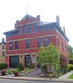 |
(#89002005) |
86 Broadway at Pine St. 42°03′32″N 73°54′43″W / 42.058889°N 73.911944°W |
Tivoli | 1898 gift to village from John Watts De Peyster now used as village hall |
| 28 | Dover Stone Church |  |
(#14000981) |
Stone Church Ln. 41°44′17″N 73°35′19″W / 41.73816°N 73.58851°W |
Dover Plains | Waterfall looking like a church window, heavily promoted by Harlem Valley Railroad as local scenic attraction |
| 29 | Peter C. DuBois House |  |
(#03001512) |
36 Slocum Rd. 41°29′01″N 73°58′25″W / 41.483611°N 73.973611°W |
Beacon | One of the last significant Greek Revival home to be built in the Hudson Valley. Later expanded and used as part of a sanitarium. |
| 30 | Dutchess Company Superintendent's House | 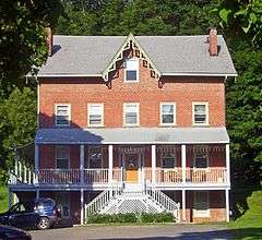 |
(#84002371) |
120 Market St. 41°35′39″N 73°55′35″W / 41.594167°N 73.926389°W |
Wappingers Falls | Company-owned 1848 home of foreman of local printing company, village's major employer in 19th century |
| 31 | Dutchess Manor |  |
(#82001131) |
400 Breakneck Rd. 41°27′37″N 73°58′56″W / 41.460278°N 73.982222°W |
Fishkill | 1889 home of Francis Timoney, Irish immigrant who grew wealthy making brick, including that used to build the house, from local clay. Today a popular local banquet hall and restaurant. |
| 32 | Elmendorph Inn |  |
(#78001850) |
43-45 N. Broadway 41°59′50″N 73°52′27″W / 41.997222°N 73.874167°W |
Red Hook | 1750s house is oldest building in Red Hook; now a community center |
| 33 | Eustatia | 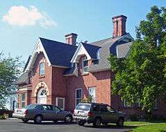 |
(#79001576) |
12 Monell Pl. 41°30′49″N 73°58′59″W / 41.513611°N 73.983056°W |
Beacon | 1867 Frederick Clarke Withers design is a rare Victorian Gothic cottage done in brick |
| 34 | Fishkill Supply Depot Site | 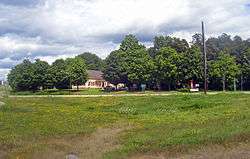 |
(#74001230) |
Bisected by US 9 south of I-84 41°31′21″N 73°53′23″W / 41.522585°N 73.889672°W |
Fishkill | Site of Revolutionary War-era army supply depot. Area around Van Wyck Homestead still has potential to yield much information in archeological digs. |
| 35 | Fishkill Village District | 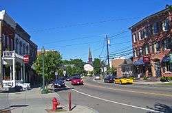 |
(#73001181) |
Roughly along NY 52 from Cary St. to Hopewell St. 41°32′03″N 73°54′05″W / 41.534167°N 73.901389°W |
Fishkill | Many well-preserved 19th century homes and commercial buildings in the center of the village |
| 36 | Franklin Delano Roosevelt High School |  |
(#10001125) |
23 Haviland Rd. 41°32′03″N 73°54′05″W / 41.534167°N 73.901389°W |
Hyde Park | Now Haviland Middle School, one of three schools erected as a Depression-era Public Works Administration project in Hyde Park |
| 37 | Graham-Brush Log House | 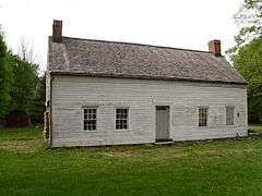 |
(#99000870) |
Church St. 41°58′48″N 73°39′20″W / 41.98°N 73.655556°W |
Pine Plains | |
| 38 | Halfway Diner | 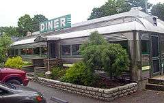 |
(#87002297) |
39 N. Broadway 41°59′48″N 73°52′29″W / 41.996667°N 73.874722°W |
Red Hook | Intact 1925 Silk City diner; has been in two other locations. A Red Hook institution and first diner in state listed on Register. |
| 39 | Haxtun-Tower House | Upload image | (#16000552) |
4 Baker Rd. 41°36′50″N 73°42′35″W / 41.613868°N 73.709753°W |
Hopewell Junction | Late Greek Revival house built around 1850 by one prominent local iron magnate and expanded later by another |
| 40 | Heermance Farmhouse |  |
(#80002604) |
N of Red Hook on W. Kerley Corners Rd. 42°02′43″N 73°51′46″W / 42.045278°N 73.862778°W |
Red Hook | Built in the 18th century; noted for its distinct decorative architectural features. |
| 41 | John Hendricks House and Dutch Barn |  |
(#84002373) |
Old Post Rd. 41°50′42″N 73°55′38″W / 41.845°N 73.927222°W |
Staatsburg | Intact 1785 stone house probably used as inn for Albany Post Road travelers. Barn redone in Picturesque mode by William Dinsmore. |
| 42 | Hiddenhurst | 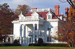 |
(#91000102) |
Sheffield Hill Rd. NW of jct. with Sharon Station Rd. 41°53′49″N 73°30′42″W / 41.896944°N 73.511667°W |
Millerton | 1903 retirement estate of industrialist Thomas Hidden is most architecturally distinctive house in Coleman Station |
| 43 | Home of Franklin D. Roosevelt National Historic Site |  |
(#66000056) |
2 mi (3.2 km). S of Hyde Park on U.S. 9 41°45′59″N 73°56′21″W / 41.766389°N 73.939167°W |
Hyde Park | Springwood estate, Roosevelt's home in childhood and much of his adult life |
| 44 | Joseph Horton House |  |
(#88000916) |
NY 376, New Hackensack Rd. 41°37′23″N 73°52′19″W / 41.623056°N 73.871944°W |
New Hackensack | |
| 45 | Howard Mansion and Carriage House | Upload image | (#93000862) |
Howard Blvd. 41°47′53″N 73°56′05″W / 41.798056°N 73.934722°W |
Hyde Park | |
| 46 | Howland Library | |
(#73001180) |
477 Main St. 41°30′07″N 73°57′55″W / 41.501944°N 73.965278°W |
Beacon | Early Richard Morris Hunt building using Norwegian elements; now a cultural center |
| 47 | Hudson River Heritage Historic District | 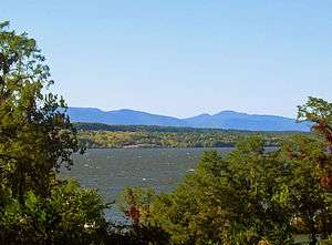 |
(#90002219) |
East side Hudson River between Germantown and Staatsburg Coordinates missing |
Staatsburg, Rhinebeck and Red Hook, also Columbia County | 30-mile (48 km) strip along east bank of Hudson preserving much architecture and land use from feudalistic colonial era. Largest historic district on U.S. mainland. |
| 48 | Hyde Park Elementary School | 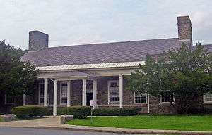 |
(#93000860) |
Post Rd. N of jct. with Fuller Ln. 41°47′28″N 73°56′10″W / 41.791111°N 73.936111°W |
Hyde Park | 1940 fieldstone building designed in close consultation with Franklin D. Roosevelt |
| 49 | Hyde Park Firehouse |  |
(#93000859) |
Post Rd. S of jct. with Market St. 41°47′28″N 73°56′14″W / 41.791111°N 73.937222°W |
Hyde Park | |
| 50 | Hyde Park Railroad Station | 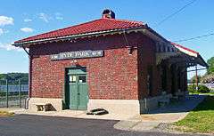 |
(#81000403) |
River Rd. 41°47′14″N 73°56′49″W / 41.787222°N 73.946944°W |
Hyde Park | 1914 station was where Roosevelt received King George VI and Queen Elizabeth; today a rail museum. |
| 51 | Indian Rock Schoolhouse | 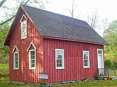 |
(#02000306) |
Mygatt Rd. 41°51′40″N 73°32′48″W / 41.861111°N 73.546667°W |
Amenia | 1850 one-room schoolhouse is only one of 12 in town surviving intact |
| 52 | John Kane House | 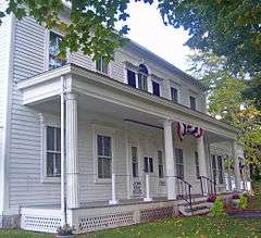 |
(#80002603) |
126 E. Main St. 41°33′22″N 73°35′31″W / 41.556111°N 73.591944°W |
Pawling | Home of 1766 Anti-Rent War leader William Prendergast and, later, Kane; confiscated after the latter became a Loyalist in 1777 and used by Washington as headquarters the next year. Today a local museum |
| 53 | LaGrange District Schoolhouse | 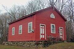 |
(#13000328) |
2 Dr. Fink Rd. 41°40′26″N 73°48′20″W / 41.67376°N 73.80552°W |
Freedom Plains | One-room schoolhouse built in 1860s remained in use through 1940s |
| 54 | Langdon Estate Gatehouse |  |
(#93000865) |
US 9, N of jct. with Market St. 41°47′28″N 73°56′16″W / 41.791111°N 73.937778°W |
Hyde Park | Built in 1876 in the Renaissance Revival style |
| 55 | Lower Main Street Historic District | |
(#87002198) |
142-192 & 131-221 Main St. 41°30′28″N 73°58′32″W / 41.507778°N 73.975556°W |
Beacon | Well-preserved commercial buildings at core of early settlement in area |
| 56 | Lynfeld | 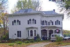 |
(#87000474) |
South Rd. 41°46′23″N 73°44′40″W / 41.773056°N 73.744444°W |
Washington | 1871 Italianate farmhouse |
| 57 | Main Street-Albertson Street-Park Place Historic District |  |
(#93000856) |
Roughly, Main St. between Park Pl. and US 9, Park between Main and Albertson St. and Albertson adjacent to Park 41°47′20″N 73°56′17″W / 41.788889°N 73.938056°W |
Hyde Park | 19th-century core of Hyde Park, with many intact vernacular buildings |
| 58 | Main Street Historic District |  |
(#09001284) |
Main St., North, South Center St. and John St.; Dutchess Ave., Park Ave., South Maple Ave and Elm Ave. 41°57′13″N 73°30′38″W / 41.953703°N 73.510678°W |
Millerton | Historic core of country town |
| 59 | Maizefield |  |
(#73001184) |
75 W. Market St. 41°59′52″N 73°52′55″W / 41.997872°N 73.882056°W |
Red Hook | Early 19th-century Federal style mansion of former Continental Army general features 1849 Alexander Jackson Davis frame cottage. |
| 60 | Marquardt Farm |  |
(#87001075) |
Wurtemburg Rd. 41°53′09″N 73°52′06″W / 41.885833°N 73.868333°W |
Wurtemburg | |
| 61 | Hendrick Martin House |  |
(#07000776) |
65 Willowbrook Ln. 42°00′18″N 73°52′28″W / 42.00500°N 73.87435°W |
Red Hook | Well-preserved mid-18th century stone house built by second-generation Palatine German family is possibly the oldest house in the town of Red Hook. |
| 62 | Melius-Bentley House | Upload image | (#82005024) |
N of Pine Plains on Mt. Ross Rd. 42°00′19″N 73°42′36″W / 42.005278°N 73.71°W |
Pine Plains | |
| 63 | Montgomery Place |  |
(#75001184) |
Annandale Rd. 42°00′52″N 73°55′08″W / 42.014444°N 73.918889°W |
Annandale-on-Hudson | Only remaining estate house from early 19th century largely intact. Shows growing influence of French styles. |
| 64 | Mt. Beacon Fire Observation Tower | Upload image | (#09000862) |
South Beacon Mountain summit 41°28′53″N 73°56′40″W / 41.481483°N 73.944306°W |
Beacon | |
| 65 | Mount Beacon Incline Railway | |
(#82001151) |
Howland Ave. and Wolcott St. 41°29′25″N 73°57′22″W / 41.490278°N 73.956111°W |
Beacon/[[Fishkill {town), New York|/Fishkill]] | Site of popular 20th-century attraction offering view of the Hudson Highlands and surrounding area. |
| 66 | Mount Gulian |  |
(#82001152) |
N of Beacon off I-84 41°31′25″N 73°58′54″W / 41.523611°N 73.981667°W |
Fishkill | Headquarters of Friedrich Wilhelm von Steuben during Revolution |
| 67 | Mulhern House | Upload image | (#84002376) |
14-16 Market St. 41°35′57″N 73°55′16″W / 41.599167°N 73.921111°W |
Wappingers Falls | 1815 house used by workers at Dutchess Co; destroyed in an explosion 1994 |
| 68 | Lewis Mumford House |  |
(#99001209) |
187 Leedsville Rd. 41°51′01″N 73°30′47″W / 41.850278°N 73.513056°W |
Amenia | Home of famous sociologist Lewis Mumford for over half a century |
| 69 | Murphy Grist Mill | Upload image | (#15000230) |
138 Beekman Poughquag Rd. 41°36′39″N 73°42′09″W / 41.610814°N 73.7025567°W |
Poughquag | Well-preserved mill was early catalyst for local settlement |
| 70 | National Biscuit Company Carton Making and Printing Plant | |
(#03000253) |
3 Beekman St. 41°30′00″N 73°58′58″W / 41.5°N 73.982778°W |
Beacon | Now Dia:Beacon. Largely intact factory recently turned into art museum for large modern installations |
| 71 | Newcomb-Brown Estate |  |
(#88001704) |
Brown Rd. at US 44 41°45′28″N 73°47′01″W / 41.757778°N 73.783611°W |
Pleasant Valley | 1770 house of local farmer and landowner shows some Dutch influences; remains mostly intact |
| 72 | Nine Partners Meeting House and Cemetery |  |
(#89000300) |
NY 343 41°46′32″N 73°41′17″W / 41.775556°N 73.688056°W |
Millbrook | 1780 built brick meeting house replaced a log meeting house built on the same location in 1745. Still used occasionally for Society of Friends Meetings |
| 73 | Oblong Friends Meetinghouse |  |
(#73001182) |
Meetinghouse Rd. on Quaker Hill 41°34′45″N 73°32′33″W / 41.579167°N 73.5425°W |
Pawling | 1764-built meetinghouse was home to first American Quaker group to refuse services or financial assistance from slaveowners, in 1767. Later used as hospital by Continental Army |
| 74 | Oswego Meeting House and Friends' Cemetery | Upload image | (#89000301) |
Oswego Rd. at jct. with Smith Rd. 41°42′10″N 73°43′46″W / 41.702778°N 73.729444°W |
Moore's Mill | |
| 75 | Parker Training Academy Dutch Barn | 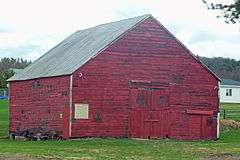 |
(#07001035) |
527 Turkey Hill Rd. 42°01′06″N 73°49′03″W / 42.01833°N 73.81755°W |
Red Hook | One of the last New World Dutch barns built in the Hudson Valley, around 1790 |
| 76 | The Pines | 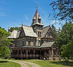 |
(#83001668) |
Maple St. 41°58′58″N 73°39′24″W / 41.982778°N 73.656667°W |
Pine Plains | |
| 77 | Pultz Farmhouse |  |
(#87001074) |
Wurtemburg Rd. 41°54′02″N 73°52′04″W / 41.900556°N 73.867778°W |
Wurtemburg | |
| 78 | Pulver-Bird House | Upload image | (#08000700) |
983 Hunns Lake Road 41°54′39″N 73°38′03″W / 41.910956°N 73.634231°W |
Stanford | |
| 79 | Quaker Lane Farms |  |
(#03001303) |
11 Ruskey Ln. 41°48′36″N 73°51′45″W / 41.81°N 73.8625°W |
Hyde Park | 1804 Farm |
| 80 | Reformed Dutch Church of Fishkill Landing | |
(#88001438) |
44-50 Ferry St. 41°30′23″N 73°59′34″W / 41.506389°N 73.992778°W |
Beacon | 1859 church designed by Frederick Clarke Withers is one of his rare uses of Victorian Gothic for a religious building. Today known as Reformed Church of Beacon. |
| 81 | Reformed Dutch Church, Parsonage and Lecture Hall | 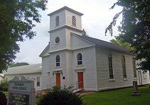 |
(#93000861) |
US 9 N of jct. with Market St. 41°47′32″N 73°56′16″W / 41.792222°N 73.937778°W |
Hyde Park | 1826 Federal-style church of congregation in existence since 1789 |
| 82 | Archibald Rogers Estate | Upload image | (#93000864) |
Jct. of Mansion and Garden Sts. 41°46′46″N 73°56′22″W / 41.779444°N 73.939444°W |
Hyde Park | |
| 83 | Rokeby | Upload image | (#75001181) |
S of Barrytown between Hudson River and River Rd. 41°59′16″N 73°55′28″W / 41.987778°N 73.924444°W |
Barrytown | |
| 84 | Roosevelt Point Cottage and Boathouse | 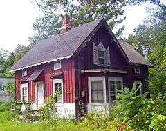 |
(#93000851) |
River Point Rd. at the Hudson R. 41°44′22″N 73°56′12″W / 41.739444°N 73.936667°W |
Hyde Park | 1860 Carpenter Gothic cottage; boathouse where John Roosevelt kept his championship ice yachts |
| 85 | Eleanor Roosevelt National Historic Site | 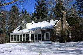 |
(#80000357) |
Violet Ave. 41°45′41″N 73°53′58″W / 41.761389°N 73.899444°W |
Hyde Park | Val-Kill, cottage of Eleanor Roosevelt |
| 86 | Isaac Roosevelt House | 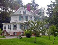 |
(#93000857) |
Riverview Cir., E side 41°44′13″N 73°55′58″W / 41.736944°N 73.932778°W |
Hyde Park | 1832 main house of Rosedale, estate of FDR's grandfather, shows mix of late Federal and Italianate elements. |
| 87 | George Rymph House | 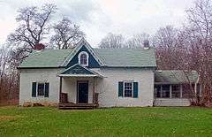 |
(#93000863) |
US 9 S of jct. with S. Cross Rd. 41°49′21″N 73°56′09″W / 41.8225°N 73.935833°W |
Hyde Park | One of the few remaining pre-Revolutionary houses in Hyde Park |
| 88 | St. Luke's Episcopal Church Complex | |
(#08000517) |
Wolcott Ave. & Rector St. 41°29′53″N 73°57′51″W / 41.498011°N 73.964258°W |
Beacon | Frederick Clarke Withers considered this 1869 church to be one of his best works; epitomizes Ecclesiological theories about Episcopalian church architecture. |
| 89 | Saint Mark's Episcopal Church | Upload image | (#87001369) |
Liberty St. 41°33′07″N 73°58′05″W / 41.551944°N 73.968056°W |
Chelsea | |
| 90 | St. Margaret's Home |  |
(#06000883) |
7260 South Broadway 41°58′51″N 73°52′57″W / 41.980833°N 73.8825°W |
Red Hook | |
| 91 | St. Paul's (Zion's) Evangelical Lutheran Church | 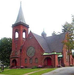 |
(#98001065) |
57 S Broadway 41°59′28″N 73°52′40″W / 41.991111°N 73.877778°W |
Red Hook | 1890 church is very sophisticated Romanesque Revival design for small town |
| 92 | St. Paul's Lutheran Church, Parsonage and Cemetery | 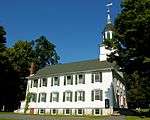 |
(#87001083) |
Wurtemburg Rd. 41°53′53″N 73°52′19″W / 41.898056°N 73.871944°W |
Wurtemburg | |
| 93 | St. Thomas' Episcopal Church | 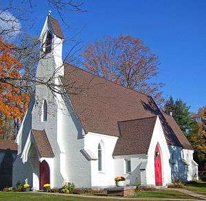 |
(#05000261) |
Leedsville Rd., N side, W of NY 41 41°49′37″N 73°30′21″W / 41.826944°N 73.505833°W |
Amenia Union | 1851 Richard Upjohn church in English rural Gothic Revival style |
| 94 | Second Baptist Church of Dover | 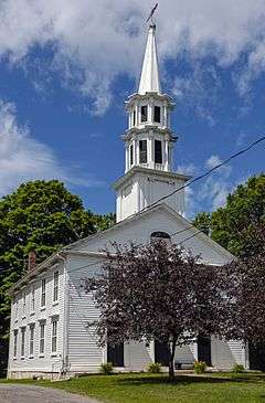 |
(#10000589) |
29 Mill St. 41°44′27″N 73°34′43″W / 41.740833°N 73.578611°W |
Dover Plains | 1830s wooden church |
| 95 | Smithfield Presbyterian Church | 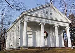 |
(#11001090) |
656 Smithfield Valley Rd. 41°53′09″N 73°36′00″W / 41.885969°N 73.599864°W |
Amenia | 1847 Greek Revival church complex was center of small rural settlement. Burials in cemetery date to the 1730s. |
| 96 | Stony Kill Farm |  |
(#80002601) |
W of Fishkill on NY 9D 41°32′27″N 73°56′20″W / 41.540833°N 73.938889°W |
Fishkill | Farm owned by early landowners the Verplanck family still in use as state environmental education center |
| 97 | Storm–Adriance–Brinckerhoff House | |
(#08000581) |
451 Beekman Rd. 41°35′49″N 73°45′40″W / 41.596972°N 73.761058°W |
East Fishkill | Wooden Dutch Colonial house built in 1759 and expanded since; residents have include some of county's prominent families. |
| 98 | William Stoutenburgh House |  |
(#72000830) |
U.S. 9G, East Park 41°47′15″N 73°54′54″W / 41.7875°N 73.915°W |
Hyde Park | Built about 1765, constructed of fieldstone |
| 99 | Sylvan Lake Rock Shelter |  |
(#74001231) |
Address Restricted |
Sylvan Lake | |
| 100 | Tabor-Wing House | 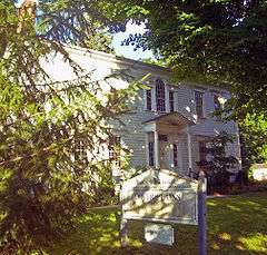 |
(#82003355) |
NY 22 and Cemetery Rd. 41°44′19″N 73°34′47″W / 41.738611°N 73.579722°W |
Dover Plains | Unusually detailed 1810 Federal-style house of prominent families in area. Later used as Dover Plains library; home to town historical society |
| 101 | Taconic State Parkway |  |
(#05001398) |
Linear north-south across central county Coordinates missing |
East Fishkill, LaGrange, Pleasant Valley, Stanford, Milan | Scenic divided highway planned by Franklin D. Roosevelt for state park access. Built between the 1920s and early 1960s, epitomizing peak period of parkway design. |
| 102 | Thorne Memorial School | 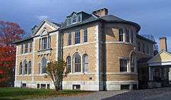 |
(#96001473) |
Jct. of Maple and Franklin Aves. 41°47′09″N 73°41′26″W / 41.785833°N 73.690556°W |
Millbrook | Beaux-Arts school built and donated to community by wealthy resident in 1895 remained in use as high school until 1962 |
| 103 | Tioronda Bridge | 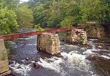 |
(#76001213) |
South Ave. 41°29′19″N 73°58′28″W / 41.488611°N 73.974444°W |
Beacon | One of the last remaining bowstring truss bridges in the U.S. Roadway has been dismantled due to structural deterioration, but could be rebuilt in future |
| 104 | Elias Titus House | 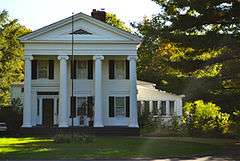 |
(#06000568) |
170 Titusville Rd. 41°39′53″N 73°52′20″W / 41.664722°N 73.872222°W |
Red Oaks Mill | Home built in 1840 in the Greek Revival style featuring a temple front elevation |
| 105 | Top Cottage | 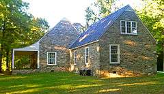 |
(#97001679) |
24 Potters Bend Rd. 41°45′54″N 73°53′22″W / 41.765°N 73.889444°W |
Hyde Park | Designed by FDR as a possible post-presidential residence, this was one of the first fully disabled-accessible buildings in the U.S. and the first one anywhere in the world designed by a disabled person. |
| 106 | Benjamin C. Tousey House | Upload image | (#94001002) |
Jct. of Salt Point Tpk. and Schultzville Rd. 41°50′03″N 73°45′58″W / 41.834167°N 73.766111°W |
Clinton | |
| 107 | John H. Traver Farm | 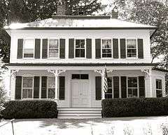 |
(#87001081) |
Wurtemburg Rd. 41°53′40″N 73°52′03″W / 41.894444°N 73.8675°W |
Wurtemburg | |
| 108 | Trinity Methodist Church | Upload image | (#09001227) |
8 Mattie Cooper Square 41°30′29″N 73°58′23″W / 41.508011°N 73.973133°W |
Beacon | |
| 109 | US Post Office-Beacon | |
(#88002456) |
369 Main St. 41°30′15″N 73°58′52″W / 41.504167°N 73.981111°W |
Beacon | First of several fieldstone post offices built in county during Depression in native Dutch Colonial Revival style championed by Roosevelt. One of Gilbert Stanley Underwood's few buildings in the eastern U.S. |
| 110 | US Post Office-Hyde Park |  |
(#88002511) |
E. Market St. and US 9 41°47′30″N 73°56′11″W / 41.791667°N 73.936389°W |
Hyde Park | Modeled after demolished 1772 John Bard House, the personal choice of Hyde Park native Franklin D. Roosevelt. |
| 111 | US Post Office-Wappingers Falls | 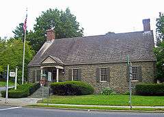 |
(#88002440) |
2 South Ave. 41°35′49″N 73°55′04″W / 41.596944°N 73.917778°W |
Wappingers Falls | Now Wappingers Falls Village Hall. Another post office design overseen by Roosevelt. Today used as village hall |
| 112 | Van Wyck-Wharton House | 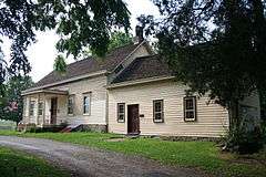 |
(#72000828) |
S of Fishkill on U.S. 9 41°31′23″N 73°53′22″W / 41.523056°N 73.889444°W |
Fishkill | Key supply depot during Revolution |
| 113 | Vanderbilt Lane Historic District | 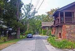 |
(#93000855) |
Jct. of Vanderbilt Ln. and US 9 41°48′08″N 73°56′14″W / 41.802222°N 73.937222°W |
Hyde Park | Intact 19th-century farm buildings that served Langond and Vanderbilt estate across road. One of only two intact estate farm complexes in the Hudson Valley. |
| 114 | Vanderbilt Mansion National Historic Site | 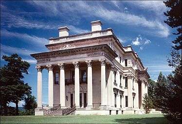 |
(#66000059) |
N edge of Hyde Park, U.S. 9 41°47′50″N 73°56′33″W / 41.797222°N 73.9425°W |
Hyde Park | 1898 mansion by McKim, Mead & White for Frederick William Vanderbilt; considered one of their finest residential works. |
| 115 | Wales House | 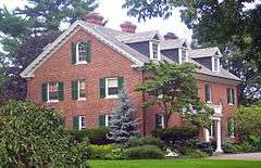 |
(#93000858) |
23 W. Market St. 41°44′13″N 73°56′14″W / 41.736944°N 73.937222°W |
Hyde Park | 1896 Colonial Revival home built by Frederick Vanderbilt for his secretary |
| 116 | Wappingers Falls Historic District |  |
(#84002380) |
Roughly bounded by South Ave., Elm, Main, Park, Walker, Market, and McKinley Sts. 41°35′50″N 73°55′17″W / 41.597222°N 73.921389°W |
Wappingers Falls | Core of 19th-century industrial village, with many original buildings |
| 117 | Warren Masonic Lodge #32 |  |
(#07000491) |
1144 Centre Rd. 41°52′41″N 73°48′16″W / 41.878056°N 73.804444°W |
Schultzville | |
| 118 | Wheeler Hill Historic District | Upload image | (#91000678) |
Wheeler Hill Rd. 41°34′36″N 73°56′37″W / 41.576667°N 73.943611°W |
Wappinger | |
| 119 | Thomas N. Wheeler Farm |  |
(#00001417) |
Indian Lake Rd. 41°54′57″N 73°30′59″W / 41.915833°N 73.516389°W |
Millerton | 1800 farmhouse in Coleman Station |
| 120 | Windswept Farm | Upload image | (#89001390) |
Sunset Trail 41°51′07″N 73°48′17″W / 41.851944°N 73.804722°W |
Clinton | |
| 121 | Hendrik Winegar House | Upload image | (#75001180) |
Southeast of Amenia on SR 2 off NY 343 41°49′40″N 73°30′41″W / 41.827778°N 73.511389°W |
Amenia | 1761 house was one of few remnants of original German settlement of Amenia; seems to have been demolished since listing |
| 122 | Zion Pilgrim Methodist Episcopal Church Site | Upload image | (#14000845) |
303 Baxtertown Rd. 41°32′51″N 73°55′30″W / 41.54738°N 73.92492°W |
Fishkill | Site of historic black church that was center of local community. |
See also
| Wikimedia Commons has media related to National Register of Historic Places in Dutchess County, New York. |
References
- ↑ The latitude and longitude information provided in this table was derived originally from the National Register Information System, which has been found to be fairly accurate for about 99% of listings. For about 1% of NRIS original coordinates, experience has shown that one or both coordinates are typos or otherwise extremely far off; some corrections may have been made. A more subtle problem causes many locations to be off by up to 150 yards, depending on location in the country: most NRIS coordinates were derived from tracing out latitude and longitudes off of USGS topographical quadrant maps created under the North American Datum of 1927, which differs from the current, highly accurate WGS84 GPS system used by most on-line maps. Chicago is about right, but NRIS longitudes in Washington are higher by about 4.5 seconds, and are lower by about 2.0 seconds in Maine. Latitudes differ by about 1.0 second in Florida. Some locations in this table may have been corrected to current GPS standards.
- ↑ "National Register of Historic Places: Weekly List Actions". National Park Service, United States Department of the Interior. Retrieved on December 16, 2016.
- ↑ Numbers represent an ordering by significant words. Various colorings, defined here, differentiate National Historic Landmarks and historic districts from other NRHP buildings, structures, sites or objects.
- ↑ The eight-digit number below each date is the number assigned to each location in the National Register Information System database, which can be viewed by clicking the number.
| Topics |   | |
|---|---|---|
| Lists by county |
| |
| Lists by city | ||
| Other lists | ||
| ||