| [4] |
Name on the Register |
Image |
Date listed[5] |
Location |
City or town |
Description |
|---|
| 1 |
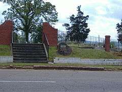
Beth Israel Cemetery |
|
000000001989-03-22-0000March 22, 1989
(#89000169) |
19th St. and 5th Ave.
32°22′38″N 88°40′57″W / 32.377222°N 88.6825°W / 32.377222; -88.6825 (Beth Israel Cemetery) |
Meridian |
A cemetery dating from 1870
|
| 2 |
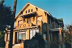
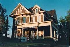
Cahn-Crawford House |
|
000000001979-12-18-0000December 18, 1979
(#79003384) |
1200 22nd Ave.
32°22′07″N 88°42′01″W / 32.368611°N 88.700278°W / 32.368611; -88.700278 (Cahn-Crawford House) |
Meridian |
|
| 3 |
Carnegie Branch Library |
Upload image |
000000001979-12-18-0000December 18, 1979
(#79003385) |
2721 13th St.
32°22′10″N 88°42′23″W / 32.369444°N 88.706389°W / 32.369444; -88.706389 (Carnegie Branch Library) |
Meridian |
|
| 4 |
Causeyville Historic District |
|
000000001986-01-02-0000January 2, 1986
(#86000058) |
Meridian-Causeyville Rd.
32°15′30″N 88°33′46″W / 32.258333°N 88.562778°W / 32.258333; -88.562778 (Causeyville Historic District) |
Causeyville |
|
| 5 |
Coosha |
Upload image |
000000001978-11-21-0000November 21, 1978
(#78001608) |
Address Restricted
|
Lizelia |
|
| 6 |
Dabney-Green House |
Upload image |
000000001979-12-18-0000December 18, 1979
(#79003386) |
1017 22nd Ave.
32°22′03″N 88°42′02″W / 32.3675°N 88.700556°W / 32.3675; -88.700556 (Dabney-Green House) |
Meridian |
|
| 7 |
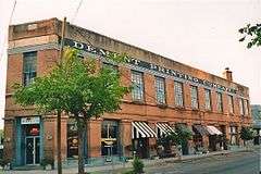
Dement Printing Company |
|
000000001979-12-18-0000December 18, 1979
(#79003387) |
2002 6th St.
32°21′55″N 88°41′57″W / 32.365278°N 88.699167°W / 32.365278; -88.699167 (Dement Printing Company) |
Meridian |
|
| 8 |
East End Historic District |
|
000000001987-08-21-0000August 21, 1987
(#87000470) |
Roughly bounded by 18th St., 11th Ave., 14th St., 14th Ave., 5th St., and 17th Ave.
32°22′20″N 88°41′28″W / 32.372222°N 88.691111°W / 32.372222; -88.691111 (East End Historic District) |
Meridian |
|
| 9 |
Elson-Dudley House |
|
000000001979-12-18-0000December 18, 1979
(#79003390) |
1101 29th Ave.
32°22′04″N 88°42′27″W / 32.367778°N 88.7075°W / 32.367778; -88.7075 (Elson-Dudley House) |
Meridian |
|
| 10 |
First Presbyterian Church of Meridian |
|
000000001979-12-18-0000December 18, 1979
(#79003391) |
911 23rd Ave.
32°21′59″N 88°42′06″W / 32.366389°N 88.701667°W / 32.366389; -88.701667 (First Presbyterian Church of Meridian) |
Meridian |
|
| 11 |
Grand Opera House |
|
000000001972-12-27-0000December 27, 1972
(#72000696) |
2208 5th St.
32°22′21″N 88°42′02″W / 32.3725°N 88.700556°W / 32.3725; -88.700556 (Grand Opera House) |
Meridian |
|
| 12 |
Highland Park |
|
000000001979-02-28-0000February 28, 1979
(#79001325) |
Roughly bounded by 15th and 19th Sts., 37th and 47th Aves.
32°22′28″N 88°43′04″W / 32.374444°N 88.717778°W / 32.374444; -88.717778 (Highland Park) |
Meridian |
|
| 13 |
Highland Park Dentzel Carousel and Shelter Building |
|
000000001987-02-27-0000February 27, 1987
(#87000863) |
Highland Park
32°22′34″N 88°43′05″W / 32.376111°N 88.718056°W / 32.376111; -88.718056 (Highland Park Dentzel Carousel and Shelter Building) |
Meridian |
|
| 14 |
Highlands Historic District |
|
000000001987-08-21-0000August 21, 1987
(#87000467) |
Roughly bounded by 15th St., 34th Ave., 5th St., 19th St., and 36th Ave.
32°22′29″N 88°42′41″W / 32.374722°N 88.711389°W / 32.374722; -88.711389 (Highlands Historic District) |
Meridian |
|
| 15 |
Lacy Homestead |
Upload image |
000000002007-07-19-0000July 19, 2007
(#07000747) |
Address Restricted
|
Toomsuba |
|
| 16 |
Lamar Hotel |
|
000000001979-12-18-0000December 18, 1979
(#79003393) |
410 21st St.
32°21′52″N 88°41′54″W / 32.364444°N 88.698333°W / 32.364444; -88.698333 (Lamar Hotel) |
Meridian |
|
| 17 |
Alex Loeb Building |
|
000000001979-12-18-0000December 18, 1979
(#79003394) |
2115 5th St.
32°21′51″N 88°41′56″W / 32.364167°N 88.698889°W / 32.364167; -88.698889 (Alex Loeb Building) |
Meridian |
|
| 18 |
Masonic Temple |
|
000000001979-12-18-0000December 18, 1979
(#79003395) |
1220 26th Ave.
32°22′10″N 88°42′16″W / 32.369444°N 88.704444°W / 32.369444; -88.704444 (Masonic Temple) |
Meridian |
Sometime after its listing the building was demolished.
|
| 19 |
McLemore Cemetery |
|
000000001979-12-18-0000December 18, 1979
(#79003396) |
601 16th Ave.
32°22′03″N 88°41′41″W / 32.3675°N 88.694722°W / 32.3675; -88.694722 (McLemore Cemetery) |
Meridian |
|
| 20 |
Meridian Downtown Historic District |
|
000000002007-01-16-0000January 16, 2007
(#06001249) |
Roughly bounded by 26th Ave., 18th Ave., 6th St., and Front St.
Coordinates missing |
Meridian |
|
| 21 |
Meridian Museum of Art |
|
000000001979-12-18-0000December 18, 1979
(#79003397) |
628 25th Ave.
32°21′49″N 88°42′12″W / 32.363611°N 88.703333°W / 32.363611; -88.703333 (Meridian Museum of Art) |
Meridian |
Art museum for many years; formerly the Carnegie Library for whites in Meridian
|
| 22 |
Meridian Senior High School and Junior College |
Upload image |
000000002014-05-29-0000May 29, 2014
(#14000275) |
2320 32nd St.
32°23′27″N 88°42′07″W / 32.390708°N 88.702026°W / 32.390708; -88.702026 (Meridian Senior High School and Junior College) |
Meridian |
|
| 23 |
Meridian Urban Center Historic District |
|
000000001979-12-18-0000December 18, 1979
(#79003732) |
Roughly bounded by 21st and 25th Aves., 6th St., and the former Gulf, Mobile and Ohio railroad line
32°21′47″N 88°42′01″W / 32.363056°N 88.700278°W / 32.363056; -88.700278 (Meridian Urban Center Historic District) |
Meridian |
|
| 24 |
Meridian Waterworks Pumping Station and Clear Water Basin |
|
000000001989-07-26-0000July 26, 1989
(#89000931) |
B St. and 17th Ave.
32°21′43″N 88°41′30″W / 32.361944°N 88.691667°W / 32.361944; -88.691667 (Meridian Waterworks Pumping Station and Clear Water Basin) |
Meridian |
|
| 25 |
Merrehope |
|
000000001971-12-09-0000December 9, 1971
(#71000455) |
905 31st Ave.
32°22′01″N 88°43′35″W / 32.366944°N 88.726389°W / 32.366944; -88.726389 (Merrehope) |
Meridian |
|
| 26 |
Merrehope Historic District |
|
000000001988-09-19-0000September 19, 1988
(#88000973) |
Roughly bounded by 33rd Ave., 30th Ave., 14th St., 25th Ave., and 8th St.
32°22′05″N 88°42′26″W / 32.368056°N 88.707222°W / 32.368056; -88.707222 (Merrehope Historic District) |
Meridian |
|
| 27 |
Mid-Town Historic District |
|
000000001987-08-21-0000August 21, 1987
(#87000463) |
Roughly bounded by 23rd Ave., 15th St., 28th Ave., and 22nd St.
32°22′38″N 88°42′07″W / 32.377222°N 88.701944°W / 32.377222; -88.701944 (Mid-Town Historic District) |
Meridian |
|
| 28 |
Municipal Building |
|
000000001979-12-18-0000December 18, 1979
(#79003399) |
601 24th Ave.
32°21′49″N 88°42′08″W / 32.363611°N 88.702222°W / 32.363611; -88.702222 (Municipal Building) |
Meridian |
|
| 29 |
Niolon Building |
|
000000001979-12-18-0000December 18, 1979
(#79003400) |
718 23rd Ave.
32°21′53″N 88°42′05″W / 32.364722°N 88.701389°W / 32.364722; -88.701389 (Niolon Building) |
Meridian |
|
| 30 |
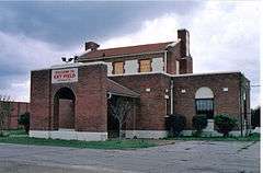
Old Terminal Building, Hangar and Powerhouse at Key Field |
|
000000002003-07-07-0000July 7, 2003
(#03000587) |
2525 U.S. Route 11, S.
32°20′14″N 88°44′33″W / 32.337222°N 88.7425°W / 32.337222; -88.7425 (Old Terminal Building, Hangar and Powerhouse at Key Field) |
Meridian |
|
| 31 |
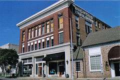
Pigford Building |
|
000000001979-12-18-0000December 18, 1979
(#79003401) |
818 22nd Ave.
32°21′56″N 88°42′00″W / 32.365556°N 88.7°W / 32.365556; -88.7 (Pigford Building) |
Meridian |
|
| 32 |
Poplar Springs Road Historic District |
|
000000001987-08-21-0000August 21, 1987
(#87000461) |
Roughly bounded by 29th St., 23rd Ave., 22nd St., and 29th Ave.
32°23′05″N 88°42′11″W / 32.384722°N 88.703056°W / 32.384722; -88.703056 (Poplar Springs Road Historic District) |
Meridian |
|
| 33 |
Porter-Crawford House |
|
000000001979-12-18-0000December 18, 1979
(#79003402) |
1208 22nd Ave.
32°22′09″N 88°42′01″W / 32.369167°N 88.700278°W / 32.369167; -88.700278 (Porter-Crawford House) |
Meridian |
|
| 34 |
St. Patrick Catholic Church |
|
000000001979-12-18-0000December 18, 1979
(#79003403) |
2614 Davis St.
32°21′48″N 88°42′17″W / 32.363333°N 88.704722°W / 32.363333; -88.704722 (St. Patrick Catholic Church) |
Meridian |
|
| 35 |
The Simmons & Wright Company |
|
000000002008-03-13-0000March 13, 2008
(#08000198) |
5493 U.S. Routes 11/80
32°25′28″N 88°26′20″W / 32.424444°N 88.438889°W / 32.424444; -88.438889 (The Simmons & Wright Company) |
Kewanee |
|
| 36 |
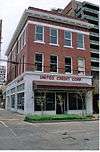
Standard Drug Company |
|
000000001989-12-07-0000December 7, 1989
(#89002050) |
601 25th Ave.
32°21′46″N 88°42′12″W / 32.362778°N 88.703333°W / 32.362778; -88.703333 (Standard Drug Company) |
Meridian |
|
| 37 |
Stevenson Primary School |
|
000000001979-12-18-0000December 18, 1979
(#79003405) |
1015 25th Ave.
32°22′01″N 88°42′14″W / 32.366944°N 88.703889°W / 32.366944; -88.703889 (Stevenson Primary School) |
Meridian |
|
| 38 |
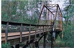
Stuckey's Bridge |
|
000000001988-11-16-0000November 16, 1988
(#88002415) |
Spans the Chunky River on a county road
32°15′20″N 88°51′19″W / 32.255556°N 88.855278°W / 32.255556; -88.855278 (Stuckey's Bridge) |
Meridian |
|
| 39 |
Temple Theater |
|
000000001979-12-18-0000December 18, 1979
(#79003407) |
2318 8th St.
32°21′54″N 88°42′09″W / 32.365°N 88.7025°W / 32.365; -88.7025 (Temple Theater) |
Meridian |
|
| 40 |
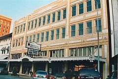
Threefoot Building |
|
000000001979-12-18-0000December 18, 1979
(#79003408) |
601 22nd Ave.
32°21′52″N 88°42′02″W / 32.364444°N 88.700556°W / 32.364444; -88.700556 (Threefoot Building) |
Meridian |
|
| 41 |
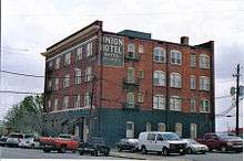
Union Hotel |
|
000000001979-12-18-0000December 18, 1979
(#79003409) |
2000 Front St.
32°21′50″N 88°41′50″W / 32.363889°N 88.697222°W / 32.363889; -88.697222 (Union Hotel) |
Meridian |
|
| 42 |
Union Station Historic District |
|
000000001979-12-18-0000December 18, 1979
(#79003731) |
Roughly bounded by 18th and 19th Aves., 5th St., and the former Gulf, Mobile and Ohio railroad line
32°21′54″N 88°41′46″W / 32.365°N 88.696111°W / 32.365; -88.696111 (Union Station Historic District) |
Meridian |
|
| 43 |
US Post Office and Courthouse |
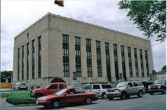
|
000000001984-05-17-0000May 17, 1984
(#84002236) |
2100 9th St.
32°21′59″N 88°41′59″W / 32.366389°N 88.699722°W / 32.366389; -88.699722 (US Post Office and Courthouse) |
Meridian |
|
| 44 |
US Sugar Crop Field Station |
|
000000001991-01-11-0000January 11, 1991
(#90002124) |
Junction of Sonny Montgomery Industrial Parkway and Peavy Dr.
32°24′41″N 88°36′44″W / 32.411389°N 88.612222°W / 32.411389; -88.612222 (US Sugar Crop Field Station) |
Meridian |
|
| 45 |
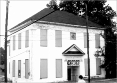
Wechsler School |
|
000000001991-07-15-0000July 15, 1991
(#91000880) |
1415 30th Ave.
32°22′17″N 88°42′33″W / 32.371389°N 88.709167°W / 32.371389; -88.709167 (Wechsler School) |
Meridian |
First brick school building built in the state, in 1894, for black children in elementary grades
|
| 46 |
West End Historic District |
|
000000001987-08-21-0000August 21, 1987
(#87000459) |
Roughly bounded by 7th St., 28th Ave., Shearer's Branch, and 5th St.
32°21′46″N 88°42′29″W / 32.362778°N 88.708056°W / 32.362778; -88.708056 (West End Historic District) |
Meridian |
|
