National Register of Historic Places listings in Waukesha County, Wisconsin

Location of Waukesha County in Wisconsin
This is a list of the National Register of Historic Places listings in Waukesha County, Wisconsin. It is intended to provide a comprehensive listing of entries in the National Register of Historic Places that are located in Waukesha County, Wisconsin. The locations of National Register properties for which the latitude and longitude coordinates are included below may be seen in a map.[1]
There are 150 properties and districts listed on the National Register in the county. Another six properties were once listed but have been removed.
- This National Park Service list is complete through NPS recent listings posted December 2, 2016.[2]
Current listings
| [3] | Name on the Register[4] | Image | Date listed[5] | Location | City or town | Description |
|---|---|---|---|---|---|---|
| 1 | Sewall Andrews House |  |
(#81000063) |
103 Main St. 42°51′42″N 88°19′57″W / 42.861667°N 88.3325°W |
Mukwonago | |
| 2 | Arcadian Bottling Works | |
(#83004326) |
900 N. Hartwell Ave. 43°00′44″N 88°13′20″W / 43.012222°N 88.222222°W |
Waukesha | |
| 3 | Arlington Apartments | |
(#86003651) |
309 Arlington St. 43°00′23″N 88°13′55″W / 43.006389°N 88.231944°W |
Waukesha | |
| 4 | Albert R. Baer House |  |
(#88001645) |
W166 N8990 Grand Ave. 43°10′52″N 88°06′57″W / 43.181111°N 88.115833°W |
Menomonee Falls | |
| 5 | Ralph C. Bailie House | |
(#86003407) |
530 North Ave. 43°06′39″N 88°20′40″W / 43.110833°N 88.344444°W |
Hartland | |
| 6 | Bank of Hartland | |
(#86003415) |
112 E. Capitol Dr. 43°06′17″N 88°20′49″W / 43.104722°N 88.346944°W |
Hartland | |
| 7 | Barfoth-Blood Mound Group (47 WK 63) | Upload image | (#82000720) |
Address Restricted |
Mukwonago | |
| 8 | Andrew Barnes House | Upload image | (#88001652) |
N89 W16840 Appleton Ave. 43°10′51″N 88°07′07″W / 43.180833°N 88.118611°W |
Menomonee Falls | |
| 9 | Barney House | |
(#94001250) |
W264 S3641 Saylesville Rd. 42°58′42″N 88°16′34″W / 42.978333°N 88.276111°W |
Waukesha | |
| 10 | Everett P. Barrett House | 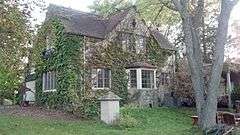 |
(#95000140) |
120 S. Porter Ave. 43°00′09″N 88°12′43″W / 43.0025°N 88.211944°W |
Waukesha | |
| 11 | Beaumont Hop House | |
(#77000058) |
Address Restricted |
Hartland | |
| 12 | Becker and Schafer Store Building | Upload image | (#95000677) |
1002-1004 White Rock Ave. 43°00′48″N 88°13′33″W / 43.013333°N 88.225833°W |
Waukesha | |
| 13 | Big Bend Mound Group No. 2 | Upload image | (#78000146) |
S of Big Bend Coordinates missing |
Big Bend | |
| 14 | Bishopstead | |
(#84003803) |
153 W. Oakwood Dr. 43°04′23″N 88°25′06″W / 43.073056°N 88.418333°W |
Delafield | |
| 15 | Sen. William Blair House | 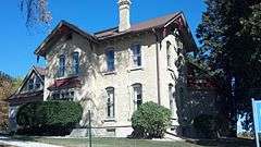 |
(#83004327) |
434 Madison St. 43°00′50″N 88°14′12″W / 43.013889°N 88.236667°W |
Waukesha | |
| 16 | Block C Historic District |  |
(#95001504) |
Roughly bounded by W. Main St., Gaspar St. and Broadway 43°00′41″N 88°13′51″W / 43.011389°N 88.230833°W |
Waukesha | |
| 17 | J. C. Booth House |  |
(#73000094) |
About 1 mi. SW of Saylesville on Saylesville Rd. 42°56′22″N 88°20′20″W / 42.939444°N 88.338889°W |
Saylesville | |
| 18 | Patrick J. Buckley House |  |
(#91000075) |
1101 Buckley St. 43°00′51″N 88°13′36″W / 43.014167°N 88.226667°W |
Waukesha | |
| 19 | Burr Oak Tavern | |
(#86003403) |
315-317 E. Capitol Dr. 43°06′17″N 88°20′33″W / 43.104722°N 88.3425°W |
Hartland | |
| 20 | Thomas Camp Farmhouse |  |
(#88001670) |
W204 N8151 Lannon Rd. 43°09′56″N 88°09′49″W / 43.165556°N 88.163611°W |
Menomonee Falls | |
| 21 | Caples' Park Historic District | |
(#88000219) |
Roughly bounded by E. Newhall Ave., S. Hartwell Ave., Windsor Dr. and Oxford Rd., and S. East Ave. 42°59′54″N 88°13′27″W / 42.998333°N 88.224167°W |
Waukesha | |
| 22 | Dr. Alfred L. Castleman House |  |
(#96000730) |
975 S. Waterville Rd. 43°01′20″N 88°26′16″W / 43.022222°N 88.437778°W |
Summit | |
| 23 | Walter S. Chandler House | |
(#74000137) |
151 W. College Ave. 43°00′10″N 88°13′44″W / 43.002778°N 88.228889°W |
Waukesha | |
| 24 | Chapel of St. Mary the Virgin | 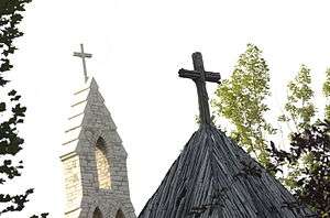 |
(#72000067) |
2 mi. SW of Nashotah on Nashotah House Rd. 43°04′57″N 88°25′34″W / 43.0825°N 88.426111°W |
Nashotah | |
| 25 | Chicago and Northwestern Railroad Passenger Depot |  |
(#95000142) |
319 Williams St. 43°00′20″N 88°13′57″W / 43.005556°N 88.2325°W |
Waukesha | |
| 26 | George Lawrence Clarke, Jr., House |  |
(#95000138) |
12810 W. Hampton Ave. 43°06′19″N 88°04′21″W / 43.105278°N 88.0725°W |
Butler | |
| 27 | George N. Cobb House |  |
(#82000719) |
S of Oconomowoc at 1505 N. Golden Lake Rd. 43°03′03″N 88°31′24″W / 43.050833°N 88.523333°W |
Oconomowoc | |
| 28 | College Avenue Historic District | |
(#83004328) |
Fountain St., S. East and College Aves. 43°00′11″N 88°13′42″W / 43.003056°N 88.228333°W |
Waukesha | |
| 29 | Alexander Cook House | |
(#83004329) |
600 E. North St. 43°00′55″N 88°14′02″W / 43.015278°N 88.233889°W |
Waukesha | |
| 30 | Cutler Mound Group | |
(#88002184) |
Address Restricted |
Waukesha | |
| 31 | Morris Cutler House | |
(#83004330) |
401 Central Ave. 43°00′13″N 88°14′03″W / 43.003611°N 88.234167°W |
Waukesha | |
| 32 | Dansk Evangelical Lutheran Kirke | |
(#86003422) |
400 W. Capitol Dr. 43°06′09″N 88°21′10″W / 43.1025°N 88.352778°W |
Hartland | |
| 33 | Cyrus Davis Farmstead | 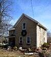 |
(#88001674) |
W204 N7776 Lannon Rd. 43°09′29″N 88°09′41″W / 43.158056°N 88.161389°W |
Menomonee Falls | |
| 34 | Cyrus Davis-Davis Brothers Farmhouse |  |
(#88001672) |
W204 N7818 Lannon Rd. 43°09′35″N 88°09′45″W / 43.159722°N 88.1625°W |
Menomonee Falls | |
| 35 | Delafield Fish Hatchery | |
(#81000064) |
Main St. 43°03′40″N 88°24′26″W / 43.061111°N 88.407222°W |
Delafield | |
| 36 | Dewey Mound Group | Upload image | (#78000147) |
Address Restricted |
Big Bend | |
| 37 | Dousman Inn |  |
(#79000118) |
15670 Blue Mound Rd. 43°02′10″N 88°06′27″W / 43.036111°N 88.1075°W |
Brookfield | |
| 38 | Downtown Historic District | 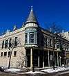 |
(#83004331) |
Roughly bounded by Broadway, Grand Ave., Clinton and South Sts. 43°00′40″N 88°13′55″W / 43.011111°N 88.231944°W |
Waukesha | |
| 39 | George Dwinnell House | |
(#83004332) |
442 W. College Ave. 43°00′11″N 88°14′10″W / 43.003056°N 88.236111°W |
Waukesha | |
| 40 | East Broadway Historic District |  |
(#96000249) |
Roughly, Broadway from Fisk Ave. to Morningside Dr. 43°00′16″N 88°12′42″W / 43.004444°N 88.211667°W |
Waukesha | |
| 41 | East Capitol Drive Historic District | |
(#86002319) |
337-702 E. Capitol Dr. 43°06′18″N 88°20′17″W / 43.105°N 88.338056°W |
Hartland | |
| 42 | Dr. F. C. Elliot House | |
(#83004333) |
501Dunbar Ave. 43°00′20″N 88°14′13″W / 43.005556°N 88.236944°W |
Waukesha | |
| 43 | Joseph Fabacker House | |
(#95000139) |
341 NW. Barstow St. 43°01′00″N 88°14′02″W / 43.016667°N 88.233889°W |
Waukesha | |
| 44 | First Baptist Church | 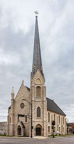 |
(#83004334) |
247 Wisconsin Ave. 43°00′34″N 88°13′52″W / 43.009444°N 88.231111°W |
Waukesha | |
| 45 | First Congregational Church | |
(#86003405) |
214 E. Capitol Dr. 43°06′18″N 88°20′36″W / 43.105°N 88.343333°W |
Hartland | |
| 46 | First Congregational Church | 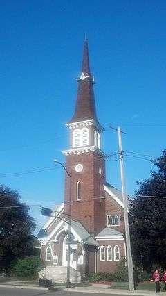 |
(#91001991) |
100 E. Broadway 43°00′24″N 88°13′17″W / 43.006667°N 88.221389°W |
Waukesha | |
| 47 | First German Reformed Church | |
(#91001390) |
413 Wisconsin Ave. 43°00′34″N 88°14′06″W / 43.009444°N 88.235°W |
Waukesha | |
| 48 | First Methodist Church |  |
(#83004335) |
121 Wisconsin Ave. 43°00′34″N 88°12′56″W / 43.009444°N 88.215556°W |
Waukesha | |
| 49 | Andrew Frame House |  |
(#83004337) |
507 N. Grand Ave. 43°00′29″N 88°13′52″W / 43.008056°N 88.231111°W |
Waukesha | |
| 50 | Freewill Baptist Church | |
(#97001409) |
19750 W. National Ave. 42°56′40″N 88°09′37″W / 42.944444°N 88.160278°W |
New Berlin | |
| 51 | Genesee Town Hall | |
(#81000065) |
Genesee St. 42°58′01″N 88°22′23″W / 42.966944°N 88.373056°W |
Genesee Depot | |
| 52 | Goodwin-McBean Site (47 WK 184) | Upload image | (#82000721) |
Address Restricted |
Big Bend | |
| 53 | Perry Grace House | |
(#83004339) |
307 N. West Ave. 43°00′23″N 88°14′11″W / 43.006389°N 88.236389°W |
Waukesha | |
| 54 | Grand View Health Resort | |
(#84003805) |
500 Riverview Ave. 43°01′17″N 88°13′59″W / 43.021389°N 88.233056°W |
Waukesha | |
| 55 | Gredler-Gramins House |  |
(#80000203) |
20190 Davidson Rd. 42°59′20″N 88°09′47″W / 42.988889°N 88.163056°W |
Brookfield | |
| 56 | Hadfield Company Lime Kilns |  |
(#82000722) |
N of Waukesha 43°02′19″N 88°12′53″W / 43.038611°N 88.214722°W |
Waukesha | |
| 57 | Hartland Railroad Depot | |
(#86003417) |
301 Pawling Ave. 43°06′01″N 88°20′57″W / 43.100278°N 88.349167°W |
Hartland | |
| 58 | Haseltine Cobblestone House | 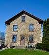 |
(#80000204) |
N of Big Bend on Big Bend Dr. 42°53′38″N 88°12′34″W / 42.893889°N 88.209444°W |
Big Bend | |
| 59 | Hawks Inn |  |
(#72000068) |
428 Wells St. 43°03′35″N 88°24′25″W / 43.059722°N 88.406944°W |
Delafield | 1846 |
| 60 | David J. Hemlock House | 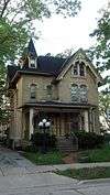 |
(#83004340) |
234 Carroll St. 43°00′29″N 88°13′51″W / 43.008056°N 88.230833°W |
Waukesha | |
| 61 | LeRoy A. Henze House | |
(#88001638) |
N89 W15781 Main St. 43°10′43″N 88°06′23″W / 43.178611°N 88.106389°W |
Menomonee Falls | |
| 62 | Ahira R. Hinkley House | 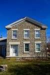 |
(#74000138) |
NE of Eagle off WI 59 42°54′04″N 88°27′08″W / 42.901111°N 88.452222°W |
Eagle | |
| 63 | Herbert Hoeltz House |  |
(#88001636) |
N87 W15714 Kenwood Blvd. 43°10′39″N 88°06′19″W / 43.1775°N 88.105278°W |
Menomonee Falls | |
| 64 | Elizabeth Hoos House | 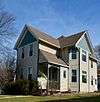 |
(#88001640) |
W164 N9010 Water St. 43°10′54″N 88°06′47″W / 43.181667°N 88.113056°W |
Menomonee Falls | |
| 65 | Hoos-Rowell House |  |
(#88001644) |
W164 N8953 Water St. 43°10′50″N 88°06′49″W / 43.180556°N 88.113611°W |
Menomonee Falls | |
| 66 | Harold Hornburg House | |
(#86003431) |
213 Warren Ave. 43°06′12″N 88°20′38″W / 43.103333°N 88.343889°W |
Hartland | |
| 67 | Jackson House | |
(#86003409) |
235 North Ave. 43°06′27″N 88°20′47″W / 43.1075°N 88.346389°W |
Hartland | |
| 68 | Samuel D. James House |  |
(#83004687) |
726 N. East Ave. 43°00′38″N 88°13′38″W / 43.010556°N 88.227222°W |
Waukesha | |
| 69 | William Johnston Lime Kiln | Upload image | (#82000723) |
E of Genesse Depot 42°57′58″N 88°19′17″W / 42.966111°N 88.321389°W |
Saylesville | |
| 70 | Robert O. Jones House | |
(#83004342) |
501 W. College Ave. 43°00′09″N 88°14′13″W / 43.0025°N 88.236944°W |
Waukesha | |
| 71 | Michael Kelliher House | 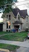 |
(#83004341) |
407 N. Grand Ave. 43°00′24″N 88°13′53″W / 43.0068°N 88.2313°W |
Waukesha | Formerly listed as "John Howitt House"; NRHP name changed in additional documentation accepted by NPS on March 3, 2015 |
| 72 | Frank Koehler House and Office | |
(#88001669) |
N88 W16623 Appleton Ave. 43°10′40″N 88°06′58″W / 43.177778°N 88.116111°W |
Menomonee Falls | |
| 73 | Koepsel House |  |
(#73000095) |
Old World Wisconsin, off WI 59 42°51′59″N 88°29′51″W / 42.866356°N 88.497422°W |
Eagle | |
| 74 | Laflin Avenue Historic District | |
(#83004343) |
W. Laflin and Garfield Aves. 43°00′03″N 88°13′46″W / 43.000833°N 88.229444°W |
Waukesha | |
| 75 | Lain-Estburg House |  |
(#74000139) |
229 Wisconsin Ave. 43°00′35″N 88°13′48″W / 43.009722°N 88.23°W |
Waukesha | |
| 76 | Garwin A. Mace House | Upload image | (#88001650) |
W166 N8941 Grand Ave. 43°10′49″N 88°06′59″W / 43.180278°N 88.116389°W |
Menomonee Falls | |
| 77 | Garwin Mace Lime Kilns | |
(#82000724) |
LimeKiln Park 43°10′38″N 88°06′47″W / 43.177222°N 88.113056°W |
Menomonee Falls | |
| 78 | Madison Street Historic District |  |
(#90000489) |
Jct. of Madison, Randall, and Third Sts. 43°00′50″N 88°14′13″W / 43.013889°N 88.236944°W |
Waukesha | |
| 79 | Main Street Historic District | |
(#88001629) |
Main and Appleton Sts. 43°10′46″N 88°06′47″W / 43.179444°N 88.113056°W |
Menomonee Falls | |
| 80 | William G. Mann House | |
(#83004349) |
346 Maple Ave. 43°00′25″N 88°14′04″W / 43.006944°N 88.234444°W |
Waukesha | |
| 81 | McCall Street Historic District | |
(#83004348) |
McCall and James Sts., and N. East and Hartwell Aves.; also roughly Charles and James Sts. from College Ave. to McCall St. and Hartwell Ave. from College to Grove St. 43°00′19″N 88°13′26″W / 43.005278°N 88.223889°W |
Waukesha | Second set of boundaries represents a boundary increase |
| 82 | Menomonee Falls City Hall | |
(#88001667) |
N88 W16631 Appleton Ave. 43°10′40″N 88°07′00″W / 43.177778°N 88.116667°W |
Menomonee Falls | |
| 83 | Menomonee Golf Club | |
(#88001663) |
N73 W13430 Appleton Ave. 43°09′03″N 88°04′36″W / 43.150833°N 88.076667°W |
Menomonee Falls | |
| 84 | Charles Merten House | |
(#95000248) |
929 Rosemary St. 43°00′48″N 88°13′08″W / 43.013333°N 88.218889°W |
Waukesha | |
| 85 | Miller-Davidson House |  |
(#73000096) |
On County Line Rd., E of U.S. 41 43°11′26″N 88°06′19″W / 43.190556°N 88.105278°W |
Menomonee Falls | |
| 86 | Dr. Volney L. Moore House |  |
(#83004350) |
307 E. Main St. 43°00′48″N 88°13′28″W / 43.013333°N 88.224444°W |
Waukesha | |
| 87 | Moreland Boulevard Pump House and Reservoir | |
(#96000726) |
413 Moreland Blvd. 43°00′32″N 88°15′00″W / 43.008889°N 88.25°W |
Waukesha | |
| 88 | Morey-Andrews House |  |
(#95000405) |
704 Westowne Ave. 43°01′23″N 88°15′26″W / 43.023056°N 88.257222°W |
Waukesha | |
| 89 | Morey-Lewis House |  |
(#95000402) |
1312 Pleasant View Ave. 43°01′41″N 88°15′30″W / 43.028056°N 88.258333°W |
Waukesha | |
| 90 | Morey-Seidens House |  |
(#95000404) |
2020 Easy St. 43°01′41″N 88°15′34″W / 43.028056°N 88.259444°W |
Waukesha | |
| 91 | National Guard Armory 127th Regiment Infantry Company G |  |
(#84000709) |
103 E. Jefferson at Main St. 43°06′17″N 88°30′02″W / 43.104722°N 88.500556°W |
Oconomowoc | |
| 92 | National Hotel | 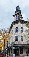 |
(#83004344) |
235 W. Main St. 43°00′42″N 88°13′48″W / 43.011667°N 88.23°W |
Waukesha | |
| 93 | Enoch Gardner and Mary Caroline Koch Needham House |  |
(#00000700) |
12713 W. Greenfield Ave. 43°00′59″N 88°04′20″W / 43.016389°N 88.072222°W |
New Berlin | |
| 94 | Charles E. Nelson Sr. House |  |
(#90000560) |
520 N. Grand Ave. 43°00′31″N 88°13′54″W / 43.008611°N 88.231667°W |
Waukesha | |
| 95 | Newhall Avenue Pump House and Reservoir | |
(#99000849) |
445 W. Newhall Ave. 42°59′58″N 88°14′09″W / 42.999444°N 88.235833°W |
Waukesha | |
| 96 | William A. Nickell House |  |
(#83004346) |
511 Lake St. 43°00′33″N 88°13′12″W / 43.009167°N 88.22°W |
Waukesha | |
| 97 | Northwestern Hotel | 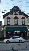 |
(#95000249) |
322 Williams St. 43°00′21″N 88°13′56″W / 43.005833°N 88.232222°W |
Waukesha | |
| 98 | Oconomowoc City Hall | 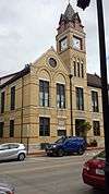 |
(#80000205) |
174 E. Wisconsin Ave. 43°06′38″N 88°29′49″W / 43.110556°N 88.496944°W |
Oconomowoc | |
| 99 | Oconomowoc Depot | |
(#80000206) |
115 Collins St. 43°06′34″N 88°29′54″W / 43.109444°N 88.498333°W |
Oconomowoc | |
| 100 | Oconomowoc High School |  |
(#13000588) |
623 Summit Ave. 43°06′15″N 88°29′25″W / 43.10403°N 88.490346°W |
Oconomowoc | Oconomowoc's former high school; replaced by the current Oconomowoc High School in 1965 |
| 101 | Okauchee House |  |
(#78000149) |
34880 Lake Dr. 43°06′44″N 88°26′21″W / 43.112222°N 88.439167°W |
Okauchee | |
| 102 | Old Waukesha County Courthouse |  |
(#75000082) |
101 W. Main St. 43°00′45″N 88°13′37″W / 43.0125°N 88.226944°W |
Waukesha | |
| 103 | Owen and Margaret Oliver House | |
(#10001182) |
W 314 S 3986 Wisconsin Highway 83 Coordinates missing |
Genesee | |
| 104 | Gustave Pabst Estate |  |
(#89002033) |
36100 Genesee Lake Rd. 43°03′06″N 88°27′56″W / 43.051667°N 88.465556°W |
Summit | |
| 105 | Pearl and Grand Avenue Historic District |  |
(#04001004) |
Pearl Ave. bounded by Grand Ave. and Franklin St. and portions of Pleasant and Division Sts. 42°51′57″N 88°19′53″W / 42.865833°N 88.331389°W |
Mukwonago | Residential historic district with 22 contributing properties built from 1892 to 1954, including the 1892 Queen Anne Asa Craig house (pictured), the 1926 Spanish Colonial St. James Catholic Church, and a small replica of a tower from the Irish Blarney Castle, built as a garden folly in 1897.[6][7] |
| 106 | Clarence Peck Residence | |
(#87002569) |
430 and 434 N. Lake Rd. 43°06′57″N 88°30′00″W / 43.115833°N 88.5°W |
Oconomowoc | |
| 107 | Walter L. Peck House | Upload image | (#86000715) |
38928 Islandale Dr. 43°07′21″N 88°30′48″W / 43.1225°N 88.513333°W |
Oconomowoc | |
| 108 | Peterson Site (47 WK 199) | Upload image | (#82000726) |
Address Restricted |
Big Bend | |
| 109 | Pokrandt Blacksmith Shop | |
(#83004351) |
128 E. St. Paul Ave. 43°00′48″N 88°14′02″W / 43.0133°N 88.2338°W |
Waukesha | |
| 110 | Hannah Pratt House |  |
(#83004352) |
501 Barney St. 43°00′30″N 88°13′29″W / 43.008333°N 88.224722°W |
Waukesha | |
| 111 | John A. Pratt House |  |
(#88001634) |
N88 W15634 Park Blvd. 43°10′43″N 88°06′15″W / 43.178611°N 88.104167°W |
Menomonee Falls | |
| 112 | Putney Block |  |
(#82000727) |
301 W. Main St., 816 and 802 Grand Ave. 43°00′40″N 88°13′54″W / 43.011111°N 88.231667°W |
Waukesha | |
| 113 | Frank H. Putney House |  |
(#83004353) |
223 Wisconsin Ave. 43°00′34″N 88°13′47″W / 43.009444°N 88.229722°W |
Waukesha | |
| 114 | Reformed Presbyterian Church of Vernon | |
(#98001595) |
W234 S7710 big Bend Rd. 42°54′55″N 88°13′07″W / 42.915278°N 88.218611°W |
Vernon | |
| 115 | Resthaven Hotel | |
(#83004354) |
915 N. Hartwell Ave. 43°00′48″N 88°13′13″W / 43.013333°N 88.220278°W |
Waukesha | |
| 116 | St. John Chrysostom Church |  |
(#72000069) |
1111 Genesee St. 43°03′49″N 88°24′19″W / 43.063611°N 88.405278°W |
Delafield | |
| 117 | St. John's Military Academy | |
(#77000059) |
Genessee St. 43°03′49″N 88°24′24″W / 43.063611°N 88.406667°W |
Delafield | |
| 118 | St. Joseph's Catholic Church Complex | 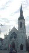 |
(#83004355) |
818 N. East Ave. 43°00′27″N 88°13′37″W / 43.0075°N 88.226944°W |
Waukesha | |
| 119 | St. Matthias Episcopal Church |  |
(#83004356) |
111 E. Main St. 43°00′46″N 88°13′36″W / 43.012778°N 88.226667°W |
Waukesha | |
| 120 | Casper M. Sanger House |  |
(#83004357) |
507 E. College Ave. 43°00′10″N 88°13′18″W / 43.002778°N 88.221667°W |
Waukesha | |
| 121 | Saylesville Historic District | |
(#03000225) |
Saylesville Rd. From Genesee Creek to Point Dr. 42°56′55″N 88°19′17″W / 42.948611°N 88.321389°W |
Genesee | |
| 122 | Carl and Therese Schauwitzer House |  |
(#13000751) |
S84 W17698 Woods Rd. 42°53′27″N 88°08′09″W / 42.890957°N 88.135964°W |
Muskego | |
| 123 | Henry and Mary Schuttler House |  |
(#87001122) |
371 E. Lisbon Rd. 43°07′16″N 88°29′41″W / 43.121111°N 88.494722°W |
Oconomowoc | |
| 124 | Sign of the Willows | |
(#86003428) |
122 E. Capitol Dr. 43°06′17″N 88°20′47″W / 43.104722°N 88.346389°W |
Hartland | |
| 125 | Silurian Mineral Springhouse | |
(#84003814) |
Post Office Circle 43°00′35″N 88°13′23″W / 43.009722°N 88.223056°W |
Waukesha | |
| 126 | William P. Sloan House | 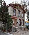 |
(#83004368) |
912 N. Barstow St. 43°00′45″N 88°13′45″W / 43.0125°N 88.229167°W |
Waukesha | |
| 127 | Camillia Smith House | |
(#83004358) |
603 N. West Ave. 43°00′32″N 88°14′10″W / 43.008889°N 88.236111°W |
Waukesha | |
| 128 | Statesan Historic District |  |
(#88000454) |
Boys School Rd. 43°01′28″N 88°23′23″W / 43.024444°N 88.389722°W |
Wales | |
| 129 | Ten Chimneys | 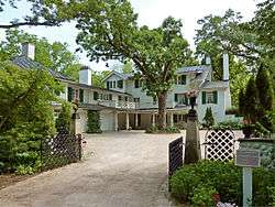 |
(#98000076) |
S42 W31610 Depot Rd. 42°57′51″N 88°22′38″W / 42.964167°N 88.377222°W |
Genesee | Summer home of actors Lynn Fontanne and Alfred Lunt; designated a U.S. National Historic Landmark on July 31, 2003 |
| 130 | Third Street Bridge |  |
(#88001647) |
Roosevelt Dr. 43°10′55″N 88°06′52″W / 43.181944°N 88.114444°W |
Menomonee Falls | |
| 131 | Totten-Butterfield House | |
(#84003816) |
515 N. Grand Ave. 43°00′29″N 88°13′52″W / 43.008056°N 88.231111°W |
Waukesha | |
| 132 | Trapp Filling Station | |
(#86003419) |
252-256 W. Capitol Dr. 43°06′11″N 88°21′03″W / 43.103056°N 88.350833°W |
Hartland | |
| 133 | Christian Turck House | 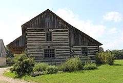 |
(#73000097) |
Off WI 59 in Old World Wisconsin 42°51′56″N 88°29′57″W / 42.865566°N 88.499292°W |
Eagle | Cedar log house chinked with rye straw and clay, built in 1846 in Washington County. It is now moved to Old World Wisconsin, and called the Schottler House.[8] |
| 134 | United Unitarian and Universalist Church | 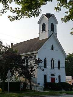 |
(#87001759) |
216 Main St. 42°51′43″N 88°19′55″W / 42.861944°N 88.331944°W |
Mukwonago | Large, traditional Gothic Revival church built in 1879.[9] |
| 135 | Sarah Belle Van Buren House | |
(#86003426) |
128 Hill St. 43°06′18″N 88°20′54″W / 43.105°N 88.348333°W |
Hartland | |
| 136 | Village Park Bandstand |  |
(#88001653) |
Village Park on Garfield Dr. 43°10′32″N 88°07′07″W / 43.175556°N 88.118611°W |
Menomonee Falls | |
| 137 | Visitation Convent Complex | _viewed_from_Watertown_Plank_Rd%2C_Elm_Grove%2C_Wis.jpg) |
(#11000311) |
13105 Watertown Plank Rd. 43°02′42″N 88°04′31″W / 43.045°N 88.075278°W |
Elm Grove | |
| 138 | Ward District No. 3 Schoolhouse |  |
(#81000066) |
WI 67 and Betts Rd. In Old World Wisconsin 42°51′27″N 88°29′37″W / 42.857570°N 88.493726°W |
Eagle | |
| 139 | Stephen Warren House | |
(#86003432) |
235 E. Capitol Dr. 43°06′16″N 88°20′36″W / 43.104444°N 88.343333°W |
Hartland | |
| 140 | Waukesha Post Office |  |
(#83004359) |
235 W. Broadway Ave. 43°00′39″N 88°13′49″W / 43.010833°N 88.230278°W |
Waukesha | |
| 141 | Waukesha Pure Food Company | |
(#83004360) |
550 Elizabeth St. 43°00′16″N 88°14′19″W / 43.004444°N 88.238611°W |
Waukesha | |
| 142 | C. A. Welch House |  |
(#83004361) |
1616 White Rock Ave. 43°01′27″N 88°13′08″W / 43.024167°N 88.218889°W |
Waukesha | |
| 143 | Deacon West Octagon House | |
(#75000083) |
370 High St. 43°05′16″N 88°15′54″W / 43.087778°N 88.265°W |
Pewaukee | |
| 144 | Weston's Antique Apple Orchard |  |
(#96000989) |
19760 W. National Ave. 42°56′38″N 88°09′45″W / 42.943889°N 88.1625°W |
New Berlin | |
| 145 | Michael Wick Farmhouse and Barn |  |
(#88001665) |
N72 W13449 Good Hope Rd. 43°08′53″N 88°04′39″W / 43.148056°N 88.0775°W |
Menomonee Falls | |
| 146 | Wisconsin Avenue Historic District | |
(#83004362) |
Wisconsin 43°00′35″N 88°13′52″W / 43.009722°N 88.231111°W |
Waukesha | |
| 147 | Wisconsin Industrial School for Boys | |
(#86003652) |
621 and 627 W. College Ave. 43°00′08″N 88°14′27″W / 43.002222°N 88.240833°W |
Waukesha | |
| 148 | Louis Yanke Saloon |  |
(#83004363) |
200 Madison Ave. 43°00′46″N 88°14′04″W / 43.012778°N 88.234444°W |
Waukesha | |
| 149 | Johann Zimmer Farmhouse |  |
(#88001632) |
W156 N9390 Pilgrim Rd. 43°11′18″N 88°06′10″W / 43.188333°N 88.102778°W |
Menomonee Falls | |
| 150 | Zion Evangelical Lutheran Church | |
(#86003423) |
403 W. Capitol Dr. 43°06′06″N 88°21′11″W / 43.101667°N 88.353056°W |
Hartland |
Former listings
| [3] | Name on the Register | Image | Date listed | Date removed | Location | City or town | Summary |
|---|---|---|---|---|---|---|---|
| 1 | Friederich Farmstead Historic District | Upload image | (#88001631) | N96 W15009 County Line Road |
Menomonee Falls | ||
| 2 | Lincoln High School | Upload image | (#88001662) | N88 W16913 Main St. |
Menomonee Falls | ||
| 3 | Mukwonago High School | Upload image | (#94001211) | 308 Washington Ave. |
Mukwonago | ||
| 4 | Oconomowoc Public Library and Museum | Upload image | (#80000207) | 212 N. Lake Rd. |
Oconomowoc | ||
| 5 | Philadelphia Toboggan Company Carousel Number 15 | Upload image | (#79003771) | Janesville Rd. |
Muskego | Delisted when it was relocated to British Columbia for Expo '76. The carousel was relocated to West Nyack, New York in 1997. The Carousel was returned to the Register under a new listing (Ref# 01000583) in 2001.[10] | |
| 6 | Waukesha County Airport Hangar | Upload image | (#98001596) | 24151 W. Bluemound Road |
Waukesha |
See also
| Wikimedia Commons has media related to National Register of Historic Places in Waukesha County, Wisconsin. |
- List of National Historic Landmarks in Wisconsin
- National Register of Historic Places listings in Wisconsin
References
- ↑ The latitude and longitude information provided is primarily from the National Register Information System, and has been found to be fairly accurate for about 99% of listings. For 1%, the location info may be way off. We seek to correct the coordinate information wherever it is found to be erroneous. Please leave a note in the Discussion page for this article if you believe any specific location is incorrect.
- ↑ "National Register of Historic Places: Weekly List Actions". National Park Service, United States Department of the Interior. Retrieved on December 2, 2016.
- 1 2 Numbers represent an ordering by significant words. Various colorings, defined here, differentiate National Historic Landmarks and historic districts from other NRHP buildings, structures, sites or objects.
- ↑ National Park Service (2008-04-24). "National Register Information System". National Register of Historic Places. National Park Service.
- ↑ The eight-digit number below each date is the number assigned to each location in the National Register Information System database, which can be viewed by clicking the number.
- ↑ "Pearl and Grand Avenue Historic District". Wisconsin Historical Society. Retrieved 2014-09-14.
- ↑ "List of some properties in Mukwonago's Pearl and Grand Historic District". Wisconsin Historical Society. Retrieved 2014-09-14.
- ↑ "Christian Turck House". Wisconsin Historical Society. Retrieved 2014-09-14.
- ↑ "United Unitarian and Universalist Church". Wisconsin Historical Society. Retrieved 2014-09-14.
- ↑
This article is issued from Wikipedia - version of the 11/1/2016. The text is available under the Creative Commons Attribution/Share Alike but additional terms may apply for the media files.