Neve Michael
| Neve Michael | |
|---|---|
|
Neve Michael as viewed from the Elah Valley | |
 Neve Michael | |
| Coordinates: 31°40′24.6″N 35°0′27.35″E / 31.673500°N 35.0075972°ECoordinates: 31°40′24.6″N 35°0′27.35″E / 31.673500°N 35.0075972°E | |
| District | Jerusalem |
| Council | Mateh Yehuda |
| Affiliation | Hitahdut HaIkarim |
| Founded | 1958 |
| Founded by | Persian Jews |
| Population (2015)[1] | 630 |
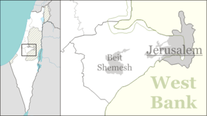
Neve Michael (Hebrew: נְוֵה מִיכָאֵל, lit. Michael's Haven)[2] is a moshav in central Israel. Located in the Adullam region and built upon an eminence in the far south-east end of the Elah Valley, close to where the historic fight between David and Goliath took place, it falls under the jurisdiction of Mateh Yehuda Regional Council. In 2015 it had a population of 630.
History
The village was established on 29 July 1958 (12 Av 5718 anno mundi) by Kurdish immigrants from Iran on farm land that had belonged to the depopulated Arab village of Bayt Nattif.[3][4] The newly restructured Jewish National Fund, working in concert with Hitahdut HaIkarim, settled new immigrants on the site in 1958, giving to the place the name Roglit (Hebrew: רוֹגְלִית), meaning "tiller [of the grapevine]". A newer regional community center built alongside it was given the name Neve Michael, in memory of American philanthropist, Michael M. Weiss, who was a donor to the Jewish National Fund.
The newer section had a regional elementary school which catered to children from the surrounding communities of Roglit, Aderet and Aviezer, but closed its doors in 1968.[5] Today, the grounds of the old school serve as a home for the mentally retarded. When the new settlement of Neve Michael failed to attract new residents, the settlement of Neve Michael was merged with Roglit in 1983.[5] A new Israel Border Police outpost was also built in Neve Michael, which was later abandoned after the Six-Day War, following the change in demarcation lines.[5] The founders were joined by immigrants from North Africa, mainly Morocco.[6] In 2005 the village started an expansion plan attracting many younger families to the moshav. The moshav has a mixed population with people of different, ages, ethnic background and Jewish religious observance.
Within relatively short driving distances from the Moshav are the ruins known as Adullam and Hurvat Itri.

Gallery
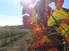
 Vineyard at Neve Michael
 View of Valley from the Moshav
%2C_in_Israel.jpg) Sunrise over the Elah Valley
Sunrise over the Elah Valley Houses in Neve Michael
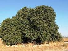
 Terebinth tree (Pistacia atlantica) in the Elah valley, on south side of Neve Michael
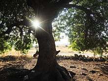
 Beneath the shady boughs of a terebinth
- Terebinth (Pistacia atlantica) growing in the Elah Valley,
References
| Wikimedia Commons has media related to Neve Michael. |
- ↑ "List of localities, in Alphabetical order" (PDF). Israel Central Bureau of Statistics. Retrieved 16 October 2016.
- ↑ English translation follows the Judeo-Arabic translation of the Hebrew "neve" = מאוא (مأوى), in Jeremiah 50:7, published in Yosef Tobi's Poetry, Judeo-Arabic Literature and the Geniza, Tel-Aviv 2006, p. 59 (Hebrew)
- ↑ Khalidi, Walid (1992). All That Remains: The Palestinian Villages Occupied and Depopulated by Israel in 1948. Washington D.C.: Institute for Palestine Studies. p. 212. ISBN 0-88728-224-5.
- ↑ Adullam: `veshavu banim ligevulam`, Heally Gross, Jerusalem 2014, p. 149 (Hebrew)
- 1 2 3 Adullam: `veshavu banim ligevulam`, Heally Gross, Jerusalem 2014, p. 156 (Hebrew)
- ↑ About Neve Michael Homee (Hebrew)
