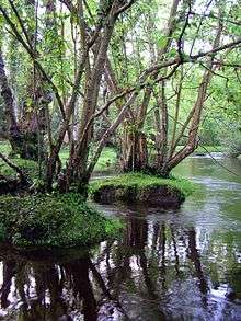
Keyhaven, Pennington, Oxey and Normandy Marshes

Keyhaven, Pennington, Oxey and Normandy Marshes, also known as the North Solent Marshes,[1] are three areas of saltmarsh in Hampshire, England. The village of Keyhaven lies to the west, the village of Pennington to the north, and the town of Lymington to the northeast. The marshes lie behind Hurst Spit and fall within the Hurst Castle And Lymington River Estuary Site of Special Scientific Interest.
History

The marshes were once used as salterns for the thriving salt industry.[2] The salterns are first mentioned in 1132, and continued in use until 1865.[3] They were replaced by oyster beds, but are now disused marshland with some enclosing banks.[3] A circular mound 1.2 metres high and 12 metres across is all that remains of a mill, and there is another mound with an overgrown brick structure and rectangular pond of unknown date.[3] Just north of the marshes, in Lower Pennington, are several 18th-century salt boiling houses.
Nature reserve
The marshes are a site of special scientific interest and an area of outstanding natural beauty.[3] They are part of the New Forest National Park, and in summer are grazed by cattle and ponies owned by New Forest commoners.[4] Part of the marshes behind the sea wall are a national nature reserve managed by English Nature, and a local nature reserve managed by Hampshire County Council.[2] Part of the intertidal mudland is also a nature reserve.[2] The marshes and tidal muds offer a variety of wildlife habitats, which are important for gulls and terns in spring/summer and waders and wildfowl in autumn/winter.[2]
At Pennington Marshes, there are several lagoons, situated just inside the seawall - at the western end is Fishtail Lagoon, and the east of that Butts Lagoon.
A number of rare vagrant birds have occurred at the marshes including a stilt sandpiper in 2002, and a lesser sand plover in 2003.
References
- ↑ Ratcliffe, Derek (1977) A Nature Conservation Review ISBN 052121159X
- 1 2 3 4 Hampshire Treasures, Volume 5 (New Forest), Page 172 - Lymington and Pennington
- 1 2 3 4 Hampshire Treasures, Volume 5 (New Forest), Page 173 - Lymington and Pennington
- ↑ "Lymington-Keyhaven Nature Reserve". Hampshire County Council. 2012-05-23. Retrieved 2012-06-07.
External links
| Wikimedia Commons has media related to Keyhaven and Pennington marshes. |
- Lymington-Keyhaven Nature Reserve, Hampshire County Council
Coordinates: 50°43′41″N 1°33′22″W / 50.728°N 1.556°W
