Northeast Cape Air Force Station
Northeast Cape Air Force Station | |
|---|---|
| Part of Alaskan Air Command (AAC) | |
|
2003 photo prior to the site remediation. The abandoned station is shown in the foreground; White Alice communications array at the base of the mountain. The radar towers are shrouded in clouds at the top of the mountain behind the White Alice antenna array. Today, all of these structures have been removed. | |
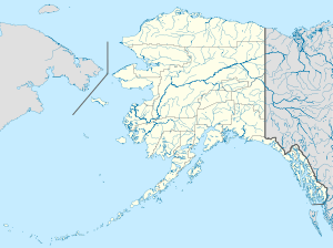
 Northeast Cape AFS Location of Northeast Cape AFS, Alaska | |
| Coordinates | 63°17′25″N 168°58′19″W / 63.29028°N 168.97194°W |
| Type | Air Force Station |
| Site information | |
| Controlled by |
|
| Site history | |
| Built | 1953 |
| In use | 1953-1969 |
| Garrison information | |
| Garrison | 712th Aircraft Control and Warning Squadron (1953-1969) |
| Occupants | United States Air Force Security Service |
Northeast Cape Air Force Station (AAC ID: F-09) is a closed United States Air Force General Surveillance Radar station. It was a forward outpost, located on St. Lawrence Island in the Bering Sea, between Alaska and Siberia, 137 miles (220 km) southwest of Nome, Alaska.
History
Northeast Cape AFS was a continental defence radar station constructed to provide the United States Air Force early warning of an attack by the Soviet Union on Alaska. The area surrounding the Northeast Cape base site had been a traditional camp site for several Yupik families for centuries. During World War II, many joined the Alaska Territorial Guard (ATG) for defense of the island. Following disbandment of the ATG in 1947 and commencing with construction of the site in 1952, many islanders joined the Alaska National Guard to continue to provide land-based defense. The station was the closest forward radar surveillance station to mainland Soviet Union, its location being about 140 miles east-southeast of the Siberian coastline.
The station, as with others of its type, was divided into two areas. The Cantonment, or base station area was located at the base of tall hills along the northeast coast of the Island. A port facility was constructed to facilitate the landing of construction equipment and bulk materiel, along with a gravel airstrip for shipment of personnel and essential supplies. The station consisted of 25 buildings and miscellaneous support structures 63°20′08″N 168°59′25″W / 63.33556°N 168.99028°W. The station buildings were, except for the civil engineering building connected by heated hallways. As a result, personnel stationed there, with only very few exceptions, were able to wear "summer" uniforms year round, unless they had a need to go outside during the winter season. The coverings of the station's three radar towers were heated from within to keep the covering from becoming brittle from extreme cold, and thus subject to being damaged or destroyed by high winds. Tours at the station were limited to one year because of the psychological strain and physical hardships.
The 712th Aircraft Control and Warning Squadron, operated AN/FPS-3, and AN/FPS-20A radars. As a surveillance station, its mission was to monitor the airspace for aircraft activity and provide information 24/7 to the air defense Direction Center at Murphy Dome AFS near Fairbanks, where it was analyzed to determine range, direction altitude speed and whether or not aircraft were friendly or hostile.
Communications were initially provided by a high frequency radio system which proved unreliable because of atmospheric disturbances. The Alaskan Air Command, after investigating various options, decided to build the White Alice Communications System, a system of Air Force-owned tropospheric scatter and microwave radio relay sites operated by the Air Force Communications Service (AFCS). The Northeast Cape site 63°19′49″N 168°58′45″W / 63.33028°N 168.97917°W was activated in 1957. After the station's inactivation by the Air Force in 1969, the White Alice communications site remained active supporting United States Navy operations in the Bering Sea. It was turned over to the Navy in 1972, eventually being inactivated in 1975.
A United States Air Force Security Service detachment of the 6981st Radio Group Mobile (RGM), Elmendorf Air Force Base, was co-located on the site. The detachment's Morse code intercept operators and Russian language linguists were tasked with the surveillance and collection of voice and electronic signals, to be forwarded to the National Security Agency for intelligence analysis. A direction finding receiver was also manned, both for surveillance and search and rescue.
Closure
Northeast Cape Air Force Station was very expensive to maintain, and was inactivated due to budget reductions on 30 September 1969, its mission being taken over by other AAC surveillance radar sites with upgraded and more capable equipment. After the station's closure, the buildings, radars and communications antennas sat derelict and abandoned for decades. The area surrounding the Northeast Cape base site had been a traditional camp site for several Yupik families for centuries. After the base closed down in the 1970s, many of these people started to experience health problems. For 20 years, Yupik elder and environmentalist Annie Alowa advocated for environmental cleanup of the hazardous materials.[1] Even today, people who grew up at Northeast Cape have high rates of cancer and other diseases, possibly due to PCB exposure around the site.[2] According to the State of Alaska, those elevated cancer rates have been shown to be comparable to the rates of other Alaskan and non-Alaskan arctic natives who were not exposed to a similar Air Force facility.[3] In any event, the majority of the facility was removed in a $10.5 million cleanup program in 2003. Monitoring of the site will continue into the future.[4] In 1998 Pacific Air Forces (PACAF) initiated "Operation Clean Sweep", in which abandoned Cold War stations in Alaska were remediated and the land restored to its previous state. After years of neglect the facilities at the station had lost any value they had when the site was closed. The site remediation of the radar, support and White Alice communication station was carried out by the 611th Civil Engineering Squadron at Elmendorf AFB, and remediation work was completed by 2005.
Air Force units and assignments


Units
- 712th Aircraft Control and Warning Squadron
- Activated on 8 December 1952
- Inactivated on 15 September 1969
- Detachment 1, 6981st Radio Squadron, Mobile[5]
- Organized in 1953
- Reorganized as Detachment 1, 6981st Radio Group, Mobile on 1 January 1956
- Reorganized as Detachment 1, 6981st Security Group on 1 July 1963
- Discontinued in 1969
Assignments
- 712th AC&WS
- 160th Aircraft Control and Warning Group, 8 December 1952
- 548th Aircraft Control and Warning Group, 5 February 1953
- 11th Air Division, 18 April 1953
- 5001st Air Defense Group 20 September 1954
- 10th Air Division, 1 October 1955
- 5060th Aircraft Control and Warning Group, 1 November 1957
- 11th Air Division, ca. 1 July 1959
- 5070th Air Defense Wing, 1 August 1960
- Alaskan Air Command, 1 November 1961 - 15 September 1969
- 6981 RSM
- U.S. Air Force Security Service 1953 - 1969
See also
References
![]() This article incorporates public domain material from the Air Force Historical Research Agency website http://www.afhra.af.mil/.
This article incorporates public domain material from the Air Force Historical Research Agency website http://www.afhra.af.mil/.
- ↑ Lerner, Steve (2010). Sacrifice Zones: The Front Lines of Toxic Chemical Exposure in the United States. MIT Press. pp. 221–22. ISBN 978-0-262-01440-3.
- ↑ Coming Clean network. "PCB's in People of St. Lawrence Island". Body Burden Report. Retrieved 2006-06-12.
- ↑ State of Alaska Epidemiology Bulletin. PCB Blood Test Results from St. Lawrence Island. February 6, 2003.
- ↑ State of Alaska Department of Environmental Conservation. "St. Lawrence Island". Contaminated Sites Program. Retrieved 2006-06-12.
- ↑ http://www.buybooksontheweb.com/peek.aspx?id=5979
