Nubarashen District
Coordinates: 40°05′31″N 44°32′57″E / 40.09194°N 44.54917°E
| Nubarashen Նուբարաշեն | |
|---|---|
|
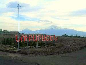
The entrance to Nubarashen | |
 | |
| Coordinates: 40°05′31″N 44°32′57″E / 40.09194°N 44.54917°E | |
| Country | Armenia |
| Marz (Province) | Yerevan |
| Government | |
| • Mayor of District | Artur Kirakosyan |
| Area | |
| • Total | 18 km2 (7 sq mi) |
| Population (2011 census) | |
| • Total | 9,561 |
| • Density | 530/km2 (1,400/sq mi) |
| Time zone | AMT (UTC+4) |
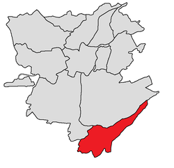
Nubarashen (Armenian: Նուբարաշեն), is one of the 12 districts of Yerevan, the capital of Armenia. It is situated at the southeastern part of the city. With a population of 9,561 (2011 census), Nubarashen is the least populous district of Yerevan. It is bordered by Shengavit and Erebuni districts from the north and Ararat Province from the east, south and west.[1] Nubarashen was formerly known as Sovetashen.
History
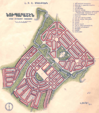
In 1930, with the support and sponsorship of founder-president of the AGBU; the Egyptian-Armenian benefactor Boghos Nubar, a new town named Sovetashen was designed to be founded at the southeastern outskirts of Yerevan. The settlement was planned and designed by architect Alexander Tamanyan.
In 1932, the construction of Nubarashen was completed. During the following years, the settlement became home to many repatriated Armenian families from Greece, Bulgaria, France, Lebanon and Syria.
With the gradual growth of Yerevan, Nubarashen was eventually absorbed by the capital city.
The district is home to the Nubarashen poultry farm, the Nubarashen pig farm and the Nubarashen shoes factory.
Streets and landmarks
- Nubarashen Main street.
- Jrashen-Nubarashen road.
- Nubarashen Central park.
- Boghos Nubar park.
- Holy Martyrs Church.
Gallery
 Plan of Nubarashen by Alexander Tamanyan
 Nubarashen Central park
 Boghos Nubar Park
 World War II memorial
 The main street in Nubarashen
 Holy Martyrs Church
