Porto Grande Bay
| Porto Grande Bay | |
|---|---|
|
Porto Grande | |
| Location | Northwest of São Vicente, Cape Verde |
| Coordinates | 16°53′N 25°01′W / 16.89°N 25.01°W |
| Max. length | 6 km |
| Max. width | 5 km |
| Average depth | 15 meters |
_p0173_CAPE_VERDES%2C_PORTO_GRANDE.jpg)
Porto Grande Bay, also as Mindelo Bay (Portuguese: Baía do Porto Grande) is a bay on the north coast of the island of São Vicente, Cape Verde. The main city of São Vicente, Mindelo, is situated at the bay. The Porto Grande Bay is a deep natural harbour, formed by an underwater volcanic crater of about 4 kilometer diameter, the area is approximately 20 km² and the depth ranges from 15 to 30 m. It stretches between the headlands Ponta João Ribeiro in the northeast and Morro Branco in the west. To the northwest it opens towards the Canal de São Vicente, the channel between the islands São Vicente and Santo Antão. The small rocky island Ilhéu dos Pássaros lies north of the bay.
The bay is considered one of the seven wonders of Cape Verde,[1] on November 12, it became the fifth most beautiful bay in the world.[2]
History
During the Last Ice Age, it was once a small caldeira that was surrounded by a rim in the north and west and belonged to the larger "Northwestern Island" as the sea levels were around 150 m lower, when the sea level was about 25 m lower, the caldeira area was flooded and formed Porto Grande Bay, the northern peninsula was once hook shaped, before the sea levels reached the current level, Ilhéu dos Passos was formed after it separated from the island. Along with the island, the bay was first explored and charted on January 22, 1462, Saint Vincent's Day. Mindelo was founded in 1795 along with its tiny port, around the mid 19th century, a coal deposit was established to supply ships on Atlantic routes, the port was expanded by the British and also used Cape Verde as a storage depot for imported coal bound for the Americas. Also in the mid 19th century, telegraph cables were established in two parts, one southwest of Ilhéu dos Pássaros and the other northeast and passed halfway between Ribeira Julião Point and the islet, as telegraphs went out of use, they are now called communications line are now even used for Internet signals. Porto Grande was a very small port and was within the city, the port expanded in 1962 and finished up to be nearly shaped like a letter F facing westward.
In 2006, ships that participated in a NATO operation known as Operation Mindelo landed in the bay to do their maneuvers for a few days, 7,000 troops took part.[3]
Several American ships made their recent visits in Mindelo, on April 26, 2007, the USS Mahan (DDG-72) visited the port of Mindelo, later on November 16, the USS Annapolis (SSN-760) visited and the US Coast Guard ship, the Dallas (WHEC-716) June 7, 2008.
Expansions
The port has undergone a few series of expansions. An expansion took place in 1997[4] as part of the Porto Grande Modernization Project, the port added 1,750 m of quays. The expansion has enlarged the port's area to 45,000 m² and it features a shipping station and a passenger terminal. The most recent expansion occurred in the northern part in 2014 and is currently expanding, the location of expansion is in the northeast and west of the Avenida Marginal, the northern part is slightly more distant.
Gallery
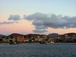
 The Harbor of Mindelo
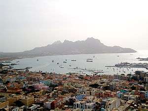
 The city of Mindelo with a view of its bay
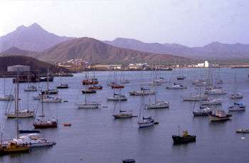
 Porto Grande Bay with Monte Cara
References
- ↑ "The Seven Wonders of Cape Verde". Sapo CV (in Portuguese).
- ↑ "Porto Grande do Mindelo é a 5ª baía mais bela do mundo" [Porto Grande Near Mindelo, the 5th Most Beautiful Bay in the World]. A Semana (in Portuguese). 12 November 2013. Retrieved 16 July 2016.
- ↑ "Landung auf den Kapverden" [Landing in Cape Verde]. BZ Online (Berliner Zeitung) (in German). 26 June 2006.
- ↑ Africa South of the Sahara 2004. Europa & Psychology Presses. 2003. p. 190. ISBN 1857431839. (part of (Europa Regional Surveys of the World 2004 Series)
Coordinates: 16°53′N 25°01′W / 16.89°N 25.01°W
