Ramsar sites in Tunisia

Chott el-Jérid

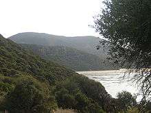
Lagune de Ghar El Melh
Lac Ichkeul
The number of Ramsar sites in Tunisia are 41 sites in 2015, which have in total 840,363 hectares of land coverage.[1] Tunisia is part of the Ramsar Convention from 1980 and has many Wetlands such as Chott el Jerid and Ichkeul Lake, as well as others.
| Ramsar number | Site name | Filing date | Governorate | Area (ha) | Coordinates |
|---|---|---|---|---|---|
| 1696 | Ain Dahab | November 7, 2007 | Siliana | 560 | TN 35°53′N 9°28′E / 35.883°N 9.467°E |
| 1697 | Bahiret el Bibane | November 7, 2007 | Medenine | 39,266 | TN 33°15′N 11°15′E / 33.250°N 11.250°E |
| 2017 | Sidi el Barrak Dam | February 2, 2012 | Beja | 2,734 | TN 37°00′N 09°01′E / 37.000°N 9.017°E |
| 1698 | Lebna Barrage | November 7, 2007 | Nabeul | 1,147 | TN 36°45′N 10°54′E / 36.750°N 10.900°E |
| 2077 | Dam Mlaabi | September 21, 2012 | Nabeul | 98 | TN 36°49′N 10°59′E / 36.817°N 10.983°E |
| 2010 | Dam Merguellil | February 2, 2012 | Kairouan | 714 | TN 35°33′N 09°44′E / 35.550°N 9.733°E |
| 2013 | Barrage Oued El Hajar | February 2, 2012 | Nabeul | 254 | TN 36°50′N 11°02′E / 36.833°N 11.033°E |
| 2014 | Barrage Oued Ermal | February 2, 2012 | Zaghouan | 620 | TN 36°20′N 10°20′E / 36.333°N 10.333°E |
| 2016 | Barrage Sidi Abdelmoneem | February 2, 2012 | Nabeul | 31 | TN 36°51′N 10°56′E / 36.850°N 10.933°E |
| 2018 | Sidi Saad Dam | February 2, 2012 | Kairouan | 8,650 | TN 35°22′N 09°40′E / 35.367°N 9.667°E |
| 2005 | Chott Elguetar | February 2, 2012 | Gafsa | 7,400 | TN 34°17′N 8°54′E / 34.283°N 8.900°E |
| 1699 | Chott el Jerid | November 7, 2007 | Tozeur and Kébili | 586,187 | TN 33°42′N 8°24′E / 33.700°N 8.400°E |
| 2096 | Complex Lake of Tunis | January 23, 2013 | Tunis | 2,243 | TN 36°49′N 10°14′E / 36.817°N 10.233°E |
| 2100 | Complex wetland Sebkhet Ez-Zessar Oum El Grin and Sebkhet | February 2, 2013 | Medenine | 9,195 | TN 33°39′N 10°31′E / 33.650°N 10.517°E |
| 2101 | Complex wetland Dam and Dam Goulla Ghdir El El Mornaguia (Al Mornaguia) | February 2, 2013 | Ariana | 273 | TN 36°46′42″N 10°02′16″E / 36.77833°N 10.03778°E |
| 2076 | Complex wetlands Chott el Guetayate and Sebkhet Dhreia Akarit and wadis, and Rekhama Meleh | September 21, 2012 | Sfax and Gabes | 4,845 | TN 34°06′N 10°01′E / 34.100°N 10.017°E |
| 1700 | Djerba Bin El Ouedian | November 7, 2007 | Medenine | 12,082 | TN 33°40′N 10°55′E / 33.667°N 10.917°E |
| 1701 | Djerba Guellala | November 7, 2007 | Medenine | 2,285 | TN 33°42′N 10°44′E / 33.700°N 10.733°E |
| 1702 | Djerba Ras Rmel | November 7, 2007 | Medenine | 1,856 | TN 33°52′N 10°54′E / 33.867°N 10.900°E |
| 1703 | Garaet Sidi Mansour | November 7, 2007 | Gafsa | 2,426 | TN 34°14′N 9°29′E / 34.233°N 9.483°E |
| 2008 | Gulf of Boughrara | February 2, 2012 | Medenine | 12,880 | TN 33°28′N 10°34′E / 33.467°N 10.567°E |
| 2009 | Gorges Thelja | February 2, 2012 | Gafsa | 675 | TN 34°09′N 8°17′E / 34.150°N 8.283°E |
| 2012 | Islands Kerkennah or the islands of Kerkennah | February 2, 2012 | Sfax | 1,500 | TN 34°47′N 11°14′E / 34.783°N 11.233°E |
| 213 | Ichkeul | November 24, 1980 | Bizerte | 12,600 | TN 37°10′N 9°40′E / 37.167°N 9.667°E |
| 1704 | Kneiss Islands with their intertidal | November 7, 2007 | Sfax | 22,027 | TN 34°22′N 10°20′E / 34.367°N 10.333°E |
| 1705 | Lake and bog Mejen Ech Chitan | November 7, 2007 | Bizerte | 7 | TN 37°9′N 9°6′E / 37.150°N 9.100°E |
| 1706 | Lagoon Ghar al Milh and Delta Mejerda | November 7, 2007 | Bizerte and Ariana | 10,168 | TN 37°6′N 10°11′E / 37.100°N 10.183°E |
| 1707 | Lagoons of Cap Bon Eastern | November 7, 2007 | Nabeul | 504 | TN 36°33′N 10°51′E / 36.550°N 10.850°E |
| 2007 | Freshwater marsh Garaet Douza | February 2, 2012 | Gafsa | 1,400 | TN 34°28′N 8°29′E / 34.467°N 8.483°E |
| 2011 | Oued Dekouk | February 2, 2012 | Tataouine | 5,750 | TN 32°08′N 10°32′E / 32.133°N 10.533°E |
| 1708 | Peat Dar Fatma | November 7, 2007 | Jendouba | 13 | TN 36°48′N 8°46′E / 36.800°N 8.767°E |
| 2015 | Salines Monastir | February 2, 2012 | Monastir | 1,000 | TN 35°45′N 10°46′E / 35.750°N 10.767°E |
| 1709 | Salines Thyna | November 7, 2007 | Sfax | 3,343 | TN 34°39′N 10°43′E / 34.650°N 10.717°E |
| 1710 | Sebkhet Kelbia | November 7, 2007 | Sousse | 8,732 | TN 35°50′N 10°15′E / 35.833°N 10.250°E |
| 1711 | Sebkhet Noual | November 7, 2007 | Sidi Bouzid and Sfax | 17,060 | TN 34°25′N 9°45′E / 34.417°N 9.750°E |
| 2006 | Sebkhet Halk Elmanzel and Oued Essed | February 2, 2012 | Sousse | 1,450 | TN 35°59′N 10°30′E / 35.983°N 10.500°E |
| 1712 | Sebkhet Sejoumi | November 7, 2007 | Tunis | 2,979 | TN 36°45′N 10°9′E / 36.750°N 10.150°E |
| 2019 | Sebkhet Sidi Elhani | February 2, 2012 | Sousse and Mahdia | 36,000 | TN 36°51′N 10°56′E / 36.850°N 10.933°E |
| 1713 | Sebkhet Soliman | November 7, 2007 | Nabeul | 880 | TN 36°43′N 10°29′E / 36.717°N 10.483°E |
| 1714 | Wetlands oasis of Kébili | November 7, 2007 | Kébili | 2,419 | TN 33°30′N 8°55′E / 33.500°N 8.917°E |
| Sources : List established under the Ramsar Convention[2] | |||||
References
- ↑ "The List of Wetlands of International Importance" (PDF). Ramsar Convention. Retrieved 5 September 2015.
- ↑ Liste des zones humides d’importance internationale (Convention de Ramsar)
External links
This article is issued from Wikipedia - version of the 12/21/2015. The text is available under the Creative Commons Attribution/Share Alike but additional terms may apply for the media files.