Richland Springs, Texas
| Richland Springs, Texas | |
|---|---|
| Town | |
| Nickname(s): Home of the fighting Coyotes | |
| Motto: Coyotes Fight Never Die | |
|
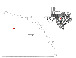
Location of Richland Springs, Texas | |
 | |
| Coordinates: 31°16′13″N 98°56′44″W / 31.27028°N 98.94556°WCoordinates: 31°16′13″N 98°56′44″W / 31.27028°N 98.94556°W | |
| Country | United States |
| State | Texas |
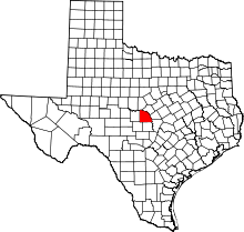
| County | San Saba |
| Area | |
| • Total | 1.0 sq mi (2.6 km2) |
| • Land | 1.0 sq mi (2.6 km2) |
| • Water | 0.0 sq mi (0.0 km2) |
| Elevation | 1,407 ft (429 m) |
| Population (2000) | |
| • Total | Only 333 |
| • Density | 348.6/sq mi (134.6/km2) |
| Time zone | Central (CST) (UTC-6) |
| • Summer (DST) | CDT (UTC-5) |
| ZIP code | 76871 |
| Area code(s) | 325 |
| FIPS code | 48-61880[1] |
| GNIS feature ID | 1366434[2] |
Richland Springs is a town in San Saba County in western Central Texas. The population was 333 at the 2010 census.
Geography
Richland Springs is located at 31°16′13″N 98°56′44″W / 31.27028°N 98.94556°W (31.270326, -98.945654).[3]
According to the United States Census Bureau, the town has a total area of 1.0 square miles (2.6 km²), all of it land.
Climate
The climate in this area is characterized by hot, humid summers and generally mild to cool winters. According to the Köppen Climate Classification system, Richland Springs has a humid subtropical climate, abbreviated "Cfa" on climate maps.[4]
Demographics
| Historical population | |||
|---|---|---|---|
| Census | Pop. | %± | |
| 1930 | 492 | — | |
| 1940 | 541 | 10.0% | |
| 1950 | 584 | 7.9% | |
| 1960 | 331 | −43.3% | |
| 1970 | 425 | 28.4% | |
| 1980 | 420 | −1.2% | |
| 1990 | 344 | −18.1% | |
| 2000 | 350 | 1.7% | |
| 2010 | 338 | −3.4% | |
| Est. 2015 | 329 | [5] | −2.7% |
As of the census[1] of 2000, 350 people, 147 households, and 99 families resided in the town. The population density was 348.6 people per square mile (135.1/km²). There were 182 housing units at an average density of 181.3 per square mile (70.3/km²). The racial makeup of the town was 96.00% White, 0.29% African American, 0.86% Native American, 1.71% from other races, and 1.14% from two or more races. Hispanic or Latino of any race were 14.29% of the population.
Of the 147 households, 32.7% had children under the age of 18 living with them, 53.1% were married couples living together, 8.8% had a female householder with no husband present, and 32.0% were not families. About 31.3% of all households were made up of individuals and 19.7% had someone living alone who was 65 years of age or older. The average household size was 2.38 and the average family size was 2.94.
The population was distributed as 27.1% under the age of 18, 6.6% from 18 to 24, 23.4% from 25 to 44, 20.6% from 45 to 64, and 22.3% who were 65 years of age or older. The median age was 39 years. For every 100 females, there were 107.1 males. For every 100 females age 18 and over, there were 97.7 males.
The median income for a household in the town was $28,750, and for a family was $40,357. Males had a median income of $26,875 versus $18,750 for females. The per capita income for the town was $15,691. About 9.1% of families and 14.0% of the population were below the poverty line, including 27.3% of those under age 18 and 4.7% of those age 65 or over.
Religion
> First Baptist Church
> Church of Christ
> First Christian Church
Education
The Town of Richland Springs is served by the Richland Springs Independent School District. The district has one campus, Richland Springs ISD, that serves students in grades kindergarten through twelve.
The Richland Springs Coyotes have appeared in 8 Texas State Six-Man football championships and have won 7 of them (2004,2006,2007,2010,2011,2012,2015).
Quarterback Tyler Ethridge holds the (US) National record for touchdown passes in ANY form of football. Tyler threw for a total of 230 touchdown's in his high school career (2004-2007).
Tyler Ethridge (HS Career Rushing) - 444 attempts - 4536 yards - 98 touchdowns.
Tyler Ethridge (HS Career Passing) - 522 completions - 744 attempts - 10681 yards - 230 touchdowns.
References
- 1 2 "American FactFinder". United States Census Bureau. Archived from the original on September 11, 2013. Retrieved 2008-01-31.
- ↑ "US Board on Geographic Names". United States Geological Survey. 2007-10-25. Retrieved 2008-01-31.
- ↑ "US Gazetteer files: 2010, 2000, and 1990". United States Census Bureau. 2011-02-12. Retrieved 2011-04-23.
- ↑ Climate Summary for Richland Springs, Texas
- ↑ "Annual Estimates of the Resident Population for Incorporated Places: April 1, 2010 to July 1, 2015". Retrieved July 2, 2016.
- ↑ "Census of Population and Housing". Census.gov. Archived from the original on May 11, 2015. Retrieved June 4, 2015.
