Rockland Rural Historic District
|
Rockland Rural Historic District | |
|
House on Rockland Road | |
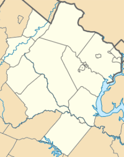   | |
| Location | Roughly bounded by Clarke Co. line, Shenandoah R., Winchester Rd. & Norfolk Southern RR., Front Royal, Virginia vicinity |
|---|---|
| Coordinates | 38°59′23″N 78°8′29″W / 38.98972°N 78.14139°WCoordinates: 38°59′23″N 78°8′29″W / 38.98972°N 78.14139°W |
| Area | 10,038 acres (4,062 ha) |
| NRHP Reference # | 15000809[1] |
| Added to NRHP | November 17, 2015 |

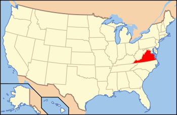
The Rockland Rural Historic District is a large rural historic district located near Front Royal in northeastern Warren County, Virginia. It encompasses more than 10,000 acres (4,000 ha), roughly bounded on the north by the Clark County line, and the east by the Shenandoah River. This area has unspoiled vistas of farms and rural crossroads communities, with a road network and land-use pattern dating to the 18th century.[2]
The district was listed on the National Register of Historic Places in 2015.[1] It includes two previously-listed properties: Erin and Mount Zion.[2]
See also
References
- 1 2 National Park Service (2010-07-09). "National Register Information System". National Register of Historic Places. National Park Service.
- 1 2 "NRHP nomination for Rockland Rural Historic District" (PDF). National Park Service. Retrieved 2015-12-23.
This article is issued from Wikipedia - version of the 12/2/2016. The text is available under the Creative Commons Attribution/Share Alike but additional terms may apply for the media files.