Ruhna Vas
| Ruhna Vas | |
|---|---|
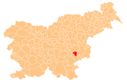
 Ruhna Vas Location in Slovenia | |
| Coordinates: 45°52′19.25″N 15°17′53.47″E / 45.8720139°N 15.2981861°ECoordinates: 45°52′19.25″N 15°17′53.47″E / 45.8720139°N 15.2981861°E | |
| Country |
|
| Traditional region | Lower Carniola |
| Statistical region | Southeast Slovenia |
| Municipality | Škocjan |
| Area | |
| • Total | 0.5 km2 (0.2 sq mi) |
| Elevation | 167.5 m (549.5 ft) |
| Population (2002) | |
| • Total | 9 |
| [1] | |
Ruhna Vas (pronounced [ˈɾuːxna ˈʋaːs]; Slovene: Ruhna vas) is a small settlement on the left bank of the Krka River in the Municipality of Škocjan in southeastern Slovenia. It belongs to the Village Community of Dobrava pri Škocjanu and Tomažja Vas. The area is part of the historical region of Lower Carniola. The municipality is now included in the Southeast Slovenia Statistical Region.[2]
The Roman road from Emona to Neviodunum ran through the area and contemporary finds show evidence of a settlement near the road.[3]
References
- ↑ Statistical Office of the Republic of Slovenia
- ↑ Škocjan municipal site
- ↑ "EŠD 8649". Registry of Immovable Cultural Heritage (in Slovenian). Ministry of Culture of the Republic of Slovenia. Retrieved 28 June 2011.
External links
| Settlements | Administrative centre: Škocjan
|  |
|---|---|---|
| Landmarks |
| |
| Notable people | ||
This article is issued from Wikipedia - version of the 1/20/2016. The text is available under the Creative Commons Attribution/Share Alike but additional terms may apply for the media files.