Rysy
| Rysy | |
|---|---|
 Northern summit | |
| Highest point | |
| Elevation | 2,503 m (8,212 ft) [1] |
| Prominence | 163 m (535 ft) [1] |
| Listing | Country high point (Poland) |
| Coordinates | 49°10′46″N 20°5′17″E / 49.17944°N 20.08806°ECoordinates: 49°10′46″N 20°5′17″E / 49.17944°N 20.08806°E [1] |
| Naming | |
| Translation | scratches or crevices (Polish and Slovak) |
| Geography | |
 Rysy Location in Slovakia (on the Polish border) | |
| Location | Poland / Slovakia |
| Parent range | High Tatras |
| Geology | |
| Mountain type | Granite |
| Climbing | |
| Easiest route | Hiking |
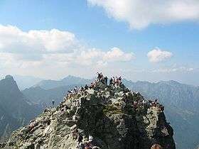
Rysy (Polish and Slovak: Rysy, Polish pronunciation: [ˈrɨsɨ]; German: Meeraugspitze, Hungarian: Tengerszem-csúcs) is a mountain in the crest of the High Tatras, lying on the border between Poland and Slovakia. Rysy has three peaks: the middle at 2,503 m (8,212 ft); the north-western at 2,499 m (8,199 ft); and the south-eastern at 2,473 m (8,114 ft). The north-western peak is the highest point of Poland; the other two peaks are on the Slovak side of the border, in the Prešov Region.
Name
Experts assume that the Polish and Slovak name Rysy, meaning "scratches" or "crevices", refers to a series of gullies, either those on the western slopes of Żabie Ridge or the very prominent 500 m (1,600 ft) high gully and numerous smaller ones on the northern side. A folk explanation on the Slovak side says that the name comes from the plural word rysy meaning "lynxes", although the habitat of the lynx does not extend above the timberline.
The Hungarian name Tengerszem-csúcs and the German name Meeraugspitze mean "eye-of-the-sea peak", from the glacial lake at the northern foot of the mountain, called "eye of the sea" (Morskie Oko in Polish).
History
The first known ascent was made in 1840, by Ede Blásy and his guide Ján Ruman-Driečny, Sr. The first winter ascent was completed in 1884, by Theodor Wundt and Jakob Horvay. In the 20th century, the communist authorities claimed Vladimir Lenin climbed the mountain sometime in the early 1910s. Rysy is the highest point in Poland.
Tourism

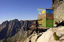
Rysy is the highest peak in the Tatra Mountains that is accessible to individual tourists on foot without a mountain guide. It is possible to ascend the peak from the Slovak side, starting at Štrbské pleso and passing Chata pod Rysmi, a mountain chalet at an altitude of 2,250 m (7,380 ft), open during the summer season (May–October). The mountain can also be ascended from the Polish side coming from the Morskie Oko lake, which is a harder and steeper route. In the period November 1 - June 15, the trail on the Slovak side is closed.

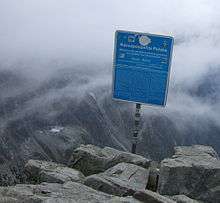
Since the accession of Poland and Slovakia to the Schengen Agreement in 2007, the border between the two countries may be easily crossed at this point like at any other.
See also
| Wikimedia Commons has media related to Rysy. |
- Orla Perć
- Tourism in Poland
- Geography of Poland
- Geography of Slovakia
- Tatra Volunteer Search and Rescue (Poland)
- Mountain Rescue Service (Slovakia)
- List of highest paved roads in Europe
- List of mountain passes
References
External links
- TOPR - Polish Tatra Mountain Rescue Service
- Additional photos
- Rysy at Peakbagger.com
- Chalet below the Rysy peak
- Additional information including some photos
3D Panorama
- Polish summit 2499 m
- Slovak summit 2503 m
- Slovak summit, September
- Slovak summit, May
- Standard weather on the summit
- Hike to Rysy (from the Polish side)
- Hike to Rysy (from the Slovak side)