Sabaya
| Sabaya | |
|---|---|
|
Church of Sabaya | |
| Coordinates: BO 19°00′53″S 68°22′15″W / 19.01472°S 68.37083°W | |
| Country |
|
| Department | Oruro |
| Province | Sabaya Province |
| Municipality | Sabaya Municipality |
| Population (2001) | |
| • Total | 573 |
| Time zone | BST (UTC-4) |

Sabaya is a small town in the Bolivian Oruro Department. In 2001 it had a population of 573 inhabitants in 2001.[1] Sabaya is the administrative center of the Sabaya Province and the Sabaya Municipality alike. It is located 200 km south-west of Oruro, the capital of the department. It is situated at 3,698 m above sea level in the valley of the Sabaya River on the eastern slopes of Pumari (4,787 m). Salar de Coipasa lies 25 km south-east of Sabaya, and the stratovolcano Tata Sabaya (5,430 m) is situated 20 km south-west of Sabaya.
See also
References
Capital: Oruro | ||
| Provinces | 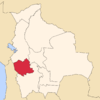 | |
| Municipalities (and seats) |
| |
This article is issued from Wikipedia - version of the 2/20/2015. The text is available under the Creative Commons Attribution/Share Alike but additional terms may apply for the media files.