Saint-Bonnet-l'Enfantier
| Saint-Bonnet-l'Enfantier | ||
|---|---|---|
| ||
 Saint-Bonnet-l'Enfantier | ||
|
Location within Nouvelle-Aquitaine region 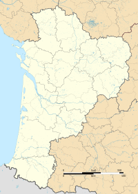 Saint-Bonnet-l'Enfantier | ||
| Coordinates: 45°18′03″N 1°31′26″E / 45.3008°N 1.5239°ECoordinates: 45°18′03″N 1°31′26″E / 45.3008°N 1.5239°E | ||
| Country | France | |
| Region | Nouvelle-Aquitaine | |
| Department | Corrèze | |
| Arrondissement | Brive-la-Gaillarde | |
| Canton | Vigeois | |
| Intercommunality | Les Trois A: A20, A89 et Avenir | |
| Government | ||
| • Mayor (2008–2014) | Didier Marsaleix | |
| Area1 | 11.78 km2 (4.55 sq mi) | |
| Population (2008)2 | 326 | |
| • Density | 28/km2 (72/sq mi) | |
| Time zone | CET (UTC+1) | |
| • Summer (DST) | CEST (UTC+2) | |
| INSEE/Postal code | 19188 / 19410 | |
| Elevation |
283–435 m (928–1,427 ft) (avg. 435 m or 1,427 ft) | |
|
1 French Land Register data, which excludes lakes, ponds, glaciers > 1 km² (0.386 sq mi or 247 acres) and river estuaries. 2 Population without double counting: residents of multiple communes (e.g., students and military personnel) only counted once. | ||
.svg.png)
Saint-Bonnet-l'Enfantier is a commune in the Corrèze department in central France.
Population
| Historical population | ||
|---|---|---|
| Year | Pop. | ±% |
| 1962 | 357 | — |
| 1968 | 369 | +3.4% |
| 1975 | 306 | −17.1% |
| 1982 | 305 | −0.3% |
| 1990 | 270 | −11.5% |
| 1999 | 258 | −4.4% |
| 2008 | 326 | +26.4% |
See also
References
| Wikimedia Commons has media related to Saint-Bonnet-l'Enfantier. |
This article is issued from Wikipedia - version of the 2/11/2016. The text is available under the Creative Commons Attribution/Share Alike but additional terms may apply for the media files.