San Pedro Nolasco Island
Coordinates: 27°57′59″N 111°22′42″W / 27.96639°N 111.37833°W
| Native name: <span class="nickname" ">Spanish: Isla San Pedro Nolasco | |
|---|---|
 Islands in the northern Gulf of California | |
 San Pedro Nolasco San Pedro Nolasco Island | |
| Geography | |
| Location | Gulf of California |
| Coordinates | 27°57′59″N 111°22′42″W / 27.96639°N 111.37833°W |
| Highest point | 1075 feet(327.66 meters) |
| Administration | |
|
Mexico | |
| State | Sonora |
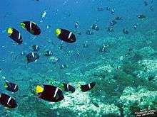
San Pedro Nolasco Island, sometimes called Seal Island, is a small and rugged Mexican island in the Gulf of California. It is 4.2 km long by 1 km wide, and lies 15 km from the nearest point of the Mexican coast and about 28 km west of the resort town of San Carlos on the coast of the Sonoran Desert. The island is protected as a nature reserve and its coastal waters are well known as a sport fishing and diving site.[1]
Flora and fauna
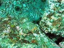
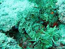
The island is home to an endemic cactus Echinocereus websterianus.[2] Endemic fauna include the San Pedro Nolasco Island spinytail iguana Ctenosaura nolascenensis and, formerly, Pemberton's deer mouse (Peromyscus pembertoni), a rodent which is now extinct. Large numbers of California sea lions frequent its surrounding waters and use the island as a haul-out.

_in_natural_habitat.jpg)
.jpg)
Popular dive sites


- Magdalena Bay
- Lighthouse
- The Little Waterfall
- The Cave
- The Beach
- La Lobera
- North Point
- The Window
- Pelican Point
- The Cavern
- The Rookery
- South Point
Magdalena Bay
Magdalena Bay is a beautiful little protected cove on the southeast corner of the island. The water depths inside the bay are shallow, making it an excellent site for novice divers and snorkelers. Consistent water clarity and amazing bio-diversity offers even the most advanced divers an unforgettable experience. The gravel beach seems to be a favorite resting place with the sea lions. Large numbers of sea lion pups, guarded by a dominate male can be observed during the summer months.


Lighthouse


The Little Waterfall
The Cave
The Beach
La Lobera
North Point
The Window
Pelican Point
The Cavern
The Rookery
South Point
Transportation and island access
Arrangements for transportation to and from San Pedro Nolasco Island can be made through numerous charter boat operators and dive shops in nearby San Carlos. However, to go ashore at San Pedro Nolasco as well as most of the Islands in the Gulf of California (Sea of Cortez) a special permit must be purchased from the Mexican government. Such permits can be obtained at the local offices of the National Commission of Protected Natural Areas (Comision Nacional de Areas Naturales Protegidas).
References
- ↑ "Isla San Pedro Nolasco". SeaSanCarlos. See the Seas. 2010-10-11. Retrieved 2011-03-21.
- ↑ Faucon, Philippe. "Echinocereus websterianus". SeaSanCarlos. Desert Tropicals. Retrieved 2011-03-21.
External links
- http://www.conanp.gob.mx/ (Comision Nacional de Areas Naturales Protegidas)
- http://www.garysdivemexico.com/ Gary's Dive Shop website