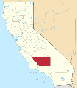
Sand Canyon, Kern County, California
Not to be confused with Sand Canyon, Los Angeles County, California.
This article is about town in California. For ancient pueblo in Colorado, see Sand Canyon Pueblo.
| Sand Canyon | |
|---|---|
| Unincorporated community | |
|
Sand Canyon  Sand Canyon Location in California | |
| Coordinates: 35°18′27″N 118°25′43″W / 35.30750°N 118.42861°WCoordinates: 35°18′27″N 118°25′43″W / 35.30750°N 118.42861°W | |
| Country | United States |
| State | California |
| County | Kern County |
| Elevation[1] | 2,710 ft (826 m) |
Sand Canyon is an unincorporated community in Kern County, California.[1] It is located on Caliente Creek 0.5 miles (0.8 km) northeast of Loraine,[2] at an elevation of 2710 feet (826 m).[1]
Not to be confused with Sand Canyon in Los Angeles County, California, location of a major 2016 wildfire known as the Sand Fire.
References
This article is issued from Wikipedia - version of the 8/3/2016. The text is available under the Creative Commons Attribution/Share Alike but additional terms may apply for the media files.
