Shotwick Park
- For the house originally called Shotwick Park, see Shotwick House
| Shotwick Park | |
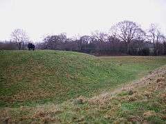
 Shotwick Castle earthworks |
|
 Shotwick Park |
|
| OS grid reference | SJ354711 |
|---|---|
| Civil parish | Shotwick Park |
| Unitary authority | Cheshire West and Chester |
| Ceremonial county | Cheshire |
| Region | North West |
| Country | England |
| Sovereign state | United Kingdom |
| Post town | CHESTER |
| Postcode district | CH1 |
| Dialling code | 01244 |
| Police | Cheshire |
| Fire | Cheshire |
| Ambulance | North West |
| EU Parliament | North West England |
| UK Parliament | City of Chester |
Coordinates: 53°13′59″N 2°57′58″W / 53.233°N 2.966°W
Shotwick Park is a civil parish in the unitary authority of Cheshire West and Chester and the ceremonial county of Cheshire, England. Located near the village of Shotwick, it is four miles north west of Chester and close to the Welsh border.
The area is the location of the remnants of Shotwick Castle (grid reference SJ349704), built about 1093 by Hugh Lupus, 1st Earl of Chester.[1]
By the 19th century, it was an extra-parochial place within the Wirral Hundred. The population was 25 in 1801, 13 in 1851, 8 in 1901 and 78 in 1951.[2]
Shotwick Park is a rural residential area with communal amenities provided in the nearby village of Saughall. A small industrial estate development also exists at Shotwick Park.
See also
References
- ↑ History of Saughall, Saughall & Shotwick Parish Council, retrieved 10 May 2007
- ↑ Cheshire Towns & Parishes: Shotwick Park, GENUKI UK & Ireland Genelaogy, retrieved 18 September 2007
External links
![]() Media related to Shotwick Park at Wikimedia Commons
Media related to Shotwick Park at Wikimedia Commons