Sion Panvel Highway
| Sion Panvel Expressway शीव पनवेल महामार्ग | |
|---|---|
 | |
| Route information | |
|
Maintained by Maharashtra State Road Development Corporation Maharashtra Public Works Department Municipal Corporation of Greater Mumbai | |
| Length: | 25 km (16 mi) |
| Major junctions | |
| West end: | Sion, Mumbai |
| East end: | Mumbai Pune Expressway at Kalamboli junction near Panvel |
| Location | |
| States: | Maharashtra |
| Districts: | Mumbai Suburban district, Raigad district, Thane district |
| Major cities: | Mumbai, Navi Mumbai, Panvel |
| Highway system | |
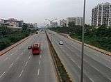
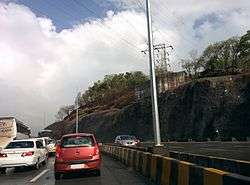
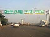
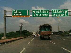
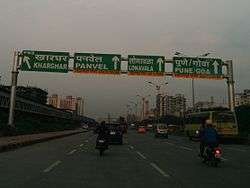
The Sion Panvel Expressway is a 25 km Indian highway connecting the Sion to Panvel via Navi Mumbai in the state of Maharashtra.[1] It is one of the busiest and most important roads in the Mumbai Metropolitan Area and connects Mumbai with the city of Pune. National Highway 4 and Mumbai Pune Expressway meet the eastern end of Sion Panvel Highway at Kalamboli junction near Panvel. The highway is also used by vehicles traveling towards Mumbai from Konkan and Goa.
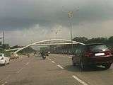
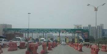
As of September 2014, stretch of the highway east of Vashi Bridge within the city of Navi Mumbai has been fully widened and concretized to 10 lanes (5 lanes in each direction).[2] New flyovers have been built at Sanpada railway station, Nerul, Uran phata and Kamothe. A toll plaza built between Kamothe and Kharghar for recovering the construction cost was controversially opened on January 6, 2015 after much delay[3] as the BJP-led Maharashtra state government admitted that it was not in a position to abolish the toll.[4] Heavy traffic snarls were reported in the initial days as workers of Maharashtra Navnirman Sena vandalized the toll booths.[5] One-way toll for motor vehicles has been set at ₹ 30.
Major connections
Following major highways cross the Sion Panvel Highway
- Mumbai Pune Expressway and National Highway 4 at Kalamboli junction
- Thane–Belapur road at Turbhe
- Palm Beach Marg at Vashi
- Mankhurd-Ghatkopar link road at Mankhurd
- Eastern Express Highway at Sion
Important destinations
Sion Panvel Highway serves the following nodes of the city of Navi Mumbai.
- Vashi
- New Panvel
- Sanpada
- Panvel
- Turbhe
- Nerul
- CBD Belapur
- Kharghar
- Kamothe
- Kalamboli
- Ghatkopar
- Chembur
- Deonar
- Mankhurd
- Bhabha Atomic Research Centre
Intersections
Sion-Panvel Highway intersects following important roads.
- Palm Beach Marg
- Thane Belapur Road
- National Highway 4 (India)
- V.N. Purav Marg
- Eastern Express Highway
- Eastern Freeway (Mumbai)
- Mankhurd-Ghatkopar link road
- Amra Marg
Widening and Concretization
- The stretch of road from BARC Junction to Kalamboli Junction is about 25 kilometres in length.
- Total Project cost Rs. 825 Crore (Based on DSR of 2006-2007).
- Base Construction cost Rs. 675 Crores
The project consists of [6]
- Widening of the existing bituminous road to 5+5 lanes with concrete pavements.
- Central 3+3 lanes to be access controlled.
- The Service roads to be provided whenever required for about 6.29 kilometres.
- Provision of signal free passage for through traffic
- 3 new Flyovers at Kamothe Junction, Sanpada Junction & Uran Junction.
- Duplication of flyovers at Taloja and Chembur Mankhurd Link Road junctions.
- Pedestrian crossing Underpasses at 10 locations.
- Foot over Bridges at 3 locations.
- Geometric Junction improvements as per standards.
- Toll plaza at Vashi to be upgraded to 8+8 lanes, Toll fee at prescribed rates (current rate)and Toll period to be quoted by BOT Contractor.
- Landscaping / Beautification of entire project corridor including Median plantation, Road side plantation, Landscaping and Beautification below flyovers.
- Renovation / upgradation of existing flyovers, structures.
- Electrification of entire project corridor.
- Operation and Maintenance of Project Facilities up to the end of toll period quoted by BOT Contractor.
Gallery
|
References
- ↑ Katkurwar, Saurabh. (2012-01-06) Sion-Panvel highway to be 10-lane in 3 yrs. Mid-day.com. Retrieved on 2013-12-06.
- ↑ "Sion-Panvel highway cuts travel time". DNAIndia.com. Retrieved 2014-09-22.
- ↑ "Navi Mumbai: New toll naka at Kharghar surprises and angers motorists". MidDay. Retrieved 2015-05-04.
- ↑ "Govt in no position to roll back Kharghar toll plaza: Maharashtra PWD minister". FirstPost.com. Retrieved 2015-05-04.
- ↑ "Kharghar toll booth vandalized, highway witnesses traffic snarls". Hidustan Times. Retrieved 2015-05-04.
- ↑ From May 2014, zip down a 10-lane Sion-Panvel highway - Mumbai - DNA. Dnaindia.com. Retrieved on 2013-12-06.
